National Park Service · National Monument · Wyoming
Devils Tower National Monument
Here, all of the campgrounds take walk-ups.
1Campgrounds
1Take walk-ups
45Sites
3,860 ftElevation
Where they are
1 of 1 mappedDrawing the map
© OpenFreeMap · OpenStreetMap · Esri hillshadeSource: RIDB · NPS · USFS EDW · BLM, unified by CAMPANAC · Oct 23, 2026
The campgrounds
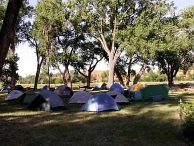
Source: RIDB · NPS · USFS EDW · BLM, unified by CAMPANAC · Oct 23, 2026
This land
measured from the nearest campground in the unitCamping here is a stake in what happens to it. More Than Just Parks tracks the threats and the comment windows.
Source: MTJP Threatened Lands map · Oct 16, 2026
Heads up
Park Closure
Campground Closed for the Season As of October 15, 2026 the campground is closed. The campground will reopen mid May of 2027.
Park Closure
Bookstore Closed: November 2-November 3 The Bookstore will be closed: November 2 through November 3. During this time the Visitor Center will remain open.
Danger
Stage 2 Burn Restrictions All campfires are prohibited. Devices using pressurized liquid or gas (stoves, grills or lanterns) that include shut-off valves are permitted when used in an area at least three feet or more from flammable material such as grasses or pine…
Source: National Park Service alerts API · Oct 23, 2026
Who answers for this land
Devils Tower National Monument’s campgrounds sit in one congressional district. These members vote on the laws that decide what happens to this land.

Harriet Hageman (R)
Source: campground records from RIDB, NPS, USFS EDW and BLM, unified by CAMPANAC, refreshed nightly