National Park Service · National Park · Wyoming
Grand Teton National Park
Here, none of the campgrounds take walk-ups.
6Campgrounds
$53–$122A night, across 5
982Sites
6,580–6,860 ftElevation
Where they are
6 of 6 mappedDrawing the map
© OpenFreeMap · OpenStreetMap · Esri hillshadeSource: RIDB · NPS · USFS EDW · BLM, unified by CAMPANAC · Oct 23, 2026
The campgrounds
6 campgrounds
 Colter Bay CampgroundReservablefrom $6110 hike-in sites177 pull-through sites360 sitesrigs to 50 ft6,820 fthookupsdrinking watertoilets
 Colter Bay RV ParkReservablefrom $12295 pull-through sites112 sitesrigs to 45 ft6,820 fthookupsdrinking watertoilets
 Colter Bay Tent VillageReservableSites from $10166 with a bear box66 sites6,860 ftdrinking watertoilets
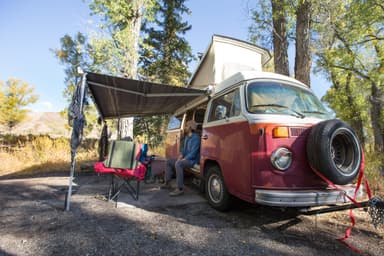 Gros Ventre CampgroundReservablefrom $59317 with a bear box2 pull-through sites322 sitesrigs to 50 ft6,580 fthookupsdrinking watertoilets
 Jenny Lake CampgroundReservablefrom $5810 with a bear box10 hike-in sites61 sitesrigs to 14 ft6,800 ftdrinking watertoilets
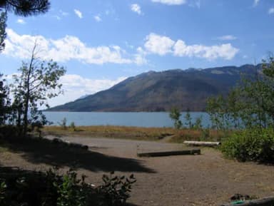 Lizard Creek CampgroundReservablefrom $5361 with a bear box26 hike-in sites61 sitesrigs to 25 ft6,810 ftdrinking watertoilets
Source: RIDB · NPS · USFS EDW · BLM, unified by CAMPANAC · Oct 23, 2026
This land
measured from the nearest campground in the unitRoadless
Camping here is a stake in what happens to it. More Than Just Parks tracks the threats and the comment windows.
Roadless areas: USFS Inventoried Roadless Areas via MTJP Roadless Map · Jul 29, 2026
Source: MTJP Threatened Lands map · Sep 30, 2026
Heads up
Caution
Construction in the South End of the Park Moose-Wilson Road between Moose and LSR Preserve closed. Expect occasional short delays between Granite Entrance and LSR Preserve. Possible intermittent delays on Teton Park Road at Cottonwood Creek Picnic Area. Cottonwood Creek picnic…
Park Closure
Death Canyon Trailhead Construction Closure Death Canyon Road and Trailhead are closed to all use. Start hikes at alternative trailheads such as Granite Canyon, LSR Preserve, and Taggart Lake.
Caution
Construction on HWY 26/89/191 Construction taking place on US HWY 26/89/191 south of Moran Junction. Expect 20-minute delays in both directions.
Information
Plan Ahead for 2027 Construction Plan ahead for construction in 2027. Check road construction and park construction pages for more information.
Source: National Park Service alerts API · Oct 24, 2026
Who answers for this land
Grand Teton National Park’s campgrounds sit in one congressional district. These members vote on the laws that decide what happens to this land.

Harriet Hageman (R)
Source: campground records from RIDB, NPS, USFS EDW and BLM, unified by CAMPANAC, refreshed nightly