National Park Service · National Park · California
Joshua Tree National Park
Here, one in four take walk-ups.
12Campgrounds
3Take walk-ups
$25–$40A night, across 10
556Sites
2,740–4,560 ftElevation
Where they are
12 of 12 mappedDrawing the map
© OpenFreeMap · OpenStreetMap · Esri hillshadeSource: RIDB · NPS · USFS EDW · BLM, unified by CAMPANAC · Oct 23, 2026
The campgrounds
12 campgrounds
 Ryan CampgroundReservableOpenfrom $3010 hike-in sites37 sitesrigs to 32 ft4,320 fttoilets
 Black Rock CampgroundReservablefrom $3514 pull-through sites99 sitesrigs to 35 ft4,050 ftdrinking watertoilets
 Cottonwood Campground (CA)Reservablefrom $3562 sitesrigs to 48 ft3,080 ftdrinking watertoilets
 Indian Cove CampgroundReservablefrom $357 hike-in sites114 sitesrigs to 35 ft2,740 fttoilets
 Jumbo Rocks CampgroundReservablefrom $3047 hike-in sites124 sitesrigs to 46 ft4,360 fttoilets
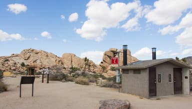 Hidden Valley CampgroundFirst-comefrom $2544 sites4,210 fttoilets
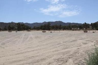 Black Rock Equestrian CampgroundReservablefrom $3521 sitesrigs to 35 ft4,050 ftdrinking watertoilets
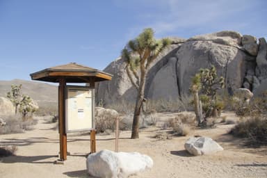 Belle CampgroundFirst-comefrom $2518 sites3,860 fttoilets
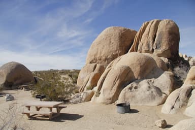 White Tank CampgroundFirst-comefrom $2515 sites3,820 fttoilets
 Indian Cove GroupReservablefrom $4013 group sites13 sitesrigs to 24 ft3,220 ft
 Sheep Pass GroupReservableSites from $556 group sites6 sites4,560 fttoilets
 Cottonwood GroupReservableSites from $553 group sites3 sites3,080 ftdrinking watertoilets
Source: RIDB · NPS · USFS EDW · BLM, unified by CAMPANAC · Oct 23, 2026
This land
measured from the nearest campground in the unitCamping here is a stake in what happens to it. More Than Just Parks tracks the threats and the comment windows.
Source: MTJP Threatened Lands map · Oct 9, 2026
Heads up
Wildfire
Park fire · 1.0 mi from the nearest campground here · 0 acres
Wildfire
Fa-Ca-Cdd-10306 fire · 6.4 mi from the nearest campground here
Wildfire
Veg/Gt/61A fire · 38 mi from the nearest campground here · 0 acres
Wildfire
Rru/North fire · 47 mi from the nearest campground here · 0 acres
Caution
Inaccurate Third-Party Apps Some third-party hiking apps are providing inaccurate trail and safety information to users. Please use the official NPS app for accurate information.
Park Closure
Geology Tour Road Temporarily Closed The park received a significant amount of rain. Due to flooding, Geology Tour Road is temporarily closed. Please use caution while traveling on all other roads in the park.
Caution
Oasis of Mara Trail Partial Closure Due to a heavy flooding event, the Oasis of Mara Trail is closed past the Oasis.
Caution
Partial Trail Closure of West Side Loop There is a partial trail closure of West Side Loop trail in the Black Rock area to allow for trail crew and volunteers to conduct trail repairs. Sections of West Side will be closed to all forms of traffic, Equestrians and hikers will have…
Alerts: National Park Service alerts API · Oct 24, 2026
Source: NIFC/IRWIN via MTJP wildfire tracker · Oct 23, 2026
Who answers for this land
Joshua Tree National Park’s campgrounds sit in 2 congressional districts. These members vote on the laws that decide what happens to this land.
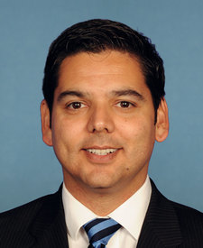
Raul Ruiz (D)

Jay Obernolte (R)
Source: campground records from RIDB, NPS, USFS EDW and BLM, unified by CAMPANAC, refreshed nightly