U.S. Forest Service · National Forest · Montana
Lolo National Forest
Here, 37% take walk-ups.
43Campgrounds
16Take walk-ups
9Free to camp
$10–$20A night, across 15
316Sites, from 25
2,530–6,910 ftElevation
Where they are
43 of 43 mappedDrawing the map
© OpenFreeMap · OpenStreetMap · Esri hillshadeSource: RIDB · NPS · USFS EDW · BLM, unified by CAMPANAC · Oct 23, 2026
The campgrounds
43 campgrounds
In 1 places, folded
Lolo National Forest43 campgrounds · 4 open›
 Rainy Lake CampgroundFirst-comeOpenFree4,130 ft
 Quartz Flat Campground (MT)Reservablefrom $156 pull-through sites79 sites2,870 fthookupsdrinking watertoilets
 Big Larch CampgroundReservable4 with a bear box4 hike-in sites56 sitesrigs to 51 ft4,060 ftdrinking watertoilets
 Lake Alva CampgroundReservablefrom $2040 sitesrigs to 64 ft4,120 ftdrinking watertoilets
 Seeley Lake Lolo Campground (MT)Reservablefrom $2030 with a tent pad30 sitesrigs to 64 ft4,010 ftdrinking watertoilets
 Sloway Campground (MT)Reservablefrom $154 with a bear box13 pull-through sites29 sites2,660 ftdrinking watertoilets
 River Point Lolo Campground (MT)Reservablefrom $2028 with a tent pad28 sitesrigs to 56 ft4,000 ftdrinking watertoilets
 Cabin City Campground (MT)Reservablefrom $1525 sitesrigs to 35 ft3,170 ftdrinking watertoilets
 Lakeside Lolo Campground (MT)Reservablefrom $101 group site8 sitesrigs to 58 ft4,170 fttoilets
 Lake Inez Point 6 (Group Camp Site)ReservableSites from $501 group site4 sitesrigs to 20 ft4,190 fttoilets
 Cascade CampgroundReservablefrom $151 group site2 sitesrigs to 30 ft2,530 ftdrinking watertoilets
 Bend Guard StationReservableSites from $901 siterigs to 40 ft3,300 ftdrinking watertoilets
Source: RIDB · NPS · USFS EDW · BLM, unified by CAMPANAC · Oct 23, 2026
This land
measured from the nearest campground in the unitcritical
Roadless
Roadless
Roadless
Roadless
Roadless
Roadless
Camping here is a stake in what happens to it. More Than Just Parks tracks the threats and the comment windows.
Roadless areas: USFS Inventoried Roadless Areas via MTJP Roadless Map · Jul 29, 2026
Source: MTJP Threatened Lands map · Oct 4, 2026
Heads up
Wildfire
Mineral Hill fire · 8.6 mi from the nearest campground here · 0 acres
Wildfire
Bras fire · 11 mi from the nearest campground here · 1,688 acres · 100% contained
Wildfire
Nugget Hill fire · 13 mi from the nearest campground here · 70 acres
Wildfire
Deer Creek fire · 18 mi from the nearest campground here · 1,099 acres · 100% contained
Wildfire
Black Bear fire · 19 mi from the nearest campground here · 2,126 acres · 100% contained
Wildfire
Nature Grove fire · 21 mi from the nearest campground here · 1,422 acres · 100% contained
Source: NIFC/IRWIN via MTJP wildfire tracker · Oct 22, 2026
Who answers for this land
Lolo National Forest’s campgrounds sit in one congressional district. These members vote on the laws that decide what happens to this land.
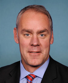
Ryan Zinke (R)
Source: campground records from RIDB, NPS, USFS EDW and BLM, unified by CAMPANAC, refreshed nightly