U.S. Forest Service · National Forest · Oregon
Malheur National Forest
Here, one in eleven take walk-ups.
44Campgrounds
4Take walk-ups
5Free to camp
$6–$13A night, across 31
197Sites, from 26
3,590–7,170 ftElevation
Where they are
44 of 44 mappedDrawing the map
© OpenFreeMap · OpenStreetMap · Esri hillshadeSource: RIDB · NPS · USFS EDW · BLM, unified by CAMPANAC · Oct 23, 2026
The campgrounds
44 campgrounds
In 1 places, folded
Malheur National Forest44 campgrounds›
 Idlewild CampgroundReservablefrom $101 pull-through site26 sites5,540 ft
 Magone Lake CampgroundReservablefrom $137 pull-through sites21 sites5,540 ftdrinking watertoilets
 Parish Cabin CampgroundReservablefrom $85 pull-through sites17 sites5,540 ftdrinking watertoilets
 Big Creek CampgroundReservablefrom $84 pull-through sites15 sites5,130 ftdrinking watertoilets
 Joaquin Miller Horse CampReservablefrom $812 sites5,540 fttoilets
 Starr CampgroundReservablefrom $66 pull-through sites11 sites5,540 fthookupstoilets
 Middle Fork CampgroundReservablefrom $810 sites3,850 fttoilets
 Strawberry CampgroundReservablefrom $810 sites5,540 ftdrinking watertoilets
 Dixie CampgroundReservablefrom $89 sites5,540 fttoilets
 Buck Spring CampgroundReservablefrom $67 sites5,540 fttoilets
 Falls Campground (Malheur National Forest)Reservablefrom $86 sites5,540 fttoilets
 Lower Camp Creek CampgroundReservablefrom $62 pull-through sites6 sites5,540 fttoilets
Source: RIDB · NPS · USFS EDW · BLM, unified by CAMPANAC · Oct 23, 2026
This land
measured from the nearest campground in the unitdeveloping
Roadless
Roadless
Roadless
Roadless
Roadless
Roadless
Camping here is a stake in what happens to it. More Than Just Parks tracks the threats and the comment windows.
Roadless areas: USFS Inventoried Roadless Areas via MTJP Roadless Map · Jul 29, 2026
Source: MTJP Threatened Lands map · Sep 30, 2026
Heads up
Wildfire
Second Flat fire · 16 mi from the nearest campground here · 105,854 acres · 99% contained
Wildfire
McCully fire · 21 mi from the nearest campground here · 13,604 acres · 91% contained
Wildfire
Summit Lake fire · 26 mi from the nearest campground here · 0 acres
Wildfire
Anthony fire · 29 mi from the nearest campground here · 2,584 acres · 100% contained
Source: NIFC/IRWIN via MTJP wildfire tracker · Oct 22, 2026
Who answers for this land
Malheur National Forest’s campgrounds sit in one congressional district. These members vote on the laws that decide what happens to this land.
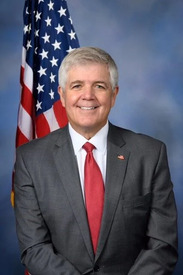
Cliff Bentz (R)
Source: campground records from RIDB, NPS, USFS EDW and BLM, unified by CAMPANAC, refreshed nightly