U.S. Forest Service · National Conservation Area · Oregon
Oregon Caves Protective Buffer Zone Protection Area (Administrative)
Here, none of the campgrounds take walk-ups.
1Campgrounds
$20A night at the one priced
17Sites
4,200 ftElevation
Where they are
1 of 1 mappedDrawing the map
© OpenFreeMap · OpenStreetMap · Esri hillshadeSource: RIDB · NPS · USFS EDW · BLM, unified by CAMPANAC · Oct 23, 2026
The campgrounds

Source: RIDB · NPS · USFS EDW · BLM, unified by CAMPANAC · Oct 23, 2026
This land
measured from the nearest campground in the unitCamping here is a stake in what happens to it. More Than Just Parks tracks the threats and the comment windows.
Roadless areas: USFS Inventoried Roadless Areas via MTJP Roadless Map · Jul 29, 2026
Source: MTJP Threatened Lands map · Sep 30, 2026
Heads up
Wildfire
Garner Rd fire · 8.6 mi from the nearest campground here
Wildfire
New Hope Rd 5465 fire · 18 mi from the nearest campground here
Wildfire
Soda fire · 29 mi from the nearest campground here · 14 acres
Wildfire
W Fork Evans Creek fire · 42 mi from the nearest campground here · 283 acres · 75% contained
Wildfire
Morrison Creek Rd Mm 2.5 fire · 44 mi from the nearest campground here · 0 acres
Information
Major road construction on Hwy 199 Travelers using Highway 199 between Crescent City and Cave Junction should expect multiple traffic delays beginning as early as May due to ongoing Caltrans construction. For the most current delay and closure information—including upcoming…
Alerts: National Park Service alerts API · Oct 24, 2026
Source: NIFC/IRWIN via MTJP wildfire tracker · Oct 23, 2026
Who answers for this land
Oregon Caves Protective Buffer Zone Protection Area (Administrative)’s campgrounds sit in one congressional district. These members vote on the laws that decide what happens to this land.
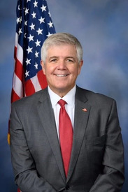
Cliff Bentz (R)
Source: campground records from RIDB, NPS, USFS EDW and BLM, unified by CAMPANAC, refreshed nightly