National Park Service · National Park · California
Sequoia National Park
Here, one in six take walk-ups.
12Campgrounds
2Take walk-ups
$6–$40A night, across 10
550Sites, from 9
2,110–7,470 ftElevation
Where they are
12 of 12 mappedDrawing the map
© OpenFreeMap · OpenStreetMap · Esri hillshadeSource: RIDB · NPS · USFS EDW · BLM, unified by CAMPANAC · Oct 23, 2026
The campgrounds
12 campgrounds
 Potwisha CampgroundReservableOpenfrom $3240 with a bear box40 with a tent pad40 sitesrigs to 49 ft2,110 ftdrinking watertoilets
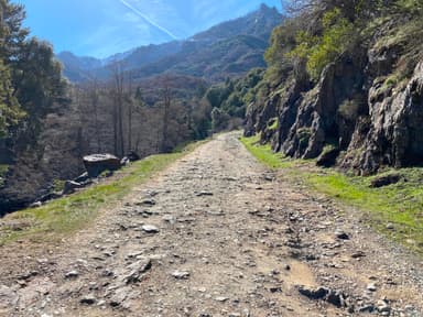 South Fork CampgroundOpenfrom $63,630 fttoilets
 Dorst Creek Campground-Sequoia and Kings Canyon National ParkReservablefrom $1624 walk-in sites204 with a bear box204 sitesrigs to 133 ft6,750 ftdrinking watertoilets
 Lodgepole Campground-Sequoia and Kings Canyon National ParkReservablefrom $3253 walk-in sites206 with a bear box206 sitesrigs to 42 ft6,740 ftdrinking watertoilets
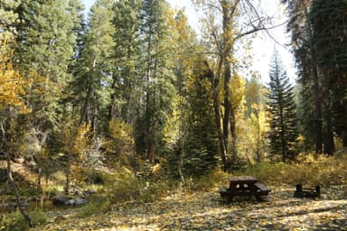 Cold Springs Campground (CA)Reservablefrom $329 walk-in sites40 with a bear box40 sitesrigs to 20 ft7,470 ftdrinking watertoilets
 Buckeye Flat CampgroundReservablefrom $1628 with a bear box28 with a tent pad28 sitesrigs to 21 ft2,930 ftdrinking watertoilets
 Atwell Mill CampgroundReservablefrom $3222 with a bear box22 with a tent pad22 sitesrigs to 20 ft6,560 ftdrinking watertoilets
 Wolverton Stock CampsitesReservablefrom $402 with a bear box2 with a tent pad2 sitesrigs to 60 ft7,050 ftAuxiliary DamReservablefrom $124 sites3,940 ftdrinking watertoiletsSouth Fork RecReservablefrom $124 sites3,940 ftdrinking watertoiletsChamise Flat Dispersed CampgroundFirst-come3,940 fttoiletsOld Goldledge CampgroundFirst-come3,940 fttoilets
Source: RIDB · NPS · USFS EDW · BLM, unified by CAMPANAC · Oct 23, 2026
This land
measured from the nearest campground in the unitCamping here is a stake in what happens to it. More Than Just Parks tracks the threats and the comment windows.
Roadless areas: USFS Inventoried Roadless Areas via MTJP Roadless Map · Jul 29, 2026
Source: MTJP Threatened Lands map · Oct 9, 2026
Heads up
Wildfire
Flat fire · 30 mi from the nearest campground here · 1 acres
Information
Weekday Traffic Delays on Generals Highway North of Giant Forest Due to removal of hazard trees along Generals Highway between Highway 180 and Giant Forest, there are traffic delays on weekdays from 8 a.m. to 5 p.m. Vehicles may experience delays of up to 30 minutes at each work site. There will not be…
Park Closure
Some Trails Closed in the Grant Grove Area Due to Prescribed Burn Activity Firefighters conducted a prescribed burn in the vicinity of Grant Grove and the General Grant Tree. Smoke and flame may be visible in the area. This is normal. Areas and trails in and around the prescribed burn are closed for safety…
Information
Fire Restrictions in Place Stage 1 Fire Restrictions are in effect. Wood and charcoal fires are prohibited at all low-elevation campgrounds and picnic areas. Additional restrictions apply. Click "more" for details.
Information
Mineral King Road Construction Traffic Delays and Closures There are temporary daytime closures and traffic delays on Mineral King Road. A schedule of daily closures and delays can be found on our Road Construction webpage. Click "more" to go there.
Alerts: National Park Service alerts API · Oct 24, 2026
Source: NIFC/IRWIN via MTJP wildfire tracker · Oct 23, 2026
Who answers for this land
Sequoia National Park’s campgrounds sit in one congressional district. These members vote on the laws that decide what happens to this land.

Vince Fong (R)
Source: campground records from RIDB, NPS, USFS EDW and BLM, unified by CAMPANAC, refreshed nightly