U.S. Forest Service · National Forest · Colorado
Uncompahgre National Forest
Here, 30% take walk-ups.
20Campgrounds
6Take walk-ups
$10–$28A night, across 7
131Sites, from 14
8,450–9,650 ftElevation
Where they are
20 of 20 mappedDrawing the map
© OpenFreeMap · OpenStreetMap · Esri hillshadeSource: RIDB · NPS · USFS EDW · BLM, unified by CAMPANAC · Oct 24, 2026
The campgrounds
20 campgrounds
 Amphitheater (CO)ReservableSeasonalSites from $283 pull-through sites35 sitesrigs to 35 ft8,450 ftdrinking watertoilets
 MatterhornReservablefrom $264 pull-through sites28 sitesrigs to 40 ft9,470 fthookupsdrinking watertoilets
 Alpine Ranger StationReservable1 site9,610 fttoilets
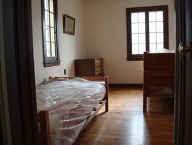 Aspen Leaf Cabin (Uncompahgre National Forest, Co)Reservable1 site8,810 ftdrinking watertoilets
 Jackson Guard StationReservableSites from $751 site9,040 fttoilets
 Lone Cone CabinReservableSites from $1201 pull-through site1 site9,220 fttoilets
 Matterhorn CabinReservableSites from $2401 site9,480 fttoilets
 Oak CabinReservable1 site8,810 fthookupsdrinking watertoilets
 Silesca CabinReservableSites from $1201 with a bear box1 siterigs to 20 ft9,120 fthookupsSilver Jack Campground (CO)Reservablefrom $201 group site45 sites9,100 ftdrinking waterBeaver Lake (CO)Reservable4 sites8,780 ftBig CimarronReservable4 sites8,650 ftSunshineReservable4 sites9,590 ftWoods LakeReservable4 sites9,390 ftBig Blue Campground - Gunnison RDFirst-come9,650 ftColumbine Campground - Ouray RDFirst-comefrom $169,070 fttoiletsDivide Forks Campground - Grand Valley RDFirst-comefrom $148,760 ftIron Springs Campground - Ouray RDFirst-comeSeasonalfrom $169,580 fttoiletsSunshine Campground - Norwood RDFirst-comeSeasonalfrom $289,590 ftThistledown Campground - Ouray RDFirst-comefrom $108,520 ft
Source: RIDB · NPS · USFS EDW · BLM, unified by CAMPANAC · Oct 24, 2026
This land
measured from the nearest campground in the unitRoadless
Roadless
Roadless
Roadless
Roadless
Roadless
Camping here is a stake in what happens to it. More Than Just Parks tracks the threats and the comment windows.
Roadless areas: USFS Inventoried Roadless Areas via MTJP Roadless Map · Jul 29, 2026
Source: MTJP Threatened Lands map · Oct 16, 2026
Heads up
Wildfire
Gold Mountain fire · 2.3 mi from the nearest campground here · 39,747 acres · 92% contained
Wildfire
Elk fire · 6.6 mi from the nearest campground here · 7,257 acres · 90% contained
Source: NIFC/IRWIN via MTJP wildfire tracker · Oct 22, 2026
Who answers for this land
Uncompahgre National Forest’s campgrounds sit in one congressional district. These members vote on the laws that decide what happens to this land.

Jeff Hurd (R)
Source: campground records from RIDB, NPS, USFS EDW and BLM, unified by CAMPANAC, refreshed nightly