National Park Service · National Park · California
Yosemite National Park
Here, none of the campgrounds take walk-ups.
16Campgrounds
$10–$50A night, across 10
1,525Sites
3,970–8,790 ftElevation
Where they are
16 of 16 mappedDrawing the map
© OpenFreeMap · OpenStreetMap · Esri hillshadeSource: RIDB · NPS · USFS EDW · BLM, unified by CAMPANAC · Oct 23, 2026
The campgrounds
16 campgrounds
 Hodgdon Meadow CampgroundReservableOpenfrom $365 walk-in sites5 with a bear box108 sitesrigs to 40 ft4,750 ftdrinking watertoilets
 North Pines CampgroundReservableOpenfrom $1699 sitesrigs to 40 ft3,980 ftdrinking watertoilets
 Upper Pines CampgroundReservableOpenfrom $36240 sitesrigs to 35 ft3,990 ftdrinking watertoilets
 Wawona CampgroundReservableOpenfrom $3610 walk-in sites1 hike-in site99 sitesrigs to 35 ft5,850 ftdrinking watertoilets
 Bridalveil Creek CampgroundReservableSeasonal1 pull-through site2 group sites107 sitesrigs to 35 ft6,970 ftdrinking watertoilets
 Camp 4Reservablefrom $1062 with a bear box68 sites3,980 ftdrinking watertoilets
 Crane Flat CampgroundReservableSeasonalfrom $364 walk-in sites1 pull-through site151 sitesrigs to 35 ft5,810 ftdrinking watertoilets
 Lower Pines CampgroundReservableSeasonalfrom $3675 sitesrigs to 40 ft3,970 ftdrinking watertoilets
 Tuolumne Meadows CampgroundReservableSeasonal7 walk-in sites25 hike-in sites309 sitesrigs to 35 ft8,620 ftdrinking watertoilets
 White Wolf CampgroundReservableSeasonal74 with a bear box10 pull-through sites74 sitesrigs to 27 ft7,870 fttoilets
 Yosemite Creek CampgroundReservableSeasonal76 with a bear box1 hike-in site76 sitesrigs to 20 ft7,220 fttoilets
 Porcupine Flat CampgroundReservableSeasonalfrom $2456 with a bear box4 pull-through sites56 sitesrigs to 24 ft8,090 fttoilets
 Tamarack Flat CampgroundReservableSeasonalfrom $2454 with a bear box2 hike-in sites54 sitesrigs to 20 ft6,340 fttoilets
 Tuolumne Horse CampsitesReservable4 with a bear box4 sitesrigs to 27 ft8,660 ftdrinking watertoilets
 Bridalveil Creek Horse CampsitesReservable1 with a bear box3 sitesrigs to 30 ft8,790 fthookupsdrinking watertoilets
 Wawona Horse CampsitesReservableSeasonalfrom $502 with a bear box2 pull-through sites2 sitesrigs to 35 ft3,980 ftdrinking watertoilets
Source: RIDB · NPS · USFS EDW · BLM, unified by CAMPANAC · Oct 23, 2026
This land
measured from the nearest campground in the unitRoadless
Roadless
Roadless
Roadless
Roadless
Roadless
Camping here is a stake in what happens to it. More Than Just Parks tracks the threats and the comment windows.
Roadless areas: USFS Inventoried Roadless Areas via MTJP Roadless Map · Jul 29, 2026
Source: MTJP Threatened Lands map · Oct 3, 2026
Heads up
Wildfire
Dome fire · 2.7 mi from the nearest campground here · 6,788 acres · 100% contained
Wildfire
Hollow fire · 16 mi from the nearest campground here · 0 acres
Wildfire
Wildfire Training fire · 23 mi from the nearest campground here · 0 acres
Wildfire
Kirkwood fire · 28 mi from the nearest campground here
Wildfire
P6 fire · 36 mi from the nearest campground here · 0 acres
Information
No overnight parking on Tioga & Glacier Point Roads Overnight parking is not allowed on Tioga Road and Glacier Point Road, including all parking lots reachable from these roads.
Alerts: National Park Service alerts API · Oct 23, 2026
Source: NIFC/IRWIN via MTJP wildfire tracker · Oct 23, 2026
Who answers for this land
Yosemite National Park’s campgrounds sit in one congressional district. These members vote on the laws that decide what happens to this land.
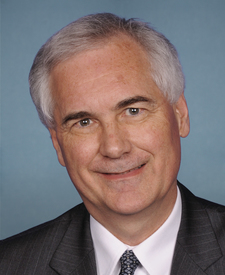
Tom McClintock (R)
Source: campground records from RIDB, NPS, USFS EDW and BLM, unified by CAMPANAC, refreshed nightly