Anthony Lake
3Heads up3 fires, nearest 3 mi
- Right now
- Nobody has saidNo season, no closure, no bookings to read
- A night
- $20From, per site
- Sites
- 41All of them booked ahead
The place
the agency’s own description · what’s there · 4 notices
In the agency’s own words
At an elevation of 7,100 feet, this campground keeps cool in the summertime heat. The sites sit among boulders and mixed conifers on a bluff over Anthony Lake. For questions for Anthony Lake, Grande Ronde Lake, Mud Lake, Peavey Cabin, and Anthony Lake Guard Station call (541) 519-3993 or email campgrounds@anthonylakes.com None of the sites offer lake views, but campers can enjoy gazing on Gunsight Mountain and the surrounding peaks of the Elkhorn range. Anthony Lakes Campgrounds Website Recreation There is a boat ramp available at the camp. Activities on Anthony Lake include boating, canoeing, kayaking and trout fishing. Trails in the area include the 22.6-mile Elkhorn Crest (foot and equestrian), 1-mile Black Lake (foot and equestrian) and the 1-mile Shoreline (foot). Keep reading
Facilities
Each site has a paved parking apron, tent pad, picnic table and campfire ring with grill. Drinking water (Peak Season) and vault toilets are available. Handicap-accessible sites are available. No OHV use in Anthony Lake Fee Area Natural Features The Wallowa-Whitman National Forest, 2.3 million acres of varied landscape, extends from the Blue Mountains and rugged Wallowa Mountains down to the spectacular canyon country of the Snake River on the Idaho border. Anthony Lake Campground is located in the Southern Elkhorn Mountain/Powder River Basin Area, with the highest peak in the Elkhorn Mountains at 9,108 feet. The area around the lake is known for conifer forests, wildflower meadows and the resident mountain goats.
Nearby Attractions
The Elkhorn Scenic Byway is a 106-mile drive through the Elkhorn Mountains. Along this drive are ghost towns and an abundance of lakes and rivers. Contact Info For facility specific information, please call (541) 519-3993.
Charges & Cancellations
A $10.00 service fee will apply if you change or cancel your reservation. Late cancellations are subject to additional fees. For full details see NRRS Reservation Policy
What the agency tells you
Group site can accommodate a maximum of 60 people
Click here for more information about Wallowa-Whitman National Forest
Don't Move Firewood: Please protect Pacific Northwest forests by preventing the spread of invasive species. Firewood can carry insects and diseases that can threaten the health of our western forests. You can make a difference by obtaining and burning your firewood near your camping destination. Visit Dontmovefirewood.org for further information.
Everything else this campground posts · 1
We do have First Come First Serve Sites, here is a list of first come first serve sites: - Drive In R.V. Sites: 9, 10, 11, 12, 15, 17, 21, 23, 25, 27 - Walk up Tent Sites: 28, 29, 30, 31, 32, 33, 34, 35, 36, 37, 38, 39, and site 0 There is a full campground map in the Photo Gallery at the top of the page.
Tents and rigs
- Sites
- 41 · 13 walk-in, 1 group, 2 cabin
- Hookups
- None
- Longest rig
- 35 ft
- Paved pads
- 27 of 41
- Accessible sites
- 3
- Pets
- Allowed
- Campfires
- Allowed, barring fire bans
- Shade
- Every site
Facilities
- Toilets
- Vault Toilets
- VAULT TOILETS on 1 of 41 campsite records, ACCESSIBLE VAULT TOILETS on 17 of 41 campsite records
- Drinking water
- Yes
- DRINKING WATER on 17 of 41 campsite records, DRINKING WATER (PEAK SEASON) on 19 of 41 campsite records, ACCESSIBLE DRINKING WATER on 1 of 41 campsite records
- Boat ramp
- Yes
- Camp host
- On site
- recreation.gov lists “Host”
Around the campground
- On the water
- Lake, River, Beach, Meadow
- Backpacking
- Biking
- Boating
- Canoeing
- Fishing
- Hiking
- Mountain biking
- Wildlife viewing
- Night sky · 231st darkest of 770 in OR
- Bortle 2
Nothing on the booking system for the next 30 nightsread 16:10 UTC
Every site here is reservable, and the record lists none held back for anyone who drives up.
Every one of the next thirty nights is in recreation.gov’s record and not one site is being offered on any of them. That’s a campground closed or not yet released for booking, not a sold-out one.
Watch for a cancellation
Full? Watch it.
One email when a night opens, plus More Than Just Parks dispatches. Unsubscribe any time.
We read recreation.gov once an hour, at 40 minutes past, and write the first time a site in your window is free for the nights you asked for.
Scanners that check every few minutes exist, and most of them charge. This one is free, it reads the same calendar, and it won’t always be first.
Tell me when the season opens
Watch for the season to open
One email when the season goes on sale, plus More Than Just Parks dispatches. Unsubscribe any time.
We check once an hour, at 40 minutes past, and write the first time the agency has that season on sale.
Scanners that check every few minutes exist, and most of them charge. This one is free, it reads the same calendar, and it won’t always be first.
We make nothing when you book. The link goes straight to the government.
Every line of the receipt · 15
What you actually pay
Derived by CAMPANAC: the agency’s published rate for this season, $20 a night, plus one $8 recreation.gov reservation fee for the booking. A weekend here means Friday and Saturday night, booked once. Optional charges (an extra vehicle, a second tent, a dump-station fee) are listed separately and aren’t in this total.
“A $10.00 service fee will apply if you change or cancel your reservation.” · this campground’s own terms
Who keeps the booking fee
The agency’s own policy text says the reservation fee and the cancellation processing fee are “retained by the reservation service contractor”, and that a campground concessionaire will decline to refund them because “they did not receive these fees”. Recreation.gov is run under contract by Booz Allen Hamilton. What share of your booking fee the contractor keeps isn’t published in any federal dataset we can read, so we print no number for it. Our reporting on the contract →
How we know this receipt · 6
recreation.gov availability, read 16:10 UTC · rules read Sep 9, 2026 · rates Oct 1, 2026 · How we know all this
The sites
41 sites · which ones have room · the site map
The sites, ranked
from 40 mapped sitesAll 41 sites
Toilet distances are OpenStreetMap’s, measured for 40 of the 41 sites listed. A site with no reading is unknown, never far.
The price is derived by CAMPANAC, not published per site: the per-night rate this campground publishes for each site’s own site type. 41 of the 41 sites listed carry one, and a site whose type has no published rate sits out of the price rather than being called free.
Measured shade is NLCD Tree Canopy Cover 2024 (USDA Forest Service / MRLC) read at the site’s own coordinate, 27% canopy or more, and only for the sites the agency gave no Shade value. It never changes the agency’s own shaded count beside it.
| Anthony Lake | 01 | standard nonelectric | yes | 114 ft | 464 ft | 55 ft | $20 | |
| Anthony Lake | 02 | standard nonelectric | 114 ft | 413 ft | 149 ft | $20 | ||
| Anthony Lake | 03 | standard nonelectric | 22 ft | 83 ft | 436 ft | 55 ft | $20 | |
| Anthony Lake | 04 | standard nonelectric | 20 ft | 80 ft | 530 ft | 147 ft | $20 | |
| Anthony Lake | 05 | standard nonelectric | 24 ft | 512 ft | 158 ft | $20 | ||
| Anthony Lake | 06 | standard nonelectric | 23 ft | yes | 24 ft | 508 ft | 165 ft | $20 |
| Anthony Lake | 07 | standard nonelectric | 66 ft | 445 ft | 102 ft | $20 | ||
| Anthony Lake | 08 | yurt | yes | 57 ft | 364 ft | 60 ft | $80–$96 | |
| Anthony Lake | 09 | standard nonelectric | 17 ft | 57 ft | 321 ft | 107 ft | $20 | |
| Anthony Lake | 10 | standard nonelectric | 16 ft | 46 ft | 335 ft | 179 ft | $20 | |
| Anthony Lake | 11 | standard nonelectric | 12 ft | 46 ft | 311 ft | 157 ft | $20 | |
| Anthony Lake | 12 | standard nonelectric | 18 ft | 62 ft | 303 ft | 109 ft | $20 | |
| Anthony Lake | 14 | standard nonelectric | 91 ft | 403 ft | 43 ft | $20 | ||
| Anthony Lake | 15 | standard nonelectric | 22 ft | 33 ft | 494 ft | 116 ft | $20 | |
| Anthony Lake | 16 | standard nonelectric | 22 ft | 33 ft | 514 ft | 131 ft | $20 | |
| Anthony Lake | 17 | standard nonelectric | 22 ft | 23 ft | 579 ft | 75 ft | $20 | |
| Anthony Lake | 18 | standard nonelectric | 22 ft | 23 ft | 584 ft | 92 ft | $20 | |
| Anthony Lake | 19 | standard nonelectric | 83 ft | 480 ft | 97 ft | $20 | ||
| Anthony Lake | 20 | standard nonelectric | 20 ft | 96 ft | 450 ft | 148 ft | $20 | |
| Anthony Lake | 21 | standard nonelectric | 21 ft | 87 ft | 471 ft | 48 ft | $20 | |
| Anthony Lake | 22 | standard nonelectric | 22 ft | 78 ft | 499 ft | 62 ft | $20 | |
| Anthony Lake | 23 | standard nonelectric | 18 ft | 78 ft | 557 ft | 107 ft | $20 | |
| Anthony Lake | 24 | standard nonelectric | 22 ft | 76 ft | 605 ft | 179 ft | $20 | |
| Anthony Lake | 25 | standard nonelectric | 18 ft | 50 ft | 531 ft | 175 ft | $20 | |
| Anthony Lake | 26 | standard nonelectric | 22 ft | 50 ft | 495 ft | 130 ft | $20 | |
| Anthony Lake | 27 | standard nonelectric | 22 ft | 51 ft | 451 ft | 81 ft | $20 | |
| Anthony Lake | 40 | yurt | 195 ft | 226 ft | 31 ft | $80–$96 | ||
| Anthony Lake | GS1 | group standard nonelectric | 35 ft | 309 ft | 384 ft | 304 ft | $100 | |
| Anthony Lake | T0 | walk to | $12 | |||||
| Anthony Lake | T28 | walk to | 107 ft | 292 ft | 115 ft | $12 | ||
| Anthony Lake | T29 | walk to | 32 ft | 224 ft | 169 ft | $12 | ||
| Anthony Lake | T30 | walk to | 32 ft | 203 ft | 196 ft | $12 | ||
| Anthony Lake | T31 | walk to | 33 ft | 203 ft | 259 ft | $12 | ||
| Anthony Lake | T32 | walk to | 33 ft | 174 ft | 289 ft | $12 | ||
| Anthony Lake | T33 | walk to | 205 ft | 372 ft | 502 ft | $12 | ||
| Anthony Lake | T34 | walk to | 106 ft | 324 ft | 668 ft | $12 | ||
| Anthony Lake | T35 | walk to | 106 ft | 234 ft | 718 ft | $12 | ||
| Anthony Lake | T36 | walk to | 169 ft | 123 ftParker Creek | 580 ft | $12 | ||
| Anthony Lake | T37 | walk to | 17 ft | 23 ftParker Creek | 412 ft | $12 | ||
| Anthony Lake | T38 | walk to | 17 ft | under 10 ftParker Creek | 395 ft | $12 | ||
| Anthony Lake | T39 | walk to | 195 ft | 249 ft | 165 ft | $12 |
25 of 41 listed
Getting there
the map and the coordinate · the agency’s directions · the phone number
Where it is
 Mud Lake CampgroundWhitman National Forest · 0.1 mi
 Anthony Lake Guard StationWhitman National Forest · 0.2 mi
 Grande Ronde Lake CampgroundWhitman National Forest · 1.0 mi
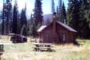 Peavy CabinWhitman National Forest · 4.0 mi
 North Fork John Day Campground (OR)Umatilla National Forest · 9.0 mi
 McCully Forks CampgroundWhitman National Forest · 14 mi
From Baker City, head north on Highway 30 toward Haines, approximately 10 miles. In Haines, turn left and follow the Anthony Lake Highway signs (turns into Forest Road 73) for 25 miles to the Anthony Lake Recreation Area. Turn left into the Anthony Lake Campground. The main campground is on the east side of the lake.
From La Grande, head south on Interstate 84 for 25 miles to exit 285 in North Powder, Oregon. In North Powder, follow the ski area signs on Highway 237 for 4 miles to Ellis Road. Turn left on Ellis Road and go about 1 mile to the Anthony Lake Highway. Turn right and follow the Anthony Lake Highway (becomes Forest Road 73) for 16 miles to campground entrance on your left.
The weather
the next four days
Next four days, and the thirty-year normal
Forecast
NWS forecast for Granite, OR
The land, and who answers for it
what threatens it · who answers for it
What threatens this place
You’re camping on ground somebody wants. We track the threats and the comment deadlines.
Who answers for this land
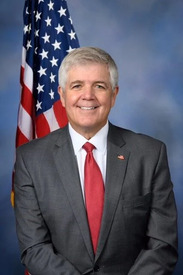
Anthony Lake is in Oregon’s 2nd congressional district. Its representative, Cliff Bentz (R), votes on the laws that decide what happens to this land. Public-lands grade so far: F. See every public-lands vote →