U.S. Forest Service · National Forest · Oregon
Whitman National Forest
Here, 39% take walk-ups.
31Campgrounds
12Take walk-ups
1Free to camp
$8–$36A night, across 18
210Sites, from 17
2,990–7,170 ftElevation
Where they are
31 of 31 mappedDrawing the map
© OpenFreeMap · OpenStreetMap · Esri hillshadeSource: RIDB · NPS · USFS EDW · BLM, unified by CAMPANAC · Oct 23, 2026
The campgrounds
31 campgrounds
 Union Creek CampgroundReservablefrom $364 group sites59 sitesrigs to 60 ft4,120 fthookupsdrinking watertoilets
 Anthony LakeReservablefrom $2013 walk-in sites13 hike-in sites41 sitesrigs to 35 ft7,150 ftdrinking watertoilets
 Mud Lake CampgroundReservableSeasonalfrom $162 pull-through sites8 sitesrigs to 30 ft7,120 fthookupsdrinking watertoilets
 Umatilla Forks CampgroundReservablefrom $108 sites4,030 ftdrinking watertoilets
 Anthony Lake Guard StationReservableSites from $1602 sites7,170 fthookupstoilets
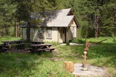 Antlers Guard Station CabinReservableSites from $1051 pull-through site1 site4,230 ftdrinking water
 North Fork Catherine Creek Group CampgroundReservableSites from $401 group site1 site4,120 fttoilets
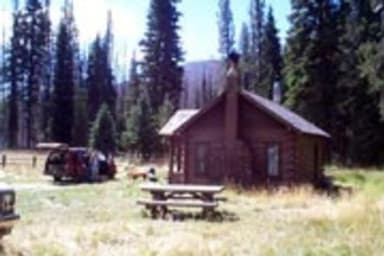 Peavy CabinReservableSites from $1051 pull-through site1 site5,850 fttoilets
 Two Color Guard StationReservableSites from $801 pull-through site1 site4,820 fttoilets
 Fish Lake CampgroundFirst-comeSeasonalfrom $156,670 ft
 Grande Ronde Lake CampgroundFirst-comeSeasonal7,170 ft
 McCully Forks CampgroundSeasonal4,560 ft
 Millers Lane CampgroundFirst-comeSeasonal4,100 ft
 North Fork Catherine Creek CampgroundFirst-comeFree3,840 ft
 Oregon CampgroundFirst-comeSeasonalfrom $104,960 ft
 South Fork CampgroundFirst-comeSeasonalfrom $154,380 ft
 Southwest Shore CampgroundFirst-comeSeasonal4,090 ft
 Umapine CampgroundFirst-comefrom $105,090 ft
 West Eagle Meadow CampgroundFirst-comefrom $105,490 ftBird Track Springs CampgroundReservablefrom $1022 sites3,130 ftSpool Cart CampgroundReservablefrom $1013 sites3,500 ftTamarack CampgroundReservablefrom $1512 sites4,460 ftWetmore CampgroundReservablefrom $1511 sites4,330 ftMcBride CampgroundReservablefrom $1010 sites4,720 ft
Source: RIDB · NPS · USFS EDW · BLM, unified by CAMPANAC · Oct 23, 2026
This land
measured from the nearest campground in the unitdeveloping
Roadless
Roadless
Roadless
Roadless
Roadless
Roadless
Camping here is a stake in what happens to it. More Than Just Parks tracks the threats and the comment windows.
Roadless areas: USFS Inventoried Roadless Areas via MTJP Roadless Map · Jul 29, 2026
Source: MTJP Threatened Lands map · Sep 30, 2026
Heads up
Wildfire
Anthony fire · 2.4 mi from the nearest campground here · 2,584 acres · 100% contained
Wildfire
Summit Lake fire · 3.8 mi from the nearest campground here · 0 acres
Wildfire
McCully fire · 4.6 mi from the nearest campground here · 13,604 acres · 91% contained
Wildfire
Bradley Flats fire · 15 mi from the nearest campground here · 227 acres · 100% contained
Wildfire
North Cayuse fire · 23 mi from the nearest campground here · 4,887 acres · 97% contained
Wildfire
Hagen fire · 24 mi from the nearest campground here · 61,380 acres · 99% contained
Source: NIFC/IRWIN via MTJP wildfire tracker · Oct 22, 2026
Who answers for this land
Whitman National Forest’s campgrounds sit in one congressional district. These members vote on the laws that decide what happens to this land.
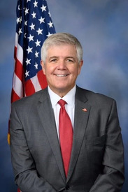
Cliff Bentz (R)
Source: campground records from RIDB, NPS, USFS EDW and BLM, unified by CAMPANAC, refreshed nightly