Arid Peak Lookout
1Heads up1 fire 14 mi away
- Right now
- Closedrecreation.gov lists every site closed this weekend, read 15:21 UTC
- Sites
- 1In the agency’s record
The place
the agency’s own description · what’s there · 10 notices
In the agency’s own words
Arid Peak Lookout was built in 1934 to help detect fires that may have been sparked by the Milwaukee Railroad Line. It was last staffed in 1969 and sat idle for over 25 years before being renovated by a team of over 30 volunteers, the Forest Fire Lookout Association and the U.S. Forest Service. Arid Peak Lookout was restored to its original splendor in 1997 and is available for rent to the public. The lookout is listed on the National Register of Historic Lookouts and provides epic 360 degree views of the Bitterroot Mountains. Access to the cabin requires a moderately-steep 3 mile hike and availability is dependent on weather conditions. Keep reading
Recreation
The Hiawatha Bicycle Trail is considered the "crown jewel" of rail-to-trail mountain biking trails as it zips across seven trestles and through 10 tunnels in the magnificent Bitterroot Mountains. The trail can be accessed just over 10 miles from the lookout. The lookout offers access to the Arid Peak Trail #173, Mozier Peak Trail #174, and Kyle Creek Trail #175. All three trails are great for day-hiking, but can also be explored over longer backpacking treks or on horseback.
Facilities
The cabin fits up to four guests. Furnishings include two cots with mattresses, basic cooking gear, dishes, a propane lantern, propane camp stove, water containers, a table with two chairs and a wood stove. An outhouse is located outside the tower. No water is available so guests must bring their own or boil and treat stream water. Propane canisters are not included; a stock of 16.4 ounce canisters are required to use cooking and lighting equipment. Other items to pack include bedding, food, binoculars, a first aid kit, flashlights, towels, toilet paper, and dish soap.
Natural Features
The Arid Peak Lookout is located within the St. Joe River area of the Idaho Panhandle National Forests, an area that includes most of what was originally established as the St. Joe National Forest. The area is known for its blue-ribbon cutthroat trout streams, Wild and Scenic Rivers and extensive roadless and primitive areas. The St. Joe Rover area is also nationally recognized for its elk herds. The 20 foot tower sits at an elevation of 5,306 feet and overlooks the beautiful Loop Creek area and the scenic Hiawatha Bicycle Trail. The mixed conifer forest around the facility includes Douglas fir and spruce. Wildlife sightings of elk, deer, black bears, moose and bald eagles are common. This is bear country; Visitors are advised to be aware of and practice bear safety. Contact Info For facility specific information, please call (208) 245-2531.
Nearby Attractions
The town of Avery has the nearest conveniences.
What the agency tells you
Entry is by combination lock; combination can be found on your confirmation.
No drinking water available; bring water or treat and boil spring water, found a half-mile down a steep trail
Please bring garbage bags; this is a 'pack it in-pack it out' facility
Everything else this campground posts · 7
Wastewater should be strained and all food particles should be packed out; remaining water should be poured in a hole away from lookout
No smoking allowed in lookout
No pets allowed
Please seal all food in rodent-proof containers (one provided) or coolers
Bring plenty of blankets and warm clothes for cold nights
Click here for more information on the Idaho Panhandle National Forest
Don't Move Firewood: Prevent the spread of tree-killing pests by obtaining firewood near your destination and burning it on-site. For more information visit dontmovefirewood.org.
Tents and rigs
- Sites
- 1 · 1 cabin
- Hookups
- None
- Accessible sites
- None listed
Facilities
- Toilets
- Yes, the record doesn't say what kind
- “An outhouse is located outside the tower.”
- Drinking water
- None, bring your own
- “…outhouse is located outside the tower. No water is available so guests must bring their own or boil…”
Around the campground
- On the water
- River, Creek
- Biking
- Hiking
Nothing to book until it reopensread 15:21 UTC
recreation.gov lists every site closed this weekend
Every one of the next thirty nights is in recreation.gov’s record and not one site is being offered on any of them. That’s a campground closed or not yet released for booking, not a sold-out one.
Tell me when it reopens
Watch for it to come back
One email when the agency reopens it, plus More Than Just Parks dispatches. Unsubscribe any time.
We check the agency’s own record once an hour, at 40 minutes past, and write the first time it stops saying closed.
Scanners that check every few minutes exist, and most of them charge. This one is free, it reads the same calendar, and it won’t always be first.
Every line of the receipt · 11
What you actually pay
Who keeps the booking fee
The agency’s own policy text says the reservation fee and the cancellation processing fee are “retained by the reservation service contractor”, and that a campground concessionaire will decline to refund them because “they did not receive these fees”. Recreation.gov is run under contract by Booz Allen Hamilton. What share of your booking fee the contractor keeps isn’t published in any federal dataset we can read, so we print no number for it. Our reporting on the contract →
How we know this receipt · 4
Why this page can’t say why
recreation.gov lists every site at Arid Peak Lookout closed this Friday and Saturday night. The U.S. Forest Service has published no closure notice we hold, so this page can’t say why, and it won’t fill the gap with a guess. A closed night isn’t a sold-out one: the reservations its record still carries were taken before the sites were closed.
There’s no notice to quote and no reason to argue with, so this page offers you the watch and the list below, and no letter.
Open within 60 miles · 4
The agency’s own word that these are open, not our reading of a season.
- Mammoth Springs CampgroundSt. Joe National Forest · 19 mi
- Gold Rush CampgroundLolo National Forest · 24 mi · walk-up
- Cedars CampgroundClearwater National Forest · 47 mi · walk-up
- Little Boulder CampgroundSt. Joe National Forest · 52 mi · walk-up
recreation.gov availability, read 15:21 UTC · rules read Sep 9, 2026 · rates Oct 1, 2026 · How we know all this
The sites
1 sites · the site map
All 1 sites
The price is derived by CAMPANAC, not published per site: the per-night rate this campground publishes for each site’s own site type. 1 of the 1 sites listed carry one, and a site whose type has no published rate sits out of the price rather than being called free.
| AREA ARID PEAK LOOKOUT | 001 | cabin nonelectric | 3,246 ft | $45 |
OpenStreetMap has no toilet mapped within 1 km of this campground, so no site here carries a toilet distance. That’s a gap in the map, not a finding about the campground.
Getting there
the map and the coordinate · the agency’s directions · the phone number
Where it is
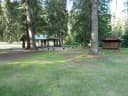 Shoshone Park Kitchen7.7 mi
 Turner Flat CampgroundSt. Joe National Forest · 9.9 miTin Can Flat CampgroundSt. Joe National Forest · 11 mi
 Huckleberry CampgroundCoeur D'Alene Field Office · 16 miBig Creek CampgroundSt. Joe National Forest · 17 mi
From Avery, turn left and head north up the North Fork of the St. Joe River Road #456 toward Wallace. Travel about 4.5 miles, then turn left down the hill just before the bridge across the river. You will then be on Road #1997, which is a single lane gravel road with pull outs. Drive about 3.5 miles and turn left on the first road (also labeled Road No. 1997). Travel 6.5 miles to Trailhead #175.
A turn-around is just past the trailhead before the gate. Do not block the turnaround or the gate. Park in the wide spot by the trailhead. Hike up Trail #175 for 1.5 miles to the junction with Trail #173. Turn right and hike 1.5 miles on Trail #173 to Arid Peak.
The weather
the next four days · the thirty-year normal
Next four days, and the thirty-year normal
Forecast
NWS forecast for Mullan, ID
Typical weather
Typical October night 32°F, day 44°F.
Coldest month of the year: typical December night 18°F, below freezing. Bring a bag rated colder than that, and expect ice in the water bottle.
Daily high and lowDays with 0.10 in or more
A normal is the 1991-2020 average for the month, not a forecast: about half of all Julys are colder than the July line. The seven-day forecast above answers the other question.
The land, and who answers for it
what threatens it · who answers for it
Roadless country, and what’s coming for it
You’re camping on ground somebody wants. We track the threats and the comment deadlines.
Who answers for this land
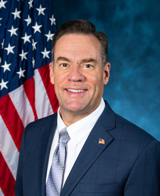
Arid Peak Lookout is in Idaho’s 1st congressional district. Its representative, Russ Fulcher (R), votes on the laws that decide what happens to this land. Public-lands grade so far: F. See every public-lands vote →