Au Sable East Group Backpacking Site
1Heads uppark alert
- Right now
- Nobody has saidNo season, no closure, no bookings to read
- Sites
- 1All of them booked ahead
The place
the agency’s own description · what’s there
In the agency’s own words
Au Sable Point East Group Campground is 0.2 miles west of the Au Sable Light Station and inland from the North Country Trail. The group campsite is surrounded by a coniferous forest. There is access to Lake Superior with a view of the Grand Sable Dunes. One shared fire ring and pit toilet. Water source is Lake Superior. Lake Superior access for kayakers.
Facilities
- Toilets
- Pit Toilets
- “…Sable Dunes. One shared fire ring and pit toilet. Water source is Lake Superior. Lake Superior…”
No reading yet, book on recreation.gov
Every site here is reservable, and the record lists none held back for anyone who drives up.
recreation.gov publishes no availability for a campground you can’t reserve, so there’s no thirty-night reading to draw here. The season bar above is what the agency does publish.
We make nothing when you book. The link goes straight to the government.
Every line of the receipt · 11
What you actually pay
Who keeps the booking fee
The agency’s own policy text says the reservation fee and the cancellation processing fee are “retained by the reservation service contractor”, and that a campground concessionaire will decline to refund them because “they did not receive these fees”. Recreation.gov is run under contract by Booz Allen Hamilton. What share of your booking fee the contractor keeps isn’t published in any federal dataset we can read, so we print no number for it. Our reporting on the contract →
How we know this receipt · 4
record Aug 24, 2026 · How we know all this
Getting there
the map and the coordinate · the phone number
Where it is
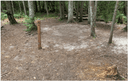 Au Sable East Individual Backpacking SitesPictured Rocks National Lakeshore · 0.1 mi
 Hurricane River CampgroundPictured Rocks National Lakeshore · 1.5 mi
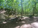 Masse Homestead Group Backpacking SitePictured Rocks National Lakeshore · 2.5 mi
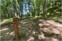 Masse Homestead Individual Backpacking SitesPictured Rocks National Lakeshore · 2.7 mi
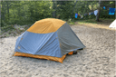 Benchmark Individual Backpacking SitesPictured Rocks National Lakeshore · 3.4 mi
 Twelvemile Beach Campground and CabinPictured Rocks National Lakeshore · 4.4 mi
The weather
the next four days · the thirty-year normal
Next four days, and the thirty-year normal
Forecast
NWS forecast for Grand Marais, MI
Typical weather
Typical October night 39°F, day 55°F.
Coldest month of the year: typical February night 12°F, below freezing. Bring a bag rated colder than that, and expect ice in the water bottle.
Daily high and lowDays with 0.10 in or more
A normal is the 1991-2020 average for the month, not a forecast: about half of all Julys are colder than the July line. The seven-day forecast above answers the other question.
The land, and who answers for it
who answers for it
Who answers for this land

Au Sable East Group Backpacking Site is in Michigan’s 1st congressional district. Its representative, Jack Bergman (R), votes on the laws that decide what happens to this land. Public-lands grade so far: F. See every public-lands vote →