Hurricane River Campground
1Heads uppark alert
- Right now
- Nobody has saidNo season, no closure, no bookings to read
- A night
- $25From, per site
- Sites
- 2221 on recreation.gov
The place
the agency’s own description · what’s there · 10 notices
In the agency’s own words
Pictured Rocks National Lakeshore hugs the Lake Superior shoreline for more than 40 miles along Michigan's northern coast. Lake Superior is the largest, deepest, coldest, and most pristine of all the Great Lakes. Camping at Pictured Rocks National Lakeshore is a great way to relax and enjoy the beauties the lakeshore has to offer. Campgrounds are rustic, and do not provide electric or sewer hookups. Campers, trailers, and RVs are welcome, note there are generator free areas. Cell phone reception is limited, so unplug, unwind, and enjoy the serenity Pictured Rocks National Lakeshore Campgrounds has to offer. Keep reading
Hurricane River Campground is located 12 miles (19 km) west of Grand Marais and is divided into two separate sections off County Highway (H-) 58, Hurricane River Upper, and Hurricane River Lower. The Upper Campground has 10 sites and the Lower Campground has 12. Campground amenities include water, pit toilets, picnic tables, fire rings, and handicap accessible sites. Hurricane River Lower Campground is the trailhead for the Au Sable Light Station, which is a 3-mile (5 km) round trip stroll to the lighthouse with views of Lake Superior, Jacobsville Sandstone, and Shipwreck remains. Upper Hurricane River is tucked back in the woods with beautiful deciduous trees between sites allowing for the woodsy experience of Northern Michigan.
Recreation
Pictured Rocks National Lakeshore offers 100 miles (161 km) of hiking trails leading to waterfalls, beaches, forest wilderness, cultural sites, and breathtaking cliff-top views of Lake Superior. Whether you have only a few minutes, hours, or days to see a portion of the lakeshore, one of these hikes may be for you. Lake Superior's rugged shoreline invites boaters to explore the beautiful Pictured Rocks National Lakeshore with its miles of colorful sandstone cliffs and long stretches of sandy beaches. Peaceful inland lakes also invite boaters to linger in the northwoods. Check the marine weather forecast before venturing out. Watch the weather carefully while on the lake. The weather can change suddenly and unexpectedly. Just because it's calm in Munising Bay or Grand Marais Harbor does not mean it is calm along the more distant shores. The Pictured Rocks cliffs rise 50 to 200 feet (15 to 61 m) directly from the lake, offering precious few protected places if the wind and waves increase.
Facilities
Pictured Rocks National Lakeshore drive-in campsites are rustic and do not have electric, water, or sewer hookups. Campsites provide a picnic table, fire ring with grill grate, and tent pad. The campgrounds have vault toilets and well water. Tent-style enclosures for campsite portable toilets are strictly prohibited. Typically there is no cell phone reception.
Natural Features
Sandstone cliffs, beaches, sand dunes, waterfalls, inland lakes, deep forest, and wild shoreline beckon you to visit Pictured Rocks National Lakeshore. The power of Lake Superior shapes the park's coastal features and affects every ecosystem, creating a unique landscape to explore. Hiking, camping, sightseeing, and four-season outdoor opportunities abound.
Nearby Attractions
Kayak and Other Guided Tours and Pictured Rocks Boat Cruises within the national lakeshore are offered by authorized private companies. Pontoon boat and other rentals for use on Lake Superior are available in nearby communities. Charges & Cancellations
What the agency tells you
Conditions for all camping: Camping is limited to 14 days per calendar year within the Lakeshore. Permits are required for all camping. Camping is only allowed at designated locations. Overflow camping is prohibited. A campsite must be occupied by the person in possession of the permit for the campsite on the date(s) of occupancy. The campsite must be vacated by 11:00 am of the following day. Campers must have the appropriate camping permit in their possession. Campers must pay required fees for the site they are occupying.
Drive-in Camping Regulations: Only one screened porch/tent may be placed over the picnic table per site. A screened tent does not count towards the four tents per site limit. No more than eight persons per site. There is not a vehicle limit per site. Vehicles must fit within the parking space provided. This is strictly enforced; there are plenty of day use parking spaces nearby for extra vehicles. All tents must be placed on or within 6 feet of the existing tent pad. A maximum combination of 4 tents or sleeping hammocks are allowed on the campsite. Generator use is not allowed in sites designated as generator free at Hurricane River Campground (#4 - #7).
Important times: Checkout time is 11:00 am. Upon arrival, you can occupy your site any time after 11:00 am. Campground quiet hours are 10 pm to 6 am. There are generator-free areas at Twelvemile Beach and Hurricane River Campgrounds. Music should be for private listening only.
Everything else this campground posts · 7
Please print your reservation and have it with you or attached to campsite post.
Fire Regulations: The lighting or maintaining of open fires is generally prohibited, except in government provided metal fire rings and fire grills at the locations they are provided, or in personal self-contained charcoal grills in a parking lot or paved sidewalk. Campfires are permitted in fire rings only. Fires or hot coals cannot be left unattended. Beach fires are not allowed. Fire must be extinguished entirely using water and not buried. Purchase wood locally. No collecting of wood. No cutting of standing trees or limbs. Ash firewood is prohibited.
Pets / The following areas are closed to dogs, cats or any other domesticated animal: The North Country Trail and Sand Point Marsh Trail. The Grand Sable Dunes Natural Area and adjacent Log Slide dune field. All winter ski trails which are maintained by grooming. All park areas east of Miners Beach to the western edge of 12 Mile Beach Campground is closed to pets including: Little Beaver Lake Campground Beaver Basin Overlook Parking Area Pets must always be on leash. Please dispose of all pet waste in the appropriate receptacles. This closure does not affect legal hunting as defined in 36 CFR 7.32.
Food Storage / The following conditions for the storage of food are in effect in the entirety of Pictured Rocks National Lakeshore: All food items, lawfully taken fish and wildlife, garbage and equipment used to cook or store food must be kept sealed in a vehicle, or in a camping unit that is constructed of solid, non-pliable material, in government provided receptacles or suspended at least 10 feet above the ground and 4 feet horizontally from a post, tree trunk or other object. This is bear country! Proper storage ensures safety for you and members of your party when enjoying the natural resource. Violations of food storage rules may result in fines.
Conditions for the disposal, containerization, or carryout of human body waste have been established as follows: Where toilet facilities are not provided, human wastes will be disposed at least 200 feet from a trail, campsite, or water source; in a hole at least six inches deep; and covered with earth or packed out of the park. Where toilet facilities are provided (park campgrounds), human waste shall not be disposed of in park trash cans. Portable toilet facilities may be used (such as in a camper) if graywater and sewage remain contained within the vehicle. Tent style enclosures for campsite portable toilets and/or showers are prohibited.
Pictured Rocks National Lakeshore drive-in campsites are rustic and do not have electric, water, or sewer hookups. Campsites provide a picnic table, fire ring with grill grate, and tent pad. The campgrounds have vault toilets and well water. Tent-style enclosures for campsite portable toilets and/or showers are strictly prohibited. Typically there is no cell phone reception. All camping at Pictured Rocks is by reservation only. Same-day reservation are accepted.
Other: Resale or auction of advance reservations is prohibited. Campsite 1 in the upper loop and campsite 11 in the lower loop can be reserved 2 weeks before your intended arrival date. Campsite 1 in the lower loop and campsite 2 in the upper loop can be reserved 4 days before your intended arrival date.
Tents and rigs
- Sites
- 22
- Hookups
- None
- Longest rig
- 42 ft
- Accessible sites
- 2
- Pets
- Allowed
- Campfires
- Allowed, barring fire bans
- Shade
- Every site
Facilities
- Toilets
- Vault Toilets - seasonal
- Drinking water
- Yes
- Camp host
- On site
- recreation.gov lists “Host”
- Stay limit
- 14 nights
- recreation.gov facility rule maxStay
Around the campground
- On the water
- Waterfall, Lake, River, Beach, Coast
- Guided Interpretive Walks
- Historic site
- Ranger programs
- Paddling
- Picnicking
- Swimming
- Night sky · 2nd darkest of 192 in MI
- Bortle 2
- Cell signal · Cell signal · Park Service says
- Spotty
No reading yet, book on recreation.gov
recreation.gov lists 21 of the 22 campsites the agency files here. The rest aren’t on its booking system, so a reservation won’t get you one.
No availability snapshot inside the last 36 hours, so this page draws nothing rather than ageing a reading into fiction.
Watch for a cancellation
Full? Watch it.
One email when a night opens, plus More Than Just Parks dispatches. Unsubscribe any time.
We read recreation.gov once an hour, at 40 minutes past, and write the first time a site in your window is free for the nights you asked for.
Scanners that check every few minutes exist, and most of them charge. This one is free, it reads the same calendar, and it won’t always be first.
Tell me when the season opens
Watch for the season to open
One email when the season goes on sale, plus More Than Just Parks dispatches. Unsubscribe any time.
We check once an hour, at 40 minutes past, and write the first time the agency has that season on sale.
Scanners that check every few minutes exist, and most of them charge. This one is free, it reads the same calendar, and it won’t always be first.
We make nothing when you book. The link goes straight to the government.
Every line of the receipt · 15
What you actually pay
Derived by CAMPANAC: the agency’s published rate for this season, $25 a night, plus one $8 recreation.gov reservation fee for the booking. A weekend here means Friday and Saturday night, booked once. Optional charges (an extra vehicle, a second tent, a dump-station fee) are listed separately and aren’t in this total.
Who keeps the booking fee
The agency’s own policy text says the reservation fee and the cancellation processing fee are “retained by the reservation service contractor”, and that a campground concessionaire will decline to refund them because “they did not receive these fees”. Recreation.gov is run under contract by Booz Allen Hamilton. What share of your booking fee the contractor keeps isn’t published in any federal dataset we can read, so we print no number for it. Our reporting on the contract →
How we know this receipt · 5
rules read Sep 9, 2026 · rates Sep 10, 2026 · How we know all this
The sites
22 sites
All 22 sites
The price is derived by CAMPANAC, not published per site: the per-night rate this campground publishes for each site’s own site type. 21 of the 22 sites listed carry one, and a site whose type has no published rate sits out of the price rather than being called free.
| Lower | 01 | standard nonelectric | 24 ft | $25 | |
| Lower | 02 | standard nonelectric | 36 ft | $25 | |
| Lower | 03 | standard nonelectric | 36 ft | $25 | |
| Lower | 04 | standard nonelectric | 36 ft | $25 | |
| Lower | 05 | standard nonelectric | 36 ft | $25 | |
| Lower | 06 | standard nonelectric | 28 ft | $25 | |
| Lower | 07 | standard nonelectric | 33 ft | $25 | |
| Lower | 08 | type not stated | 36 ft | ||
| Lower | 09 | standard nonelectric | 36 ft | $25 | |
| Lower | 10 | standard nonelectric | 36 ft | $25 | |
| Lower | 11 | standard nonelectric | 36 ft | $25 | |
| Lower | 12 | standard nonelectric | 36 ft | yes | $25 |
| Upper | 01 | standard nonelectric | 34 ft | $25 | |
| Upper | 02 | standard nonelectric | 36 ft | $25 | |
| Upper | 03 | standard nonelectric | 36 ft | $25 | |
| Upper | 04 | standard nonelectric | 36 ft | $25 | |
| Upper | 05 | standard nonelectric | 36 ft | $25 | |
| Upper | 06 | standard nonelectric | 36 ft | $25 | |
| Upper | 07 | standard nonelectric | 36 ft | $25 | |
| Upper | 08 | standard nonelectric | 42 ft | $25 | |
| Upper | 09 | standard nonelectric | 36 ft | $25 | |
| Upper | 10 | standard nonelectric | 36 ft | yes | $25 |
Getting there
the map and the coordinate · the agency’s directions · the phone number
Where it is
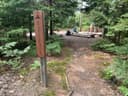 Au Sable East Group Backpacking SitePictured Rocks National Lakeshore · 1.5 mi
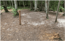 Au Sable East Individual Backpacking SitesPictured Rocks National Lakeshore · 1.5 mi
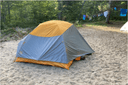 Benchmark Individual Backpacking SitesPictured Rocks National Lakeshore · 2.0 mi
 Twelvemile Beach Campground and CabinPictured Rocks National Lakeshore · 3.0 mi
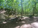 Masse Homestead Group Backpacking SitePictured Rocks National Lakeshore · 3.6 mi
 Masse Homestead Individual Backpacking SitesPictured Rocks National Lakeshore · 3.8 mi
Pictured Rocks NL is located on the south shore of Lake Superior in Michigan's Upper Peninsula, between the towns of Munising (west) and Grand Marais (east). Access the west side of the park via Michigan highways M-28 and M-94 to Munising. State highway M-77 leads to Grand Marais on the east side. Alger County Road H-58 runs parallel and through the park, providing access to spur roads that lead to scenic overlooks, trailheads, campgrounds, beaches, etc. Many roads are closed in winter due to snow.
The weather
the next four days · the thirty-year normal
Next four days, and the thirty-year normal
Forecast
NWS forecast for Grand Marais, MI
Typical weather
Typical October night 39°F, day 55°F.
Coldest month of the year: typical February night 12°F, below freezing. Bring a bag rated colder than that, and expect ice in the water bottle.
Daily high and lowDays with 0.10 in or more
A normal is the 1991-2020 average for the month, not a forecast: about half of all Julys are colder than the July line. The seven-day forecast above answers the other question.
The land, and who answers for it
who answers for it
Who answers for this land

Hurricane River Campground is in Michigan’s 1st congressional district. Its representative, Jack Bergman (R), votes on the laws that decide what happens to this land. Public-lands grade so far: F. See every public-lands vote →
How we know
every fact on this page, and where it came from
“…are welcome, note there are generator free areas. Cell phone reception is limited, so unplug, unwind, and enjoy the serenity Pictured Rocks…”