Blue Bend Recreation Area and Campground
- Right now
- Nobody has saidNo season, no closure, no bookings to read
- A night
- $16From, per site
The place
the agency’s own description · what’s there
In the agency’s own words
Located on State Route 16, near Alvon, West Virginia, Blue Bend is in a rustic and beautiful setting along scenic Anthony Creek. The area serves both campers and daytime visitors, and is popular for fishing, swimming, hiking, and picnicking. Most of these trails were constructed in the 1930's by the Civilian Conservation Corps. Anthony Creek Trail follows the creek in a narrow valley filled with rhododendron and many flowering forest trees. Blue Bend Loop Trail offers three scenic overlooks and has a trail shelter for overnight use. The South Boundary Trail travels from the beautiful Greenbrier River, fords Anthony Creek, then winds through mountains along the forest's southern boundary. The Beaver's Tale Braille plaques along its route invite the visitor to explore this unique river-bottom site.
Around the campground
- On the water
- River, Creek
- Fall color · reported 10 days ago, 25 km away
- Peak color
Phone before you drive
recreation.gov publishes no availability for a campground you can’t reserve, so there’s no thirty-night reading to draw here. The season bar above is what the agency does publish.
Every line of the receipt · 5
What you actually pay
Derived by CAMPANAC: the lowest per-night amount the agency’s fee record states ($16), and no booking fee, because this campground takes no reservations. A weekend here means Friday and Saturday night. Optional charges (an extra vehicle, a second tent, a dump-station fee) are listed separately and aren’t in this total.
How we know this receipt · 5
record Aug 24, 2026 · How we know all this
Getting there
the map and the coordinate
Where it is
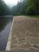 Blue Bend Rec AreaMonongahela National Forest · 0.6 mi
 Blue Meadow0.6 mi
 Hopkins Mountain Fireman's CabinMonongahela National Forest · 1.8 mi
 Lake Sherwood Recreation Area and CampgroundMonongahela National Forest · 15 mi
 Lake SherwoodMonongahela National Forest · 15 mi
 Morris Hill CampgroundGeorge Washington National Forest · 16 mi
The weather
the next four days · the thirty-year normal
Next four days, and the thirty-year normal
Forecast
NWS forecast for Falling Spring, WV
Typical weather
Typical October night 39°F, day 65°F.
Coldest month of the year: typical January night 20°F, below freezing. Bring a bag rated colder than that, and expect ice in the water bottle.
Daily high and lowDays with 0.10 in or more
A normal is the 1991-2020 average for the month, not a forecast: about half of all Julys are colder than the July line. The seven-day forecast above answers the other question.
The land, and who answers for it
what threatens it · who answers for it
Roadless country, and what’s coming for it
You’re camping on ground somebody wants. We track the threats and the comment deadlines.
Who answers for this land

Blue Bend Recreation Area and Campground is in West Virginia’s 1st congressional district. Its representative, Carol Miller (R), votes on the laws that decide what happens to this land. Public-lands grade so far: F. See every public-lands vote →