Caretakers Cabin
3Heads up3 fires, nearest 6 mi
- Right now
- Taking bookingsSites offered on 28 of the next 30 nights read 16:27 UTC
- Sites
- 1All of them booked ahead
The place
the agency’s own description · what’s there · 10 notices
In the agency’s own words
Caretaker's Cabin allows guests to relax in the outdoors at the historic Fremont Powerhouse site. As one of four cabins located at the site, the cabin offers flexibility for large groups, like weddings or reunions. Guests can rent all cabins (see Congo Gulch, Hilltop Hideaway, and Miner's Retreat) and also pitch tents in the grassy yard. Caretaker’s Cabin sits on a hill beside Miner’s Retreat and has parking access beside it. The cabin can accommodate up to 10 guests. Winter access may require skis, snowshoes or snowmobiles. In the 1800s, the North Fork John Day drainage was bustling with gold and silver mining. Keep reading
Around 1903, local mines began to notice a decline in earnings and promoted construction of a cheaper power source in an effort to operate the mines more economically. As a result, the Fremont Powerhouse was constructed and began operation in 1908. Two dams were constructed at Olive Lake and water from the lake was piped through an eight-mile-long wood and steel pipeline to the powerhouse to generate the much-needed electrical power. The Caretaker’s Cabin house was constructed in the 1930s to shelter workers who monitored the pipeline for leaks and kept the powerhouse operating. The entire site and pipeline are listed as an historic district on the National Register of Historic Places.
Recreation
Guests can hike on North Fork John Day Wilderness trails or go mountain biking on forest roads. A drive along the Blue Mountain Scenic Byway is a treat, as are activities like huckleberry and mushroom picking, bird watching, wildlife viewing and photographing the vast landscape. Nearby Olive Lake offers boating, fishing and swimming.
Facilities
The cabin is a 2-story house with wood siding and a shake shingle roof that can accommodate 10 guests. The cabin features: · two bedrooms upstairs with dressers, 2 twin beds, and 2 full-over-queen bunkbeds; · parlor with 2 futons and end tables; · dining room with a table and chairs to seat 10; · kitchen with refrigerator, electric stove/oven, microwave, coffee pot, toaster, cookware, and dishes; · bathroom with flush toilet and claw-footed tub (no shower). Outside there is a fire ring and picnic table--prior to arrival please contact the District office to determine whether fires have been banned. The cabin has electric lights and electric wall heaters. Cleaning supplies are also provided and renters are required to clean the house before they leave. Water is available June through September only. No water or indoor plumbing from October to May. Instead, an outhouse is available for use. In these seasons, guests are asked to bring plenty of water for drinking, cooking and washing. Other items to pack year-round include food, bedding, a first aid kit, flashlight, matches and all other basic camping gear. Click here for more cabin details.
Natural Features
Perched on a small rise at about 5,000 feet in elevation, the cabin is set on a hillside under a large spruce tree. A grassy lawn in front spreads to the three other cabins in the area. The forest lies in the Blue Mountains and is home to Ponderosa pine, lodgepole pine, larch and Douglas-fir. Birds in the area include the black-backed woodpecker, American kestrel and the boreal owl. Black bear, cougar, wolves, elk and deer are among the native land mammals. Click here to learn about bear safety.
Nearby Attractions
The cabin is located less than 6 miles from Granite, Oregon, a ghost town that once bustled with prospectors and pioneers. The town provides groceries and fuel. Opportunities for horseback riding are within 10 miles of the cabin.
What the agency tells you
Entry to the cabin is by combination lock. Your cabin code is located at the bottom of this email.
FS Road 52 is not maintained in the winter, so from October through May access is only available from Baker City. Do not attempt to cross Forest Road 52 during those months without calling the District to confirm it is passable. Many people have gotten stuck in snow drifts they thought they could push through and this area is remote and there is no cell phone coverage.
Pets are welcome, but no horses or other stock allowed
Everything else this campground posts · 7
Please bring garbage bags; this is a 'pack it in, pack it out' facility
No smoking allowed
No drinking water or plumbing from October to May
For current fire restrictions click here or call ranger district
Don't Move Firewood: Please protect Pacific Northwest forests by preventing the spread of invasive species. Firewood can carry insects and diseases that can threaten the health of our western forests. You can make a difference by obtaining and burning your firewood near your camping destination. Visit Dontmovefirewood.org for further information.
There is additional space for tent camping
The maximum length stay is 14 consecutive nights
Tents and rigs
- Sites
- 1 · 1 cabin
- Hookups
- 1 electric
- Accessible sites
- None listed
- Pets
- Allowed
- Shade
- Every site
Facilities
- Toilets
- Flush Toilets
- FLUSH TOILETS (SEASONAL) on 1 of 1 campsite records
- Drinking water
- Yes
- WATER (SEASONAL) on 1 of 1 campsite records
Around the campground
- On the water
- Lake
- Berry Picking
- Birding
- Hiking
- Historic site
- Hunting
- Wildlife viewing
1 of 2 site-nights open this Friday and Saturdayread 16:27 UTC
Every site here is reservable, and the record lists none held back for anyone who drives up.
OpenBookedClosed
Watch for a cancellation
Full? Watch it.
One email when a night opens, plus More Than Just Parks dispatches. Unsubscribe any time.
We read recreation.gov once an hour, at 40 minutes past, and write the first time a site in your window is free for the nights you asked for.
Scanners that check every few minutes exist, and most of them charge. This one is free, it reads the same calendar, and it won’t always be first.
Tell me when the season opens
Watch for the season to open
One email when the season goes on sale, plus More Than Just Parks dispatches. Unsubscribe any time.
We check once an hour, at 40 minutes past, and write the first time the agency has that season on sale.
Scanners that check every few minutes exist, and most of them charge. This one is free, it reads the same calendar, and it won’t always be first.
We make nothing when you book. The link goes straight to the government.
Every line of the receipt · 12
What you actually pay
Who keeps the booking fee
The agency’s own policy text says the reservation fee and the cancellation processing fee are “retained by the reservation service contractor”, and that a campground concessionaire will decline to refund them because “they did not receive these fees”. Recreation.gov is run under contract by Booz Allen Hamilton. What share of your booking fee the contractor keeps isn’t published in any federal dataset we can read, so we print no number for it. Our reporting on the contract →
How we know this receipt · 5
recreation.gov availability, read 16:27 UTC · rules read Sep 9, 2026 · rates Oct 1, 2026 · How we know all this
The sites
1 sites · the site map
All 1 sites
The price is derived by CAMPANAC, not published per site: the per-night rate this campground publishes for each site’s own site type. 1 of the 1 sites listed carry one, and a site whose type has no published rate sits out of the price rather than being called free.
| CARETAKERS CABIN | 01 | cabin electric | 259 ft | $80 |
OpenStreetMap has no toilet mapped within 1 km of this campground, so no site here carries a toilet distance. That’s a gap in the map, not a finding about the campground.
Getting there
the map and the coordinate · the agency’s directions · the phone number
Where it is
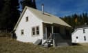 Miners RetreatUmatilla National Forest · 0.0 mi
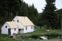 Congo GulchUmatilla National Forest · 0.0 mi
 Hilltop Hideaway - Umatilla NF (OR)Umatilla National Forest · 0.1 mi
 Olive Lake Campground (OR)Umatilla National Forest · 4.9 mi
 North Fork John Day Campground (OR)Umatilla National Forest · 9.4 miHead O' Boulder Forest CampMalheur National Forest · 10 mi
From Pendleton, Oregon: Travel south on Highway 395 for 50 miles to the Ukiah exit. Turn left on Highway 244 to Ukiah. Turn right (south) just before the city park; this road becomes Forest Service Road (FSR) 52 at the Forest boundary. Travel 50 miles to the small town of Granite. From Granite go west on County Road 24 for approximately 6 miles. The main road veers left along the creek bed. At this junction turn right (uphill) on FSR 10 and follow the signs to the Fremont Powerhouse, towards Fremont Congo Gulch Cabin. Do not use between October and June without confirming this route is open with the Ranger District. From Baker City, Oregon: Travel west on Highway 7 and continue 20 miles to the junction with FSR 73. Proceed north through Sumpter and another 17 miles to the small town of Granite. From Granite go west on County Road 24 for approximately 6 miles. The main road veers left along the creek bed. At this junction turn right (uphill) on FSR 10 and follow the signs to the Fremont Powerhouse, towards Fremont Congo Gulch Cabin. This route is plowed in the winter and provides the only winter access.
The weather
the next four days · the thirty-year normal
Next four days, and the thirty-year normal
Forecast
NWS forecast for Granite, OR
Typical weather
Typical October night 28°F, day 59°F.
Coldest month of the year: typical January night 15°F, below freezing. Bring a bag rated colder than that, and expect ice in the water bottle.
Daily high and lowDays with 0.10 in or more
A normal is the 1991-2020 average for the month, not a forecast: about half of all Julys are colder than the July line. The seven-day forecast above answers the other question.
The land, and who answers for it
what threatens it · who answers for it
What threatens this place
You’re camping on ground somebody wants. We track the threats and the comment deadlines.
Who answers for this land
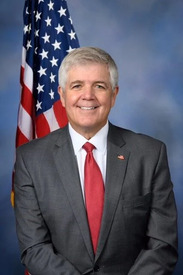
Caretakers Cabin is in Oregon’s 2nd congressional district. Its representative, Cliff Bentz (R), votes on the laws that decide what happens to this land. Public-lands grade so far: F. See every public-lands vote →