U.S. Forest Service · National Forest · Oregon and Washington
Umatilla National Forest
Here, one in two take walk-ups.
50Campgrounds
25Take walk-ups
10Free to camp
$8–$17A night, across 21
184Sites, from 20
2,340–6,150 ftElevation
2States
Where they are
50 of 50 mappedDrawing the map
© OpenFreeMap · OpenStreetMap · Esri hillshadeSource: RIDB · NPS · USFS EDW · BLM, unified by CAMPANAC · Oct 23, 2026
The campgrounds
50 campgrounds
In 2 states, folded
Oregon33 campgrounds · 5 open›
 Jubilee Lake Campground (OR)ReservableOpenfrom $1714 pull-through sites55 sites4,740 fttoilets
 Olive Lake Campground (OR)ReservableOpenfrom $121 pull-through site2 group sites28 sites6,030 ft
 Target Meadows CampgroundReservableOpenfrom $1217 sites4,780 ft
 Bull Prairie Campground (OR)Reservablefrom $1429 with a tent pad1 pull-through site30 sites4,040 ftdrinking watertoilets
 North Fork John Day Campground (OR)Reservablefrom $820 with a tent pad1 group site20 sites5,200 fttoilets
 Woodward CampgroundReservablefrom $1215 sites4,910 ft
 Woodland CampgroundReservablefrom $86 sites5,040 ft
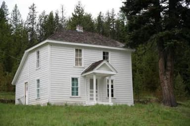 Caretakers CabinReservableSites from $801 site4,950 ftdrinking watertoilets
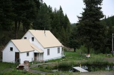 Congo GulchReservableSites from $801 site4,950 ftdrinking watertoilets
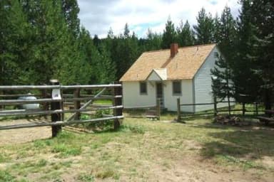 Ditch Creek Guard Station CabReservableSites from $501 site4,670 ftdrinking watertoilets
 Fry Meadows Guard StationReservableSites from $401 site4,120 fttoilets
 Hilltop Hideaway - Umatilla NF (OR)ReservableSites from $551 siterigs to 30 ft4,940 ftdrinking watertoilets
Washington17 campgrounds · 8 open›
 Clearwater Big HouseReservableSites from $751 pull-through site1 site5,490 fttoilets
 Clearwater Lookout CabinReservableSites from $501 pull-through site1 site5,660 fttoilets
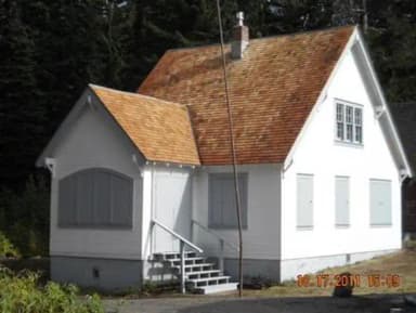 Godman Guard StationReservableSites from $751 site5,680 fttoilets
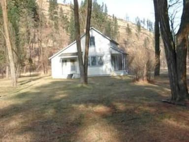 Tucannon Guard StationReservableSites from $1001 site2,590 ftdrinking watertoilets
 Wenatchee Guard StationReservableSites from $501 pull-through site1 site5,490 fttoiletsGodman Campground/TrailheadFirst-comeOpenFree5,730 ftLadybug CampgroundFirst-comeOpenfrom $83,200 ftMidway CampgroundFirst-comeOpen5,140 ftMisery Spring CampgroundFirst-comeOpenFree6,150 ftPanjab CampgroundFirst-comeOpen2,980 ftTeal Spring CampgroundFirst-comeOpen5,630 ftTucannon CampgroundFirst-comeOpenfrom $82,650 ft
Source: RIDB · NPS · USFS EDW · BLM, unified by CAMPANAC · Oct 23, 2026
This land
measured from the nearest campground in the unitdeveloping
Roadless
Roadless
Roadless
Roadless
Roadless
Roadless
Camping here is a stake in what happens to it. More Than Just Parks tracks the threats and the comment windows.
Roadless areas: USFS Inventoried Roadless Areas via MTJP Roadless Map · Jul 29, 2026
Source: MTJP Threatened Lands map · Sep 30, 2026
Heads up
Wildfire
Hagen fire · 4.1 mi from the nearest campground here · 61,380 acres · 99% contained
Wildfire
Columbia Center Mutual Aid fire · 6.5 mi from the nearest campground here · 150 acres
Wildfire
McCully fire · 8.5 mi from the nearest campground here · 13,604 acres · 91% contained
Wildfire
Paradise fire · 9.0 mi from the nearest campground here · 9,656 acres · 86% contained
Wildfire
Bradley Flats fire · 9.8 mi from the nearest campground here · 227 acres · 100% contained
Wildfire
Summit Lake fire · 10 mi from the nearest campground here · 0 acres
Source: NIFC/IRWIN via MTJP wildfire tracker · Oct 22, 2026
Who answers for this land
Umatilla National Forest’s campgrounds sit in 2 congressional districts. These members vote on the laws that decide what happens to this land.
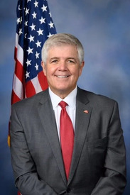
Cliff Bentz (R)

Michael Baumgartner (R)
Source: campground records from RIDB, NPS, USFS EDW and BLM, unified by CAMPANAC, refreshed nightly