Cave Creek
- Right now
- Nobody has saidNo season, no closure, no bookings to read
- Sites
- 63All of them booked ahead
The place
the agency’s own description · what’s there · 7 notices
In the agency’s own words
Cave Creek Campground is located on the shore of Rough River Lake in south central Kentucky. The 5,100-acre lake is a hometown paradise for visitors who love the outdoors, and more than two million visitors camp, picnic, fish, swim, boat and relax on the lake shore each year. Keep reading
Recreation
A wide variety of recreational activities and facilities are provided at the lake, including ample opportunities for boating and fishing. The most sought after fish are bass, crappie and catfish, and bass tournaments occur at the lake throughout the year. Additionally, pontoon, johnboat and jet ski rentals are available at the nearby marinas.
Facilities
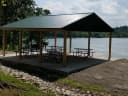
Cave Creek Campground offers 65 campsites, 36 of which have electric hookups. The facility also provides a dump station, playground, boat ramp, drinking water, a shower house, disc golf course, basketball court, and fishing pier.
Natural Features
The rolling, forested hills of rural south central Kentucky offer an extraordinary setting for those who visit the lake. Rough River Lake provides views of ancient sandstone, shale and limestone cliffs. An abundance of water in the area, both surface and underground, has carved through limestone to create a myriad of sinks and caverns. The lake itself is home to numerous species of wildlife, including migratory songbirds and waterfowl. Contact Info For facility specific information, please call (270) 879-4304.
Nearby Attractions
This historic Green Farm is adjacent to the lake. It consists of about 3,000 acres, a large ancestral home, an old water-powered mill, and a golf course. Mammoth Cave National Park, which boasts the longest cave system in the world with more than 240 miles of mapped passageways, is about a one-hour drive away. Other nearby attractions also include the historic Holt House in Hardinsburg, the Jack Thomas House in Leitchfield, and the new Aquatic Center in Leitchfield.
Charges & Cancellations
Once a reservation has been created, there will be a $10 fee to cancel your reservation, change sites, or change dates. Cancellations made the date before you are scheduled to arrive through the day after your arrival date will also be charged the first night's use fee. No-show's are charged a $20 fee plus the first night's use fee. If your reservaiton is for onliy 1 night, and you have been charged the first night's use fee, there is no $10 or $20 service fee charged.
What the agency tells you
Off-road vehicles are not permitted
No alcohol allowed due to local Grayson County ordinance.
Park Attendant can be reached while on duty at (270) 879-4304. If no answer, contact the Rough River Lake U.S. Army Corps of Engineers office at (270) 257-2061.
Everything else this campground posts · 4
$5 per day boat ramp fee
Reservations will not be marked in advance at the campsite. Do not set up at any campsite without reserving the site first.
Don't Move Firewood: Protect your forests from tree-killing pests by buying your firewood locally and burning it on-site. Visit Dontmovefirewood.org for further information.
Quiet hours are 10:00 p.m. - 6:00 a.m. Generators and other noise-producing devices must be turned off during this time.
Tents and rigs
- Sites
- 63 · 5 tent-only
- Hookups
- 47 electric, 46 water
- Longest rig
- 125 ft
- Paved pads
- 17 of 63
- Accessible sites
- 1
- Pets
- Allowed
- Campfires
- Allowed, barring fire bans
- Shade
- 46 of 60 sites
Facilities
- Showers
- Yes, the record doesn’t say what kind
- “The facility also provides a dump station, playground, boat ramp, drinking water, a shower house, disc golf course, basketball court, and fishing pier.”
- Drinking water
- Yes
- “…a dump station, playground, boat ramp, drinking water, a shower house, disc golf course, basketball…”
- Dump station
- Yes
- recreation.gov lists “Dump Station”
- Boat ramp
- Yes
- Playground
- Yes
- Stay limit
- 14 nights
- recreation.gov facility rule maxStay
Around the campground
- On the water
- Lake, River, Creek
- Boating
- Fishing
- Night sky · 19th darkest of 60 in KY
- Bortle 4
No reading yet, book on recreation.gov
Every site here is reservable, and the record lists none held back for anyone who drives up.
No availability snapshot inside the last 36 hours, so this page draws nothing rather than ageing a reading into fiction.
Watch for a cancellation
Full? Watch it.
One email when a night opens, plus More Than Just Parks dispatches. Unsubscribe any time.
We read recreation.gov once an hour, at 40 minutes past, and write the first time a site in your window is free for the nights you asked for.
Scanners that check every few minutes exist, and most of them charge. This one is free, it reads the same calendar, and it won’t always be first.
We make nothing when you book. The link goes straight to the government.
Every line of the receipt · 9
What you actually pay
“Once a reservation has been created, there will be a $10 fee to cancel your reservation, change sites, or change dates. No-show's are charged a $20 fee plus the first night's use fee.” · this campground’s own no-show terms
Who keeps the booking fee
The agency’s own policy text says the reservation fee and the cancellation processing fee are “retained by the reservation service contractor”, and that a campground concessionaire will decline to refund them because “they did not receive these fees”. Recreation.gov is run under contract by Booz Allen Hamilton. What share of your booking fee the contractor keeps isn’t published in any federal dataset we can read, so we print no number for it. Our reporting on the contract →
How we know this receipt · 5
rules read Sep 9, 2026 · record Aug 23, 2026 · How we know all this
The sites
64 records · which ones have room · the site map
The sites, ranked
from 62 mapped sitesAll 64 records
Measured shade is NLCD Tree Canopy Cover 2024 (USDA Forest Service / MRLC) read at the site’s own coordinate, 27% canopy or more, and only for the sites the agency gave no Shade value. It never changes the agency’s own shaded count beside it.
| A | 01 | standard electric | 53 ft | 50 amp | 94 ft | 825 ft | |
| A | 02 | standard electric | 50 ft | 50 amp | 94 ft | 917 ft | |
| A | 03 | standard electric | 50 ft | 50 amp | |||
| A | 04 | standard electric | 40 ft | 50 amp | 84 ft | 857 ft | |
| A | 05 | standard electric | 48 ft | 50 amp | 84 ft | 941 ft | |
| A | 06 | standard electric | 58 ft | 50 amp | 93 ft | 940 ft | |
| A | 07 | standard electric | 66 ft | 50 amp | 48 ft | 840 ft | |
| A | 08 | standard electric | 60 ft | 50 amp | 97 ft | 918 ft | |
| A | 09 | standard electric | 26 ft | 50 amp | 89 ft | 832 ft | |
| A | 10 | standard electric | 28 ft | 50 amp | 48 ft | 799 ft | |
| A | 11 | standard electric | 34 ft | 50 amp | 88 ft | 747 ft | |
| A | 12 | standard electric | 44 ft | 50 amp | 88 ft | 661 ft | |
| A | 13 | standard electric | 52 ft | 50 amp | 144 ft | 598 ft | |
| B | 14 | standard electric | 45 ft | 50 amp | 49 ft | 460 ft | |
| B | 15 | standard electric | 43 ft | 50 amp | 60 ft | 502 ft | |
| B | 16 | standard electric | 32 ft | 50 amp | 52 ft | 496 ft | |
| B | 17 | standard electric | 43 ft | 50 amp | 60 ft | 550 ft | |
| B | 18 | standard electric | 54 ft | 50 amp | 71 ft | 559 ft | |
| B | 19 | standard electric | 45 ft | 50 amp | 71 ft | 628 ft | |
| B | 20 | standard electric | 43 ft | 50 amp | 71 ft | 630 ft | |
| B | 21/22 | standard electric | 53 ft | 50 amp | 91 ft | 698 ft | |
| B | 23 | standard electric | 43 ft | 50 amp | 101 ft | 549 ft | |
| B | 24 | standard electric | 68 ft | 50 amp | 75 ft | 455 ft | |
| B | 25/26 | standard electric | 60 ft | 50 amp | 125 ft | 381 ft | |
| C | 27 | standard electric | 66 ft | 50 amp | 49 ft | 428 ft | |
| C | 28 | standard electric | 50 ft | 50 amp | yes | 67 ft | 377 ft |
| C | 29 | standard electric | 50 ft | 50 amp | 63 ft | 457 ft | |
| C | 30 | standard electric | 44 ft | 50 amp | 63 ft | 397 ft | |
| C | 31 | standard electric | 48 ft | 50 amp | 57 ft | 365 ft | |
| C | 32 | standard electric | 60 ft | 50 amp | 44 ft | 302 ft | |
| C | 33 | standard electric | 94 ft | 50 amp | 73 ft | 238 ft | |
| C | 34 | standard electric | 80 ft | 50 amp | 52 ft | 180 ft | |
| C | 35 | standard electric | 93 ft | 50 amp | 52 ft | 139 ft | |
| C | 36 | standard electric | 75 ft | 50 amp | 62 ft | 193 ft | |
| C | 37 | standard electric | 50 ft | 50 amp | 29 ft | 454 ft | |
| D | 38 | standard nonelectric | 57 ft | 29 ft | 448 ft | ||
| D | 39 | standard nonelectric | 65 ft | 45 ft | 458 ft | ||
| D | 40 | standard nonelectric | 62 ft | 42 ft | 419 ft | ||
| D | 41 | standard nonelectric | 60 ft | 57 ft | 373 ft | ||
| D | 42 | standard nonelectric | 73 ft | 42 ft | 378 ft | ||
| D | 43 | standard nonelectric | 50 ft | 44 ft | 315 ft | ||
| D | 44 | standard nonelectric | 100 ft | 52 ft | 325 ft | ||
| D | 45 | standard nonelectric | 55 ft | 54 ft | 257 ft | ||
| D | 46 | standard nonelectric | 55 ft | 52 ft | 273 ft | ||
| D | 47 | standard nonelectric | 80 ft | 31 ft | 214 ft | ||
| D | 48 | standard nonelectric | 63 ft | 31 ft | 186 ft | ||
| E | 49 | standard electric | 125 ft | 50 amp | 82 ft | 78 ft | |
| E | 50 | standard electric | 60 ft | 50 amp | 62 ft | 167 ft | |
| E | 51 | standard electric | 70 ft | 50 amp | 53 ft | 56 ft | |
| E | 52 | standard electric | 84 ft | 50 amp | 53 ft | 42 ft | |
| E | 53 | standard electric | 100 ft | 50 amp | 72 ft | 138 ft | |
| E | 54 | standard electric | 60 ft | 50 amp | 55 ft | 176 ft | |
| E | 55 | standard electric | 60 ft | 50 amp | 56 ft | 271 ft | |
| E | 56 | standard electric | 95 ft | 50 amp | 73 ft | 298 ft | |
| E | 57 | standard electric | 77 ft | 50 amp | 55 ft | 231 ft | |
| E | 58 | standard electric | 61 ft | 50 amp | 70 ft | 177 ft | |
| E | 59 | standard electric | 65 ft | 50 amp | 57 ft | 226 ft | |
| E | 60 | standard electric | 90 ft | 50 amp | 70 ft | 157 ft | |
| F | 61 | tent only nonelectric | 70 ft | 144 ft | |||
| F | 62 | tent only nonelectric | 81 ft | 63 ft | |||
| F | 63 | tent only nonelectric | 70 ft | 126 ft | |||
| F | 64 | tent only nonelectric | 85 ft | 140 ft | |||
| F | 65 | tent only nonelectric | 85 ft | 165 ft | |||
| Shelter 1 | day use | 30 amp | yes |
The agency files 1 more record here that isn’t a site for the night. It files it as day use. It’s in the table above, marked for what it is, and it isn’t counted as a site.
OpenStreetMap has no toilet mapped within 1 km of this campground, so no site here carries a toilet distance. That’s a gap in the map, not a finding about the campground.
25 of 64 listed
Getting there
the map and the coordinate · the agency’s directions · the phone number
Where it is
 Laurel Branch3.3 mi
 Axtel4.1 mi
 North Fork (KY)5.0 mi
 Moutardier23 mi
 WAX26 mi
 Dog Creek (KY)27 mi
Begin at ramp onto Gene Snyder Freeway KY-841W toward I-65, traveling 6.5 miles. Take I-65/Louisville/Nashville, Exit Number 10, onto I-65 S toward Nashville/Elizabethtown, traveling 34 miles. Take US-31W/KY-62/Wendell H Ford Western Kentucky Parkway/Hodgenville/Paducah, Exit Number 91, toward Paducah/Elizabethtown/Owensboro/Western Kentucky Parkway W, traveling 29.6 miles. Take KY-259/Leitchfield/Brownsville, Exit Number 107, traveling .3 miles. Turn right onto S Main Street/KY-259, traveling .9 miles. Take 3rd exit from roundabout Courthouse Square onto W Main Street/KY-54, traveling 10.9 miles. Turn right onto Falls of Rough Road/KY-79, traveling 4.6 miles. Turn right onto Cave Creek Road KY-736, traveling 1.8 miles. End at 1543 Cave Creek Road, Falls of Rough, KY. Distance is approximately 90 miles with an approximate travel time of 1.5 hours.
The weather
the next four days · the thirty-year normal
Next four days, and the thirty-year normal
Forecast
NWS forecast for Caneyville, KY
Typical weather
Typical October night 44°F, day 72°F.
Coldest month of the year: typical January night 24°F, below freezing. Bring a bag rated colder than that, and expect ice in the water bottle.
Daily high and lowDays with 0.10 in or more
A normal is the 1991-2020 average for the month, not a forecast: about half of all Julys are colder than the July line. The seven-day forecast above answers the other question.
The land, and who answers for it
who answers for it
Who answers for this land

Cave Creek is in Kentucky’s 2nd congressional district. Its representative, Brett Guthrie (R), votes on the laws that decide what happens to this land. Public-lands grade so far: F. See every public-lands vote →