Charles Waters Campground
2Heads up2 fires, nearest 30 mi
This is how it should work.
- Right now
- OpenInside the published season, our reading
- Season
- May 1Opens May 1. No closing date published.
The place
the agency’s own description · what’s there
In the agency’s own words
The Charles Waters campground is paved asphalt with 26 campsites plus one double site, including 4 pull-through, one bicycle site, and one horse site; there is also one accessible site with electric hook-up. The campground also has water; accessible vault toilets; open meadow for activities and can accommodate RV's or trailers to 70 feet. Please note that the bicycle site and horse site are reserved for those users until 6 p.m. daily after which time if no one is occupying them then they are considered available on a first come first served basis. A campground host is available Memorial Day through Labor Day. Keep reading
Also associated with the Charles Waters Campground is the Bass Creek Recreation Area. This recreation area includes four picnic sites; an interpretive nature trail; fire ecology trail and numerous trailheads to hiking, biking and stock routes with access to the Selway-Bitterroot Wilderness. The Larry Creek Group Site is located within the Bass Creek Recreation Area, this large overnight group site is available for reservation through Recreation.gov. The gate will close to the Larry Creek Group Site on Dec. 1. For more information please contact the Stevensville Ranger District at (406) 777-5461.
Facilities
- Toilets
- Vault Toilets
- “…campground also has water; accessible vault toilets; open meadow for activities and can accommodate…”
Around the campground
- On the water
- Creek, Meadow
- Picnicking
Nothing to book, just show up
One of 1,623 federal campgrounds where the site still goes to whoever pulls in first. Get there before noon on a summer weekend.
recreation.gov publishes no availability for a campground you can’t reserve, so there’s no thirty-night reading to draw here. The season bar above is what the agency does publish.
Every line of the receipt · 3
What you actually pay
How we know this receipt · 4
rules read Sep 7, 2026 · record Aug 23, 2026 · How we know all this
Getting there
the map and the coordinate
Where it is
 Larry Creek Group CampBitterroot National Forest · 1.0 mi
 West Fork Butte LookoutLolo National Forest · 17 mi
 Gold Creek CampgroundBitterroot National Forest · 17 mi
 Lolo Creek Campground and Picnic AreaLolo National Forest · 18 miHarry's Flat CampgroundLolo National Forest · 19 miBitterroot Flat CampgroundLolo National Forest · 19 mi
The weather
the next four days · the thirty-year normal
Next four days, and the thirty-year normal
Forecast
NWS forecast for Florence, MT
Typical weather
Typical May night 39°F, day 68°F.
Coldest night of the open season: typical May night 39°F. Bring the bag rated for it.
Daily high and lowDays with 0.10 in or moreOutside the published season
A normal is the 1991-2020 average for the month, not a forecast: about half of all Julys are colder than the July line. The seven-day forecast above answers the other question.
The land, and who answers for it
what threatens it · who answers for it
What threatens this place
You’re camping on ground somebody wants. We track the threats and the comment deadlines.
Who answers for this land
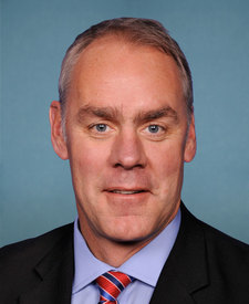
Charles Waters Campground is in Montana’s 1st congressional district. Its representative, Ryan Zinke (R), votes on the laws that decide what happens to this land. Public-lands grade so far: F. See every public-lands vote →