Larry Creek Group Camp
1Heads up1 fire 35 mi away
- Right now
- OpenInside the published season, our reading
- Sites
- 1All of them booked ahead
- Season
- May 1Opens May 1. No closing date published.
The place
the agency’s own description · what’s there · 2 notices
In the agency’s own words
Larry Creek Group Campground is located in western Montana's Bitterroot National Forest. It is a great location for an extended family or group getaway, providing access to many fishing, hiking, mountain biking and hunting opportunities. Keep reading
Recreation
A variety of non-motorized trails are nearby, including a half-mile nature trail that highlights some the area's best features. The 9-mile Bass Creek Trail is located just south of the campground and leads to a scenic overlook and many fishing holes. Bass Lake, Bass Creek and numerous additional mountain streams make the campground a very popular location for fishing. An interpretive trail, fitness trail and volleyball court are located within the campground.
Facilities
The campground offers one large, accessible group campsite, available for tent and RV camping. It can accommodate up to 75 people and 10 vehicles. The adjacent parking area is small, limiting RVs to about 30 feet in length. The site is equipped with a picnic shelter, several tables, a large campfire circle and grills. Accessible vault toilets and drinking water are provided. A gravel road accesses the campground. Vehicles must stay on Forest Roads and in the designated parking area. Vehicles are not allowed off-road. Motorized access to the meadow is not allowed.
Natural Features
The campground sits at a fairly low elevation in the Bass Creek Recreation Area between Missoula and Hamilton. It is situated west of the Lee Metcalf National Wildlife Refuge, in an area forested with pine, spruce and fir trees. A variety of wildlife, including mule and white-tailed deer, elk, moose and birds can often be seen in the area.
Nearby Attractions
The Lee Metcalf National Wildlife Refuge is located along the Bitterroot River about 20 miles from the campground. The refuge provides visitors with opportunities for wildlife observation, photography, hunting, fishing and environmental education. A wildlife viewing area offers 2.5 miles of nature trails, including an accessible 0.5-mile path. The trails meander through meadows and woodlands along the river. A variety of services are available in the neighboring city of Stevensville.
What the agency tells you
Click here for more information on the Bitterroot National Forest
Don't Move Firewood: Prevent the spread of tree-killing pests by obtaining firewood near your destination and burning it on-site. For more information visit dontmovefirewood.org.
Tents and rigs
- Sites
- 1 · 1 group
- Hookups
- None
- Longest rig
- 30 ft
- Accessible sites
- 1
- Pets
- Not allowed
Facilities
- Toilets
- Vault Toilets
- ACCESSIBLE VAULT TOILETS on 1 of 1 campsite records
- Drinking water
- Yes
- DRINKING WATER (HAND PUMP) on 1 of 1 campsite records
Around the campground
- On the water
- Lake, River, Creek, Meadow
- Backpacking
- Biking
- Fishing
- Hiking
- Hunting
- Wildlife viewing
- Night sky · 491st darkest of 501 in MT
- Bortle 3
No reading yet, book on recreation.gov
Every site here is reservable, and the record lists none held back for anyone who drives up.
No availability snapshot inside the last 36 hours, so this page draws nothing rather than ageing a reading into fiction.
Watch for a cancellation
Full? Watch it.
One email when a night opens, plus More Than Just Parks dispatches. Unsubscribe any time.
We read recreation.gov once an hour, at 40 minutes past, and write the first time a site in your window is free for the nights you asked for.
Scanners that check every few minutes exist, and most of them charge. This one is free, it reads the same calendar, and it won’t always be first.
Tell me when the season opens
Watch for the season to open
One email when the season goes on sale, plus More Than Just Parks dispatches. Unsubscribe any time.
We check once an hour, at 40 minutes past, and write the first time the agency has that season on sale.
Scanners that check every few minutes exist, and most of them charge. This one is free, it reads the same calendar, and it won’t always be first.
We make nothing when you book. The link goes straight to the government.
Every line of the receipt · 12
What you actually pay
Who keeps the booking fee
The agency’s own policy text says the reservation fee and the cancellation processing fee are “retained by the reservation service contractor”, and that a campground concessionaire will decline to refund them because “they did not receive these fees”. Recreation.gov is run under contract by Booz Allen Hamilton. What share of your booking fee the contractor keeps isn’t published in any federal dataset we can read, so we print no number for it. Our reporting on the contract →
How we know this receipt · 5
rules read Sep 9, 2026 · rates Oct 1, 2026 · How we know all this
The sites
1 sites · the site map
All 1 sites
The price is derived by CAMPANAC, not published per site: the per-night rate this campground publishes for each site’s own site type. 1 of the 1 sites listed carry one, and a site whose type has no published rate sits out of the price rather than being called free.
Measured shade is NLCD Tree Canopy Cover 2024 (USDA Forest Service / MRLC) read at the site’s own coordinate, 27% canopy or more, and only for the sites the agency gave no Shade value. It never changes the agency’s own shaded count beside it.
| GROU | G01 | group standard nonelectric | 30 ft | yes | 4,285 ft | $75 |
OpenStreetMap has no toilet mapped within 1 km of this campground, so no site here carries a toilet distance. That’s a gap in the map, not a finding about the campground.
Getting there
the map and the coordinate · the agency’s directions · the phone number
Where it is
 Charles Waters CampgroundBitterroot National Forest · 1.0 mi
 West Fork Butte LookoutLolo National Forest · 17 mi
 Gold Creek CampgroundBitterroot National Forest · 17 mi
 Lolo Creek Campground and Picnic AreaLolo National Forest · 18 miHarry's Flat CampgroundLolo National Forest · 18 miBitterroot Flat CampgroundLolo National Forest · 19 mi
From Stevensville, travel northwest on County Road 269 to Highway 93. Continue about 4 miles to Bass Creek Road. Travel 2 miles on Bass Creek Road and less than a mile on Forest Road 1136. Turn onto Forest Road 1316 and continue about a mile to the campground.
The weather
the next four days · the thirty-year normal
Next four days, and the thirty-year normal
Forecast
NWS forecast for Florence, MT
Typical weather
Typical May night 39°F, day 68°F.
Coldest night of the open season: typical May night 39°F. Bring the bag rated for it.
Daily high and lowDays with 0.10 in or moreOutside the published season
A normal is the 1991-2020 average for the month, not a forecast: about half of all Julys are colder than the July line. The seven-day forecast above answers the other question.
The land, and who answers for it
what threatens it · who answers for it
What threatens this place
You’re camping on ground somebody wants. We track the threats and the comment deadlines.
Who answers for this land
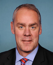
Larry Creek Group Camp is in Montana’s 1st congressional district. Its representative, Ryan Zinke (R), votes on the laws that decide what happens to this land. Public-lands grade so far: F. See every public-lands vote →