Coal Creek Group Camp
2Heads up2 fires, nearest 38 mi
- Right now
- Nobody has saidNo season, no closure, no bookings to read
- Sites
- 1All of them booked ahead
The place
the agency’s own description · what’s there · 8 notices
In the agency’s own words
Coal Creek Group Campground sits along the scenic Mountain Loop Road in the Mt. Baker-Snoqualmie National Forest. Surrounded by stands of old-growth forest and located near the confluence the of the tranquil Stillaguamish River and bubbling Coal Creek, this site is ideal for small group or family camping excursions. Keep reading
Recreation
Coal Creek is a prime location for hiking, fishing, picnicking and horseback riding in summer and early fall, and offers excellent skiing and snowshoeing in the winter months. Hikers may want to explore the nearby Big Four Ice Caves Trail off of the Mountain Loop Highway. The trail ends with a view of the ice fields and the immense north face of the 6,153 foot Big Four Mountain. The caves are exposed during August and remain visible through October. The nearby Gold Basin Mill Pond interpretive trail is also accessible from the campground. This interpretive site includes a short, barrier-free trail that passes by mill relics and ends on a floating viewpoint looking across the old millpond. Interpretive signs discuss the history of the mill and the wildlife in the area. The trail is located directly across from the Gold Basin Campground.
Facilities
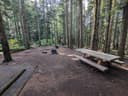
The campground offers one large group campsite, making it a perfect setting for families or groups wanting privacy. The site can accommodate about 25 guests and is ideal for tent mixed with RVs. The site is equipped with tables, tent pads, campfire rings with grills and vault toilets.
Natural Features
Located in the majestic Cascade region of Washington, the Mt. Baker-Snoqualmie National Forest showcases rugged peaks, scenic rivers and lush forests. The banks of the Stillaguamish River are lined with old-growth forests of cedar, fir and hemlock. On a clear day visitors can spot Mt. Baker, the most prominent feature of the Mt. Baker Wilderness Area. Rising to an elevation of 10,781 feet, this active volcano is perpetually snow-capped and mantled with an extensive network of creeping glaciers. Mt. Baker's summit, Grant Peak, is actually a 1,300-foot-deep mound of ice, which hides a massive volcanic crater. The surrounding undeveloped wilderness, clean streams and diverse forests support an abundance of wildlife. In addition to being home for a multitude of mammals, birds, amphibians and reptiles, the area sustains more rare species such as lynx, moose, wolves and wolverine. Grizzly bear sightings have been confirmed in the Cascade region, though black bear sightings are more common. Contact Info For facility specific information, please call (530) 932-0242.
Nearby Attractions
Visitors enjoy the North Cascades and Mt. Rainer National Parks, where interpretive programs and exhibits offer education about the diverse landscape and history of the area. The spectacular Pacific Crest Trail (PCT), one of the world's premier National Scenic Trails, showcases some of North America's most fantastic scenery, winding its way its way from Mexico to Canada through California, Oregon and Washington, and is accessible near the campground.
Charges & Cancellations
Once your reservation start date has begun, neither the Recreation.gov Contact Center nor the campground manager will be able to modify your reservation.
What the agency tells you
This is a NO WATER facility so campers will need to bring their own supply.
Group campground gate keys are available from the lock box located at Gold Basin Campground’s Information Kiosk. Registered guests will receive a lock bock combination code in a confirmation email from Recreation.gov. If assistance is needed, please call (530) 932-0242 prior to traveling to the area as cellular service is unavailable on-site.
Fire Restrictions: Fire restrictions may be imposed at any time due to hot, dry weather conditions, at which time campfires and charcoal fires may not be allowed.
Everything else this campground posts · 5
Once your reservation start date has begun, neither the Recreation.gov Contact Center nor the campground manager will be able to modify your reservation.
Refunds: Refund requests made through www.recreation.gov will be charged a $10 processing fee. This fee is retained by the reservation service contractor along with the non-refundable reservation fee. All requests for the return of the non-refundable reservation fee and the cancellation fee will be declined by the campground concessionaire as they did not receive these fees (these are the fees retained by the reservation contractor, a different entity).
The Mt. Baker-Snoqualmie National Forest has a Food Storage Order in effect. All food and refuse must be acceptably stored (in a hard sided vehicle or trailer, food storage locker, or certified bear resistant container) or acceptably possessed (attended to by a person who is physically present).
Don't Move Firewood: Please protect Pacific Northwest forests by preventing the spread of invasive species. Firewood can carry insects and diseases that can threaten the health of our western forests. You can make a difference by obtaining and burning your firewood near your camping destination. Visit Dontmovefirewood.org for further information.
If any assistance is required, please visit the camp hosts at the nearby Verlot Campground at milepost 11 on the Mtn. Loop Highway where water and firewood are also available.
Tents and rigs
- Sites
- 1 · 1 group
- Hookups
- None
- Longest rig
- 36 ft
- Accessible sites
- None listed
- Pets
- Allowed
- Campfires
- Allowed, barring fire bans
- Shade
- Every site
Facilities
- Toilets
- Vault Toilets
- “…pads, campfire rings with grills and vault toilets. Natural Features Located in the majestic Cascade…”
Around the campground
- On the water
- River, Creek
- Night sky · 352nd darkest of 400 in WA
- Bortle 4
No reading yet, book on recreation.gov
Every site here is reservable, and the record lists none held back for anyone who drives up.
No availability snapshot inside the last 36 hours, so this page draws nothing rather than ageing a reading into fiction.
Watch for a cancellation
Full? Watch it.
One email when a night opens, plus More Than Just Parks dispatches. Unsubscribe any time.
We read recreation.gov once an hour, at 40 minutes past, and write the first time a site in your window is free for the nights you asked for.
Scanners that check every few minutes exist, and most of them charge. This one is free, it reads the same calendar, and it won’t always be first.
Tell me when the season opens
Watch for the season to open
One email when the season goes on sale, plus More Than Just Parks dispatches. Unsubscribe any time.
We check once an hour, at 40 minutes past, and write the first time the agency has that season on sale.
Scanners that check every few minutes exist, and most of them charge. This one is free, it reads the same calendar, and it won’t always be first.
We make nothing when you book. The link goes straight to the government.
Every line of the receipt · 12
What you actually pay
“Once your reservation start date has begun, neither the Recreation.gov Contact Center nor the campground manager will be able to modify your reservation.” · this campground’s own terms
Who keeps the booking fee
The agency’s own policy text says the reservation fee and the cancellation processing fee are “retained by the reservation service contractor”, and that a campground concessionaire will decline to refund them because “they did not receive these fees”. Recreation.gov is run under contract by Booz Allen Hamilton. What share of your booking fee the contractor keeps isn’t published in any federal dataset we can read, so we print no number for it. Our reporting on the contract →
How we know this receipt · 6
rules read Sep 9, 2026 · rates Oct 1, 2026 · How we know all this
The sites
1 sites · the site map
All 1 sites
The price is derived by CAMPANAC, not published per site: the per-night rate this campground publishes for each site’s own site type. 1 of the 1 sites listed carry one, and a site whose type has no published rate sits out of the price rather than being called free.
| COAL | 001 | group standard nonelectric | 36 ft | under 10 ftDeer Creek | $100 |
OpenStreetMap has no toilet mapped within 1 km of this campground, so no site here carries a toilet distance. That’s a gap in the map, not a finding about the campground.
Getting there
the map and the coordinate · the agency’s directions · the phone number
Where it is
 Coal Creek Group CampgroundMt. Baker National Forest · 0.8 miBeaver Creek Group CampgroundMt. Baker National Forest · 1.4 mi
 Tulalip Mill Site Group CampgroundMt. Baker National Forest · 3.6 mi
 Red Bridge CampgroundMt. Baker National Forest · 4.5 mi
 Boardman Group CampMt. Baker National Forest · 5.7 mi
 Esswine Group Camp6.6 mi
From Seattle, Washington, go north on I-5 to Everett. Take exit 194 onto Highway 2, then head north at Highway 204 towards Lake Stevens. Turn north on Highway 9, then east on Highway 92 to Granite Falls. The campground is located approximately 23.5 miles east of Granite Falls on Highway 7 Scenic Byway.
The weather
the next four days · the thirty-year normal
Next four days, and the thirty-year normal
Forecast
NWS forecast for Verlot, WA
Typical weather
Typical October night 42°F, day 58°F.
Coldest month of the year: typical January night 32°F, below freezing. Bring a bag rated colder than that, and expect ice in the water bottle.
Daily high and lowDays with 0.10 in or more
A normal is the 1991-2020 average for the month, not a forecast: about half of all Augusts are colder than the August line. The seven-day forecast above answers the other question.
The land, and who answers for it
what threatens it · who answers for it
Roadless country, and what’s coming for it
You’re camping on ground somebody wants. We track the threats and the comment deadlines.
Who answers for this land
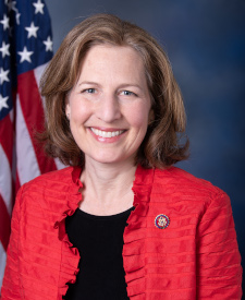
Coal Creek Group Camp is in Washington’s 8th congressional district. Its representative, Kim Schrier (D), votes on the laws that decide what happens to this land. Public-lands grade so far: A+. See every public-lands vote →