Cochise Stronghold Campground
This is how it should work.
- Right now
- OpenThe agency lists it open
- Season
- September 1 – May 31Open September 1 through May 31, across the new year
The place
the agency’s own description · what’s there
In the agency’s own words
This campground is in a magnificent, rugged canyon that served the famous Chiricahua Apache leader, Cochise, as a refuge against his enemies. As you enter the East Stronghold Canyon, you pass in the shadow of rocks that quite likely served the Apache warrior as perches for his lookouts. The haunting shapes into which the forces of nature have carved those rocks helps make a visit to this charismatic place an unforgettable experience. Keep reading
Eleven individual and two group campsites at Cochise Stronghold are shaded by oaks and surrounded by a diverse community of vegetation that includes plants of both the Upper Sonoran and Chihuahuan Desert. To help you become better acquainted with this unusual environment, the Stronghold Nature Trail follows a 0.4-mile barrier-free loop that wanders among the yucca, cactus, and rocks. This short, easy stroll provides a self-guided introduction to several desert plants, as well as some of the principles of desert ecology. It also provides good views of the rocks that form the ramparts of the Stronghold. A wheelchair-accessible, 400-foot history trail in the campground tells of the area's colorful past. The Cochise Trail #279 , which also starts in the campground, climbs past dozens of fantastic rock formations to Stronghold Divide at 5,900 feet and continues on to West Stronghold Canyon and the Council Rocks historic area. Note: No potable water is available in the campground. Bring plenty with you. Black bears in area. Store and dispose of all food in bear-safe containers and trash bins or keep it locked in your vehicle. Download the Cochise Stronghold Recreation Guide in English. Solo en inglés ahora. La traducción estará disponible aquí pronto.
Facilities
- Drinking water
- None, bring your own
- “…the Council Rocks historic area. Note: No potable water is available in the campground. Bring plenty with…”
Nothing to book, just show up
One of 1,623 federal campgrounds where the site still goes to whoever pulls in first. Get there before noon on a summer weekend.
recreation.gov publishes no availability for a campground you can’t reserve, so there’s no thirty-night reading to draw here. The season bar above is what the agency does publish.
Every line of the receipt · 10
What you actually pay
How we know this receipt · 4
record Aug 24, 2026 · How we know all this
Getting there
the map and the coordinate
Where it is
 Shaw HouseCoronado National Forest · 0.7 mi
 Half Moon RanchCoronado National Forest · 1.8 mi
 Happy Valley SaddleSaguaro National Park · 36 mi
 Bonita Canyon CampgroundChiricahua National Monument · 37 miAg Fields Group SiteLas Cienegas National Conservation Area · 37 mi
 Walnut Grove CampgroundCoronado National Forest · 37 mi
The weather
the next four days · the thirty-year normal
Next four days, and the thirty-year normal
Forecast
NWS forecast for Sunsites, AZ
Typical weather
Typical October night 46°F, day 80°F.
Coldest night of the open season: typical January night 29°F, below freezing. Bring a bag rated colder than that, and expect ice in the water bottle.
Daily high and lowDays with 0.10 in or moreOutside the published season
A normal is the 1991-2020 average for the month, not a forecast: about half of all Junes are colder than the June line. The seven-day forecast above answers the other question.
The land, and who answers for it
what threatens it · who answers for it
What threatens this place
You’re camping on ground somebody wants. We track the threats and the comment deadlines.
Who answers for this land
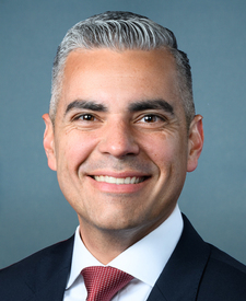
Cochise Stronghold Campground is in Arizona’s 6th congressional district. Its representative, Juan Ciscomani (R), votes on the laws that decide what happens to this land. Public-lands grade so far: F. See every public-lands vote →