Council Bluff Recreation Area
- Right now
- Listed not openA database flag with no reason and no date
- A night
- $15From, per site
The place
the agency’s own description · what’s there
In the agency’s own words
The Council Bluff Recreation Area, located next to the largest lake on the Mark Twain National Forest, is perfect for anyone looking to enjoy the outdoors. The area provides ample opportunities for camping, picnicking, hiking, fishing, swimming and more. The site is large and spread out, the campground and beach are about a 1 mile hike apart, the hike/bike is downhill from the campground to the beach, but uphill coming back. Located in southern Missouri, the Council Bluff Lake was created by a dam built across Big River. It is 440 acres in size and 87 feet deep in some places. Keep reading
The Wild Boar Campground and sheltered picnic area are available for individual families or large groups. The Chapel Hill Beach is at the eastern end of the campground and provides 1.25 acres of sandy beach. The beach is accessible via a short walkway from the parking area. Boating and paddling is a popular pastime on the lake, but all boats on the lake must operate at a no-wake speed. Visitors can access the water via the two boat ramps located at the lake. Fishing is also available. Anglers can expect a catch of a variety of freshwater fish, including bass, bluegills, catfish and crappies. The 12-mile Council Bluff Trail encircles the lake, with spurs to the campground. Hikers can enjoy scenic views of the lake and a look at the Mark Twain wilderness. The Ozark Trail connects to the Council Bluff Trail at Trace Creek mile 15. Waterfowl hunting is allowed on Council Bluff Lake and the nearby Enough Fields provide upland game opportunities. A variety of wildlife makes its home in the heavily wooded area. A Printable Brochure and map is available.
Facilities
- Boat ramp
- Yes
Around the campground
- On the water
- Lake, River, Creek, Beach
Phone before you drive
recreation.gov publishes no availability for a campground you can’t reserve, so there’s no thirty-night reading to draw here. The season bar above is what the agency does publish.
Every line of the receipt · 5
What you actually pay
Derived by CAMPANAC: the lowest per-night amount the agency’s fee record states ($15), and no booking fee, because this campground takes no reservations. A weekend here means Friday and Saturday night. Optional charges (an extra vehicle, a second tent, a dump-station fee) are listed separately and aren’t in this total.
How we know this receipt · 5
record Aug 24, 2026 · How we know all this
Getting there
the map and the coordinate
Where it is
 Council Bluff Recreation AreaMark Twain National Forest · 1.0 miHazel Creek CampgroundMark Twain National Forest · 9.0 mi
 Red Bluff CampgroundMark Twain National Forest · 14 miRed Bluff Recreation AreaMark Twain National Forest · 14 mi
 Berryman CampgroundMark Twain National Forest · 16 mi
 Sutton Bluff Recreation AreaMark Twain National Forest · 17 mi
The weather
the next four days · the thirty-year normal
Next four days, and the thirty-year normal
Forecast
NWS forecast for Caledonia, MO
Typical weather
Typical October night 46°F, day 68°F.
Coldest month of the year: typical January night 21°F, below freezing. Bring a bag rated colder than that, and expect ice in the water bottle.
Daily high and lowDays with 0.10 in or more
A normal is the 1991-2020 average for the month, not a forecast: about half of all Julys are colder than the July line. The seven-day forecast above answers the other question.
The land, and who answers for it
what threatens it · who answers for it
What threatens this place
You’re camping on ground somebody wants. We track the threats and the comment deadlines.
Who answers for this land
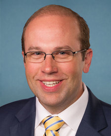
Council Bluff Recreation Area is in Missouri’s 8th congressional district. Its representative, Jason Smith (R), votes on the laws that decide what happens to this land. Public-lands grade so far: F. See every public-lands vote →