Halfway Flat Campground
5Heads up5 fires, nearest 30 mi
- Right now
- Listed not openA database flag with no reason and no date
- A night
- $10–$18Across the site types the agency prices
- Sites
- 8All of them booked ahead
The place
the agency’s own description · what’s there · 3 notices
In the agency’s own words
Halfway Flat Campground is located about 30 miles west of Naches, Washington on the east side of the Cascades mountain range. Keep reading
Recreation
The campground setting provides ready access to the Naches River, where fishing is popular. Hiking and horseback riding trails extend into the William O. Douglas and Norse Peak Wilderness areas, and off-road vehicle and snowmobile access draws visitors to the Little Naches drainage. Halfway Flat Campground is conveniently located 30 minutes below the summit of Chinook Pass and Mt. Rainer National Park. A trip along the scenic Mather Parkway is a fantastic outing. The Naches River, adjacent to the campground offers a scenic backdrop for anglers. Its cold, clear waters sustain populations of rainbow and brown trout. Whitewater enthusiasts may enjoy a paddle on the river or one of the many other tributaries.
Facilities
The campground has eight campsites, with five campsites available for advanced reservation between Memorial Day through Labor Day weekend. After, mid-September all sites are available on a first-come, first-served basis. Vault toilets and potable water are available.
Natural Features
The Halfway Flat Campground is nestled in an old-growth forest of Douglas fir, western hemlock, and cedar with grassy areas, ferns and mosses covering the forest floor. With the William O. Douglas and Norse Peak Wilderness areas nearby, the location is home to abundant wildlife, including deer, elk, porcupine, native fish and migratory birds. Endangered and threatened species, including the Northern Spotted Owl, gray wolves, and grizzly bears also find havens in local ecosystems. Summer temperatures are generally sunny and warm with little precipitation, and winters boast mostly clear skies, but plenty of snow.
Nearby Attractions
Hikers may want to traverse a portion of the spectacular Pacific Crest Trail (PCT), one of the world's premier National Scenic Trails. Boulder Cave Trail is one of the most popular places in the Naches District. Visitors can walk the accessible trail along the river or explore Boulder Cave. Interpretive signs along the trail explain the geology, plants, animals and history of the area. Within 10 miles of the campground there is lake access, a boat ramp, hunting opportunities, historic sites, and trails for horseback riding, mountain biking, and off-highway vehicles.
What the agency tells you
Single site fees include 1 vehicle and 1 legally towed vehicle. Additional vehicles are subject to an extra vehicle fee, space permitting.
Don't Move Firewood: Please protect Pacific Northwest forests by preventing the spread of invasive species. Firewood can carry insects and diseases that can threaten the health of our western forests. You can make a difference by obtaining and burning your firewood near your camping destination. Visit Dontmovefirewood.org for further information
Off-road vehicle use not permitted in the campground
Tents and rigs
- Sites
- 8
- Hookups
- None
- Longest rig
- 150 ft
- Accessible sites
- 2
- Pets
- Allowed
- Campfires
- Allowed, barring fire bans
- Shade
- Every site
Facilities
- Toilets
- Vault Toilets
- “…on a first-come, first-served basis. Vault toilets and potable water are available. Natural Features…”
- Drinking water
- Yes
- “…first-served basis. Vault toilets and potable water are available. Natural Features The Halfway Flat…”
- Boat ramp
- Yes
- Camp host
- On site
- recreation.gov lists “Host”
Around the campground
- On the water
- Lake, River
- Fishing
- Historic Sites
- Mountain biking
- Off Highway Vehicle Trails
- Off Road Vehicle Trails
- Water access
- Whitewater rafting
- Night sky · 275th darkest of 400 in WA
- Bortle 3
No reading yet, book on recreation.gov
Every site here is reservable, and the record lists none held back for anyone who drives up.
No availability snapshot inside the last 36 hours, so this page draws nothing rather than ageing a reading into fiction.
Watch for a cancellation
Full? Watch it.
One email when a night opens, plus More Than Just Parks dispatches. Unsubscribe any time.
We read recreation.gov once an hour, at 40 minutes past, and write the first time a site in your window is free for the nights you asked for.
Scanners that check every few minutes exist, and most of them charge. This one is free, it reads the same calendar, and it won’t always be first.
Tell me when the season opens
Watch for the season to open
One email when the season goes on sale, plus More Than Just Parks dispatches. Unsubscribe any time.
We check once an hour, at 40 minutes past, and write the first time the agency has that season on sale.
Scanners that check every few minutes exist, and most of them charge. This one is free, it reads the same calendar, and it won’t always be first.
We make nothing when you book. The link goes straight to the government.
Every line of the receipt · 13
What you actually pay
Derived by CAMPANAC: the agency’s published rates for this season, $10–$18 a night, plus one $8 recreation.gov reservation fee for the booking. A weekend here means Friday and Saturday night, booked once. Optional charges (an extra vehicle, a second tent, a dump-station fee) are listed separately and aren’t in this total.
Who keeps the booking fee
The agency’s own policy text says the reservation fee and the cancellation processing fee are “retained by the reservation service contractor”, and that a campground concessionaire will decline to refund them because “they did not receive these fees”. Recreation.gov is run under contract by Booz Allen Hamilton. What share of your booking fee the contractor keeps isn’t published in any federal dataset we can read, so we print no number for it. Our reporting on the contract →
How we know this receipt · 5
rules read Sep 9, 2026 · rates Oct 1, 2026 · How we know all this
The sites
8 sites · which ones have room · the site map
The sites, ranked
from 8 mapped sitesAll 8 sites
The price is derived by CAMPANAC, not published per site: the per-night rate this campground publishes for each site’s own site type. 8 of the 8 sites listed carry one, and a site whose type has no published rate sits out of the price rather than being called free.
| HALFWAY FLAT CAMPGROUND | 001 | standard nonelectric | 95 ft | 124 ft | 126 ft | $10–$18 | |
| HALFWAY FLAT CAMPGROUND | 002 | standard nonelectric | 40 ft | 64 ft | 128 ft | $10–$18 | |
| HALFWAY FLAT CAMPGROUND | 003 | standard nonelectric | 35 ft | yes | 64 ft | 130 ft | $10–$18 |
| HALFWAY FLAT CAMPGROUND | 004 | standard nonelectric | 110 ft | 67 ft | 127 ft | $10–$18 | |
| HALFWAY FLAT CAMPGROUND | 005 | standard nonelectric | 90 ft | 104 ft | 113 ft | $10–$18 | |
| HALFWAY FLAT CAMPGROUND | 006 | standard nonelectric | 150 ft | yes | 170 ft | 64 ft | $10–$18 |
| HALFWAY FLAT CAMPGROUND | 007 | standard nonelectric | 85 ft | 142 ft | 104 ft | $10–$18 | |
| HALFWAY FLAT CAMPGROUND | 008 | standard nonelectric | 130 ft | 142 ft | 89 ft | $10–$18 |
Getting there
the map and the coordinate · the agency’s directions · the phone number
Where it is
 Sawmill Flat CampgroundSnoqualmie National Forest · 0.4 mi
 Little Naches CampgroundSnoqualmie National Forest · 0.7 mi
 Indian Flat Group SiteSnoqualmie National Forest · 2.5 mi
 Kaner Flat Group SiteSnoqualmie National Forest · 2.7 mi
 Kaner Flat CampgroundSnoqualmie National Forest · 2.7 mi
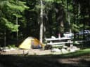 Cedar Springs Campground (WA)Snoqualmie National Forest · 3.2 mi
From Naches, Washington, follow Highway 410 for approximately 30 miles west to Forest Road 1709. Turn left on Forest Road 1709, cross the bridge then turn left on Forest Road 1704 follow the road approximately 1 mile. Campground is located on the left. From Enumclaw depart WA-164/Griffin Ave toward Wells St. After ½ mile turn left onto WA-410/Roosevelt Ave. Follow WA-410 approximately 63 miles east to the intersection with Forest Road 1709. Turn right on Forest Road 1704 follow the road approximately 1 mile. Campground is located on the left.
The weather
the next four days · the thirty-year normal
Next four days, and the thirty-year normal
Forecast
NWS forecast for Cliffdell, WA
Typical weather
Typical October night 37°F, day 62°F.
Coldest month of the year: typical December night 24°F, below freezing. Bring a bag rated colder than that, and expect ice in the water bottle.
Daily high and lowDays with 0.10 in or more
A normal is the 1991-2020 average for the month, not a forecast: about half of all Augusts are colder than the August line. The seven-day forecast above answers the other question.
The land, and who answers for it
what threatens it · who answers for it
Roadless country, and what’s coming for it
You’re camping on ground somebody wants. We track the threats and the comment deadlines.
Who answers for this land
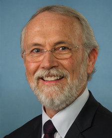
Halfway Flat Campground is in Washington’s 4th congressional district. Its representative, Dan Newhouse (R), votes on the laws that decide what happens to this land. Public-lands grade so far: F. See every public-lands vote →