Katahdin Woods & Waters National Monument Camping
- Right now
- Nobody has saidNo season, no closure, no bookings to read
- Sites
- 2722 on recreation.gov
The place
the agency’s own description · what’s there · 6 notices
In the agency’s own words
Katahdin Woods and Waters National Monument is located in Maine’s north woods. Katahdin Woods and Waters protects part of an extraordinary natural and cultural landscape: the mountains, woods, and waters where the East Branch of the Penobscot River and its tributaries, including the Wassataquoik Stream and the Seboeis River, run freely. Campsites, lean-tos and huts located throughout the monument provide opportunities to stay overnight while hiking, biking, paddling and enjoying other recreational activities. Keep reading
Recreation
There are many ways visitors can experience Katahdin Woods and Waters National Monument. Below are a few recommended activities: Hiking: Choose a hike that meets your abilities to observe the biodiversity of the monument. Biking: Bike on historic logging roads (current and former) within the monument that display signs of logging activity that dates back as early as the 1800s. Camping: Sleep under the stars. Katahdin Woods and Waters is an International Dark Sky Sanctuary, the first to be certified in the state of Maine and in New England. Paddling: Paddlers can experience the scenic hydraulic features that are ecologically and culturally significant within the monument. The streams and rivers within the monument provide important habitat for spawning and rearing federally endangered Atlantic salmon. Wildlife watching and birding : The monument provides a landscape for a wide variety of wildlife. Birds can be seen and heard year-round. Pollinators, reptiles, and amphibians are most active during the spring and summer months. However, large mammals like moose, black bear, and Canada lynx are often what visitors have their cameras ready for. Fishing : Anglers enjoy catching brook trout, rainbow trout, brown trout, as well as smallmouth and largemouth bass at the monument. Sight seeing : Visitors often enjoy the views of Katahdin (located in Baxter State Park ) and the scenic waterways at the monument. Snowmobiling and hunting in designated areas: Snowmobiling and hunting are only allowed in specifically designated areas of the monument. Cross-country skiing and snowshoeing in the winter: The monument provides a limited area of groomed cross-country trails at the North Gate for visitors to use.
Facilities
Campsites, lean-tos and huts are dispersed throughout Katahdin Woods and Waters National Monument. Huts are only open for reservation and stay during the winter season. All roads within the monument are unpaved. Some sites can only be reached by hiking, biking, paddling, skiing or snowshoeing. There are no flush toilets within the monument boundaries. Campsites may have vault or pit toilets; other sites require following Leave No Trace practices for human waste. Most campsites have picnic tables and a stone or metal fire ring. Brown metal food storage lockers , also known as bear boxes, are available in some campsites. All odorous items must be stored in a bear-resistant canister or in a contained vehicle if there is no food locker available. Campfires may require a permit from the Maine Forest Service .
Natural Features
The East Branch of the Penobscot River flows all the way through the monument, about 25 miles from north to south. The first 10 miles drops over 200ft, creating a series of waterfalls and rapids (Stair Falls, Haskell Rock Pitch, Pond Pitch, Grand Pitch, the Hulling Machine, and Bowlin Falls). The Seboeis River and Wassataquoik Stream also create scenic viewpoints in the monument, such as Orin Falls. Katahdin Woods and Waters is known for its dark sky. In 2020 it was certified as an International Dark Sky Sanctuary. Forest, waterways, and wetlands provide critical habitat and corridors for plants and wildlife, including threatened species such as Atlantic salmon, Canada lynx, and rare mussels and butterflies. Geological formations are throughout the monument. Haskell Rock is a 20 ft tall conglomerate bedrock pillar in the East Branch. Popular hikes include trails on Barnard, Deasey, and Lunksoos Mountains. Contact Info This location is unstaffed. To speak with our main office for general information, please call: (207) 456-6001.
Nearby Attractions
Baxter State Park (where Katahdin and the Appalachian Trail's northern terminus are located) is adjacent to the western boundary of Katahdin Woods and Waters National Monument. Penobscot River Trails Charges & Cancellations The reservation fee is non-refundable. Please cancel your reservation if you do not plan to use it. You may cancel or modify your reservation online up to one day prior to your reservation start date.
What the agency tells you
Campsites at Upper East Branch, Lunksoos and Sandbank Stream can be accessed by road during the summer. Upper East Branch and Lunksoos campsites require a short walk from the parking area to the campsites. Sandbank Stream is the only location that will accommodate small RVs and campers. All other sites and lean-tos require hiking, biking or paddling for access.
Roads with in Katahdin Woods and Waters National Monument are typically open to motorized vehicles from late May to mid-November. Exact dates vary depending on road conditions. At other times of year, access is by foot or bicycle only. Check current conditions. All vehicles (including bicycles, e-bikes, and other motorized vehicles) must follow established speed limits when traveling within Katahdin Woods and Waters NM. The Katahdin Loop Road and Seboeis River Road speed limit is 15mph. All other roads within Katahdin Woods and Waters National Monument have a 25mph speed limit. Sometimes, vehicles may need to travel at slower speeds depending on current road conditions.
It is not possible to drive from the north entrance to the south entrance through the monument. Some sites may be accessed only from the north and others only from the south, unless you are paddling or hiking long distances.
Everything else this campground posts · 3
Do not bring firewood from more than 50 miles away. Help protect forests from the spread of hidden, tree-killing insects by obtaining firewood from local vendors near the monument. Please visit Don't Move Firewood for more information.
Pets are permitted at campsites and must be leashed at all times. Leashes must be six feet or less in length. Pets are not permitted in lean-tos or huts.
All scented items (food, trash, coolers, toiletries, cooking materials, and cleaning supplies) must be stored inside your sealed vehicle or in an NPS wildlife-proof locker at your campsite or picnic site. Help us keep the wildlife wild.
Tents and rigs
- Sites
- 27 · 17 walk-in, 2 boat-in, 2 group
- Hookups
- None
- Accessible sites
- 1
- Pets
- Allowed at 18 of 20 sites
- Campfires
- Allowed, barring fire bans
- Shade
- 19 of 22 sites
Facilities
- Toilets
- Vault Toilets · Pit Toilets
- VAULT TOILETS on 7 of 24 campsite records / PIT TOILETS on 8 of 24 campsite records
- Bear boxes
- Yes
- Stay limit
- 30 nights
- recreation.gov facility rule maxStay
Around the campground
- On the water
- Waterfall, River, Creek
- Biking
- Birding
- Canoeing
- Cross Country Skiing
- Hiking
- Mountain biking
- Paddling
- Picnicking
- Scenic drives
- Snowshoeing
- Wildlife viewing
- Winter sports
- Fall color · reported 3 days ago, in Penobscot County
- Past peak
Nothing on the booking system for the next 30 nightsread 14:17 UTC
recreation.gov lists 22 of the 27 campsites the agency files here. The rest aren’t on its booking system, so a reservation won’t get you one.
Every one of the next thirty nights is in recreation.gov’s record and not one site is being offered on any of them. That’s a campground closed or not yet released for booking, not a sold-out one.
Watch for a cancellation
Full? Watch it.
One email when a night opens, plus More Than Just Parks dispatches. Unsubscribe any time.
We read recreation.gov once an hour, at 40 minutes past, and write the first time a site in your window is free for the nights you asked for.
Scanners that check every few minutes exist, and most of them charge. This one is free, it reads the same calendar, and it won’t always be first.
Tell me when the season opens
Watch for the season to open
One email when the season goes on sale, plus More Than Just Parks dispatches. Unsubscribe any time.
We check once an hour, at 40 minutes past, and write the first time the agency has that season on sale.
Scanners that check every few minutes exist, and most of them charge. This one is free, it reads the same calendar, and it won’t always be first.
We make nothing when you book. The link goes straight to the government.
Every line of the receipt · 16
What you actually pay
“The reservation fee is non-refundable. Please cancel your reservation if you do not plan to use it. You may cancel or modify your reservation online up to one day prior to your reservation start date.” · this campground’s own terms
Who keeps the booking fee
The agency’s own policy text says the reservation fee and the cancellation processing fee are “retained by the reservation service contractor”, and that a campground concessionaire will decline to refund them because “they did not receive these fees”. Recreation.gov is run under contract by Booz Allen Hamilton. What share of your booking fee the contractor keeps isn’t published in any federal dataset we can read, so we print no number for it. Our reporting on the contract →
How we know this receipt · 5
recreation.gov availability, read 14:17 UTC · rules read Sep 9, 2026 · rates Sep 10, 2026 · How we know all this
The sites
27 sites · which ones have room · the site map
The sites, ranked
from 19 mapped sitesAll 27 sites
Toilet distances are OpenStreetMap’s, measured for 3 of the 27 sites listed. A site with no reading is unknown, never far.
Measured shade is NLCD Tree Canopy Cover 2024 (USDA Forest Service / MRLC) read at the site’s own coordinate, 27% canopy or more, and only for the sites the agency gave no Shade value. It never changes the agency’s own shaded count beside it.
| Katahdin Woods and Waters | Big Seboeis | boat in | 9783 ft | 16 ftEast Branch Penobscot River | Pit Toilets listed | |
| Katahdin Woods and Waters | Big Spring Brook | boat in | 12047 ft | 33 ftEast Branch Penobscot River | ||
| Katahdin Woods and Waters | Big Spring Brook Hut | type not stated | 181 ftBig Spring Brook | Pit Toilets listed | ||
| Katahdin Woods and Waters | Esker | hike to | 12640 ft | 73 ftWassataquoik Stream | ||
| Katahdin Woods and Waters | Grand Pitch Lean-to | hike to | 2607 ft | 203 ftEast Branch Penobscot River | Pit Toilets listed | |
| Katahdin Woods and Waters | Haskell Deadwater | hike to | 4977 ft | 72 ftEast Branch Penobscot River | 2,370 ft | |
| Katahdin Woods and Waters | Haskell Hut | type not stated | 65 ftEast Branch Penobscot River | 127 ft | ||
| Katahdin Woods and Waters | Katahdin Brook Lean-to | hike to | 12868 ft | 201 ftKatahdin Brook | Pit Toilets listed | |
| Katahdin Woods and Waters | Lunksoos 1 | walk to | yes | 79 ft | 328 ftEast Branch Penobscot River | Vault Toilets listed |
| Katahdin Woods and Waters | Lunksoos 2 | walk to | 10 ft | 399 ftEast Branch Penobscot River | Vault Toilets listed | |
| Katahdin Woods and Waters | Lunksoos 3 | walk to | 10 ft | 404 ftEast Branch Penobscot River | Vault Toilets listed | |
| Katahdin Woods and Waters | Lunksoos 4 | walk to | 126 ft | 440 ftEast Branch Penobscot River | Vault Toilets listed | |
| Katahdin Woods and Waters | Lunksoos 5 | walk to | 126 ft | 315 ftEast Branch Penobscot River | Vault Toilets listed | |
| Katahdin Woods and Waters | Lunksoos 6 | group walk to | 136 ft | 559 ftEast Branch Penobscot River | Vault Toilets listed | |
| Katahdin Woods and Waters | Lunksoos 7 | group walk to | 136 ft | 428 ftEast Branch Penobscot River | Vault Toilets listed | |
| Katahdin Woods and Waters | Lunksoos Lean-to | hike to | 9384 ft | 784 ft | Pit Toilets listed | |
| Katahdin Woods and Waters | Pond Pitch | hike to | 2607 ft | 146 ftEast Branch Penobscot River | ||
| Katahdin Woods and Waters | Sandbank Stream 1 | standard nonelectric | ||||
| Katahdin Woods and Waters | Sandbank Stream 2 | standard nonelectric | ||||
| Katahdin Woods and Waters | Sandbank Stream 3 | standard nonelectric | ||||
| Katahdin Woods and Waters | Stair Falls | hike to | 5677 ft | 58 ftEast Branch Penobscot River | ||
| Katahdin Woods and Waters | Upper East Branch | walk to | 10932 ft | 93 ftEast Branch Penobscot River | 211 ft | |
| Katahdin Woods and Waters | Wassataquoik | hike to | 222 ft | 67 ft | ||
| Katahdin Woods and Waters | Wassataquoik Lean-to | hike to | 222 ft | 254 ft | Pit Toilets listed | |
| Sandbank Stream | Sandbank Stream Site 1 | standard nonelectric | ||||
| Sandbank Stream | Sandbank Stream Site 2 | standard nonelectric | ||||
| Sandbank Stream | Sandbank Stream Site 3 | standard nonelectric |
25 of 27 listed
Getting there
the map and the coordinate · the agency’s directions · the phone number
Where it is
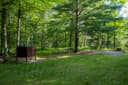 Upper East Branch CampsiteKatahdin Woods and Waters National Monument · 0.8 mi
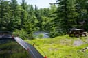 Stair Falls CampsiteKatahdin Woods and Waters National Monument · 2.9 mi
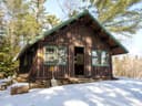 Haskell HutKatahdin Woods and Waters National Monument · 3.5 mi
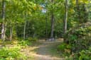 Haskell Deadwater CampsiteKatahdin Woods and Waters National Monument · 3.9 mi
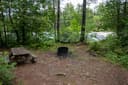 Pond Pitch CampsiteKatahdin Woods and Waters National Monument · 4.8 mi
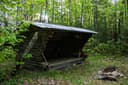 Grand Pitch Lean-toKatahdin Woods and Waters National Monument · 5.3 mi
Katahdin Woods and Waters National Monument is located in north central Maine, approximately a 2-hour drive northwest of Acadia National Park in Bar Harbor and 1.5-hour drive north of Bangor, Maine. Both areas are served by regional airports.
You can access all parts of the monument from I-95. Take exit 244 (Medway) or exit 264 (Sherman) to access Maine Route 11. Once you exit I-95, you will travel on Maine Route 11 to access the monument. If you are southbound on I-95, you can also access the monument from exit 276 (Island Falls). Maine Route 11 is the main access route to the monument. It is also known as the Katahdin Woods and Waters National Scenic Byway.
North Entrance
The weather
the thirty-year normal
Next four days, and the thirty-year normal
Typical weather
Typical October night 37°F, day 55°F.
Coldest month of the year: typical January night 5°F, below freezing. Bring a bag rated colder than that, and expect ice in the water bottle.
Daily high and lowDays with 0.10 in or more
A normal is the 1991-2020 average for the month, not a forecast: about half of all Julys are colder than the July line. The seven-day forecast above answers the other question.
The land, and who answers for it
what threatens it · who answers for it
What threatens this place
You’re camping on ground somebody wants. We track the threats and the comment deadlines.
Who answers for this land

Katahdin Woods & Waters National Monument Camping is in Maine’s 2nd congressional district. Its representative, Jared Golden (D), votes on the laws that decide what happens to this land. Public-lands grade so far: F. See every public-lands vote →