U.S. Forest Service · Fishlake National Forest · UT

Mallard Bay Overflow Rec Site

The agency doesn’t say how you get a siteIts record carries no access type, so treat it as a place to phone before you drive.
Right now
OpenInside the published season, our reading
Season
May 1Opens May 1. No closing date published.
Drawn from the record · 8,860 ft · 0% tree cover · Fish Lake within reach · Bortle 2 sky
8,860 ftElevation
203 ftWater · Fish Lake
20.7 miSE of Monroe, UT
0%Tree cover
Bortle 2Night sky · 79th darkest of 458 in UT
Opens May 1. No closing date published.Today

The place

the agency’s own description · what’s there

In the agency’s own words

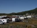
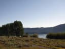
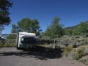
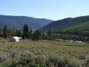
Mallard Bay Overflow Camping Area is next to Fish Lake and the Fishlake Scenic Byway in central Utah at an 9,000 feet elevation. The camping area is used as an overflow camping area when all other campgrounds in the Fish Lake Basin are full. Keep reading

Recreation

Fish Lake is Utah's largest natural mountain lake, covering 2,500 acres. It is famous for its 20-40 pound Mackinaw lake trout. Anglers also enjoy fishing for rainbow trout and splake. Boating, canoeing, swimming and scuba diving are popular activities. The five-mile Pelican Canyon Trail begins at nearby Bowery Creek Campground. It leads through meadows and dense forests of spruce, pine and aspen as it climbs to the 11,633-foot Fish Lake Hightop. The popular Lakeshore National Recreation Trail lines the eastern side of the lake. Hikers are rewarded with stunning lake views after climbing 900 feet elevation.

Source: USFS Enterprise Data Warehouse · Aug 24, 2026

Around the campground

On the water
Lake, Creek, Coast, Meadow
Fall color · reported 14 days ago, 0.9 km away
Patchy color
Source: Stated in the agency description
Fall color: More Than Just Parks foliage tracker, joined to this campground by distance (0.9 km) · Oct 3, 2026

Phone before you drive

recreation.gov publishes no availability for a campground you can’t reserve, so there’s no thirty-night reading to draw here. The season bar above is what the agency does publish.

Booking window6 months outBooking opens 6 months ahead; today unlocks arrivals through April 16, 2027. The agency publishes no reservable season in the record we hold, so the window may close earlier than that.recreation.gov
Runs itU.S. Forest Servicethe agency’s record
Every line of the receipt · 6

What you actually pay

The sign priceU.S. Forest Service
The U.S. Forest Service publishes no per-night rate for this campground that we can read, so there’s no sign price to print. That’s a gap in the record, not a free campground.
Please call or email for fees.
Please Note: All campgrounds on the Fishlake National Forest are managed by High Country Recreation under the terms and conditions of a concession permit that was issued to them by the Forest Service in 2020.
Email: highcountryrec@gmail.com ​Phone: 435-633-3028
The booking feerecreation.gov
We hold no recreation.gov booking record for this campground, so we can’t say whether a booking fee applies.
What a stay costs
The agency publishes no nightly rate for this campground, so there’s no total to show.
How we know this receipt · 4
Source: USFS Enterprise Data Warehouse · Aug 24, 2026

record Aug 24, 2026 · How we know all this

Seen something wrong here? Tell us.

Getting there

the map and the coordinate

The weather

the next four days

Next four days, and the thirty-year normal

Forecast

Overnight31°Mostly Clear
Saturday56°Sunny
Saturday Night33°Mostly Cloudy9% rain
Sunday52°Mostly Cloudy then Slight Chance Rain And Snow19% rain

NWS forecast for Koosharem, UT

The land, and who answers for it

what threatens it · who answers for it

Roadless country, and what’s coming for it

Roadless
Mytoge8,286 acres · 6 mi · inventoried roadless area
Roadless
Fishlake Mountain25,217 acres · 8 mi · inventoried roadless area

You’re camping on ground somebody wants. We track the threats and the comment deadlines.

Who answers for this land
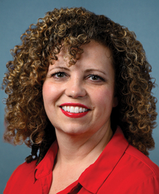
Celeste Maloy, official portrait

Mallard Bay Overflow Rec Site is in Utah’s 2nd congressional district. Its representative, Celeste Maloy (R), votes on the laws that decide what happens to this land. Public-lands grade so far: F. See every public-lands vote →

Seen something wrong here? Tell us.

How we know

every fact on this page, and where it came from
Right now: Today falls inside the season the agency publishes, and it has posted nothing else. That reading is ours.
Season: USFS Enterprise Data Warehouse · Aug 24, 2026
Fall color: More Than Just Parks foliage tracker, joined to this campground by distance (0.9 km) · Oct 3, 2026
Cell signal: the Forest Service’s own campground description, read as text by CAMPANAC. None of this is a measurement. It’s what the land manager published about the place, and phones, carriers and weather all disagree with each other; treat it as a warning, not a promise.
Nearest place of any size: Koosharem, UT, 7.6 mi E. Straight line.