McCormack Lake Recreation Area
This is how it should work.
- Right now
- OpenThe agency lists it open
- A night
- FreeNo camping fee
- Season
- January 1 – December 31Open January 1 through December 31
The place
the agency’s own description · what’s there
In the agency’s own words
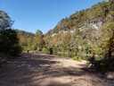
McCormack Lake Recreation Area is surrounded by maple trees. Hiking - There is hiking at McCormack Lake Recreation Area. This is a trailhead in McCormack Lake Day Use Area for the 1.07-mileMcCormack Lake spur trail, which connects to the Eleven Point River Section of the Ozark Trail and the Lazy C Trail . Fishing and Boating - The 15-acre lake is stocked annually with panfish and bass being the catch of the day. During the warm months the vegetation in the lake can make fishing and boating difficult. The lake is a non-motorized area; boat motors are not allowed. An electric trolling motor is permitted. There is ample parking for picnickers and fishermen. Camping - The campground is primitive with limited picnic tables, firerings and lantern posts. A vault toilet is provided. No water is available.
Facilities
- Toilets
- Vault Toilets
- “…tables, firerings and lantern posts. A vault toilet is provided. No water is available.”
- Drinking water
- None, bring your own
- “…posts. A vault toilet is provided. No water is available.”
Around the campground
- On the water
- Lake, River
Nothing to book, just show up
One of 1,623 federal campgrounds where the site still goes to whoever pulls in first, and it costs nothing at all. Get there before noon on a summer weekend.
recreation.gov publishes no availability for a campground you can’t reserve, so there’s no thirty-night reading to draw here. The season bar above is what the agency does publish.
Every line of the receipt · 4
What you actually pay
Derived by CAMPANAC: the agency’s own record says there’s no camping fee, and no booking fee, because this campground takes no reservations. A weekend here means Friday and Saturday night. Optional charges (an extra vehicle, a second tent, a dump-station fee) are listed separately and aren’t in this total.
How we know this receipt · 5
record Aug 24, 2026 · How we know all this
Getting there
the map and the coordinate
Where it is
 Rymers CampgroundOzark National Scenic Riverways · 20 mi
 Fourche Lake Recreation AreaMark Twain National Forest · 21 mi
 Bachers CampgroundOzark National Scenic Riverways · 22 mi
 Jacks Fork / Middle Current Backcountry Campsites22 mi
 Lower Current District Backcountry Campsites22 mi
The weather
the next four days · the thirty-year normal
Next four days, and the thirty-year normal
Forecast
NWS forecast for Alton, MO
Typical weather
Typical October night 43°F, day 70°F.
Coldest month of the year: typical January night 22°F, below freezing. Bring a bag rated colder than that, and expect ice in the water bottle.
Daily high and lowDays with 0.10 in or more
A normal is the 1991-2020 average for the month, not a forecast: about half of all Julys are colder than the July line. The seven-day forecast above answers the other question.
The land, and who answers for it
what threatens it · who answers for it
What threatens this place
You’re camping on ground somebody wants. We track the threats and the comment deadlines.
Who answers for this land

McCormack Lake Recreation Area is in Missouri’s 8th congressional district. Its representative, Jason Smith (R), votes on the laws that decide what happens to this land. Public-lands grade so far: F. See every public-lands vote →