Greer Crossing Recreation Area
This is how it should work.
- Right now
- OpenThe agency lists it open
- Season
- January 1 – December 31Open January 1 through December 31
The place
the agency’s own description · what’s there
In the agency’s own words
A you exit the highway, the campground is located to the left with campsites located off of a loop road that circles through the campground. If you stay straight you will get to the boat launch and day use area. This campground is primarily used by people using the river. It's a nice flat, level area immediately adjacent to the highway. This campground is a hub that puts you in the vicinity of Greer Mill, Greer Spring , and numerous other historic mills and springs. There are several historic sites in the area also. These sites are not within walking distance, but are a reasonable drive away along Highway 19. Keep reading
When you access the site from the river, it will be located on the right-hand side. Camping The campground is set back away from the water's edge. A campground host is on site in the summer. Sites, which offer seclusion and privacy, each with a table, fire ring, and lantern post. Picnicking and Boating A picnic area is near the boat access. The boating access is one of the most popular launch sites for people floating the Eleven Point. Hiking There is one trail available for hikers; a 4-mile trail that follows the river and through typical Ozark hills up to McCormack Lake then circles back for a 2 mile walk back to Greer. This trail runs along the river and then back along the hillside above the river. Fishing Fishing is plentiful, there are rainbow trout, small mouth bass, and sunfish, just to name a few.
Facilities
- Boat ramp
- Yes
Around the campground
- On the water
- Lake, River
Nothing to book, just show up
One of 1,623 federal campgrounds where the site still goes to whoever pulls in first. Get there before noon on a summer weekend.
recreation.gov publishes no availability for a campground you can’t reserve, so there’s no thirty-night reading to draw here. The season bar above is what the agency does publish.
Every line of the receipt · 5
What you actually pay
How we know this receipt · 4
record Aug 24, 2026 · How we know all this
Getting there
the map and the coordinate
Where it is
 Fourche Lake Recreation AreaMark Twain National Forest · 19 mi
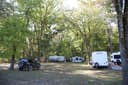 Gooseneck Campground21 miGrubb Hollow CampgroundOzark National Scenic Riverways · 22 mi
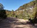 Rymers CampgroundOzark National Scenic Riverways · 22 mi
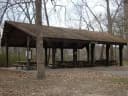 WatercressMark Twain National Forest · 23 mi
The weather
the next four days · the thirty-year normal
Next four days, and the thirty-year normal
Forecast
NWS forecast for Alton, MO
Typical weather
Typical October night 43°F, day 70°F.
Coldest month of the year: typical January night 22°F, below freezing. Bring a bag rated colder than that, and expect ice in the water bottle.
Daily high and lowDays with 0.10 in or more
A normal is the 1991-2020 average for the month, not a forecast: about half of all Julys are colder than the July line. The seven-day forecast above answers the other question.
The land, and who answers for it
what threatens it · who answers for it
What threatens this place
You’re camping on ground somebody wants. We track the threats and the comment deadlines.
Who answers for this land

Greer Crossing Recreation Area is in Missouri’s 8th congressional district. Its representative, Jason Smith (R), votes on the laws that decide what happens to this land. Public-lands grade so far: F. See every public-lands vote →