North Fork Campground
4Heads up4 fires, nearest 19 mi
This is how it should work.
- Right now
- Nobody has saidNo season, no closure, no bookings to read
The place
the agency’s own description · what’s there
In the agency’s own words
North Fork Campground is a quiet, semi-shaded, remote campground bordered by the North Fork of the Smith River. This is a perfect place to “get away from it all” and to stay before rafting the Wild North Fork. The campground is also popular with four-wheel-drive groups who enjoy driving the jeep trails and back roads of the area. The landscape surrounding the campground is dramatically steep and rocky. The vegetation is sparse due to the serpentine soil which stunts plant growth. The Biscuit Fire swept through the area in 2002, burning much of the vegetation in the surrounding area. Keep reading
Spring and early summer bring beautiful wildflowers to the area including the fragrant western azalea and beautiful blue brodiaeas. The campground is within the North Fork Smith River botanical area, which harbors many rare plants adapted to the serpentine soil. Access to the North Fork of the Smith River is ¼ mile west of the campground at the North Fork river access (also known as Brown's Flat and Major Moore's). There are some nice pools but the water is very chilly and the shoreline is very cobbled except for a small patch of sand at the upstream end. It is a good place to sit on a rock and soak your feet on a hot day. Click on the "Photos and Multimedia" link on the right sidebar to view a photo of the North Fork river access.
Around the campground
- On the water
- River, Beach
- Hiking
Nothing to book, just show up
One of 1,623 federal campgrounds where the site still goes to whoever pulls in first. Get there before noon on a summer weekend.
recreation.gov publishes no availability for a campground you can’t reserve, so there’s no thirty-night reading to draw here. The season bar above is what the agency does publish.
Every line of the receipt · 3
What you actually pay
How we know this receipt · 4
rules read Sep 7, 2026 · record Aug 23, 2026 · How we know all this
Getting there
the map and the coordinate
Where it is
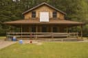 Ludlum HouseSiskiyou National Forest · 8.6 miLudlum CampgroundSiskiyou National Forest · 8.6 miGrassy Flat CampgroundSmith River National Recreation Area · 9.2 miPatrick Creek CampgroundSmith River National Recreation Area · 9.4 mi
 Panther Flat CampgroundSmith River National Recreation Area · 9.5 mi
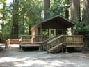 Jedediah Smith Campground - Jedediah Smith Redwoods State Park14 mi
The weather
the next four days · the thirty-year normal
Next four days, and the thirty-year normal
Forecast
NWS forecast for Gasquet, CA
Typical weather
Typical October night 48°F, day 65°F.
Coldest month of the year: typical January night 42°F. Bring the bag rated for it.
Daily high and lowDays with 0.10 in or more
A normal is the 1991-2020 average for the month, not a forecast: about half of all Julys are colder than the July line. The seven-day forecast above answers the other question.
The land, and who answers for it
what threatens it · who answers for it
Roadless country, and what’s coming for it
You’re camping on ground somebody wants. We track the threats and the comment deadlines.
Who answers for this land

North Fork Campground is in California’s 2nd congressional district. Its representative, Jared Huffman (D), votes on the laws that decide what happens to this land. Public-lands grade so far: A+. See every public-lands vote →