U.S. Forest Service · National Recreation Area · California
Smith River National Recreation Area
Here, one in three take walk-ups.
6Campgrounds
2Take walk-ups
$10–$15A night, across 3
72Sites, from 4
510–5,080 ftElevation
Where they are
6 of 6 mappedDrawing the map
© OpenFreeMap · OpenStreetMap · Esri hillshadeSource: RIDB · NPS · USFS EDW · BLM, unified by CAMPANAC · Oct 29, 2026
The campgrounds
6 campgrounds
 Panther Flat CampgroundReservablefrom $1539 sitesrigs to 45 ft510 ftdrinking watertoilets
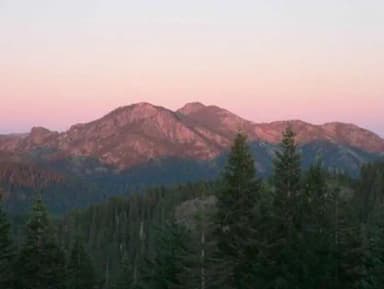 Bear Basin Lookout and CabinReservableSites from $751 site5,080 fttoilets
 Big Flat CampgroundFirst-come600 ftdrinking waterGrassy Flat CampgroundReservablefrom $104 walk-in sites19 sitesrigs to 40 ft650 fttoiletsPatrick Creek CampgroundReservablefrom $1413 sitesrigs to 45 ft820 ftdrinking watertoiletsNorth Fork CampgroundFirst-come910 ft
Source: RIDB · NPS · USFS EDW · BLM, unified by CAMPANAC · Oct 29, 2026
This land
measured from the nearest campground in the unitRoadless
Roadless
Roadless
Roadless
Roadless
Roadless
Camping here is a stake in what happens to it. More Than Just Parks tracks the threats and the comment windows.
Source: USFS Inventoried Roadless Areas via MTJP Roadless Map · Jul 29, 2026
Heads up
Wildfire
Red Rock fire · 42 mi from the nearest campground here
Source: NIFC/IRWIN via MTJP wildfire tracker · Oct 27, 2026
Who answers for this land
Smith River National Recreation Area’s campgrounds sit in one congressional district. These members vote on the laws that decide what happens to this land.
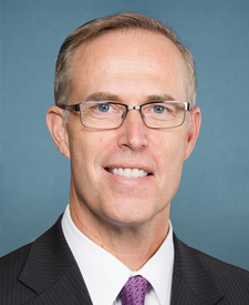
Jared Huffman (D)
Source: campground records from RIDB, NPS, USFS EDW and BLM, unified by CAMPANAC, refreshed nightly