Olallie Lake Campground
4Heads up4 fires, nearest 32 mi
- Right now
- Listed not openA database flag with no reason and no date
The place
the agency’s own description · what’s there
In the agency’s own words
This campground, on the shores of Ollalie Lake, offers 5 small sites and one larger area with room for RVs. The sites offer scenic views of Mt. Adams from the lake. It's located in a high elevation stand of lodgepole and subalpine pine. Mosquitos can be numerous in the early season. Some parking spurs are at a right angle, so backing may be challenging. Nearby High Lakes Trail #116 and East Canyon Trail #265 are open to motorcycle use. View a Olallie Lake Campground map (.pdf).
Around the campground
- On the water
- Lake
- Fall color · reported 9 days ago, 17 km away
- Patchy color
Phone before you drive
recreation.gov publishes no availability for a campground you can’t reserve, so there’s no thirty-night reading to draw here. The season bar above is what the agency does publish.
Every line of the receipt · 4
What you actually pay
“Camping : Single Site/$20 Double Site/$36 Extra Vehicle : $8” · the U.S. Forest Service’s own fee record
How we know this receipt · 5
record Aug 24, 2026 · How we know all this
Getting there
the map and the coordinate
Where it is
 Takhlakh Lake CampgroundGifford Pinchot National Forest · 1.3 mi
 Horseshoe Lake CampgroundGifford Pinchot National Forest · 2.9 mi
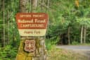 Adams Fork CampgroundGifford Pinchot National Forest · 3.5 mi
 Killen Creek CampgroundGifford Pinchot National Forest · 3.5 miTwin Falls CampgroundGifford Pinchot National Forest · 5.6 mi
 Blue Lake Creek Campground - Gifford Pinchot NF (WA)Gifford Pinchot National Forest · 9.5 mi
The weather
the next four days
Next four days, and the thirty-year normal
Forecast
NWS forecast for Trout Lake, WA
The land, and who answers for it
what threatens it · who answers for it
What threatens this place
You’re camping on ground somebody wants. We track the threats and the comment deadlines.
Who answers for this land
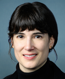
Olallie Lake Campground is in Washington’s 3rd congressional district. Its representative, Marie Gluesenkamp Perez (D), votes on the laws that decide what happens to this land. Public-lands grade so far: C. See every public-lands vote →