Packers Cabin
5Heads up5 fires, nearest 23 mi
- Right now
- Nobody has saidNo season, no closure, no bookings to read
- Sites
- 1All of them booked ahead
The place
the agency’s own description · what’s there · 8 notices
In the agency’s own words
Packers Cabin was originally built during the 1930s and served as the headquarters for the Forest Service packer who supplied lookouts and field crews by horse or mule pack trains. Today, visitors no longer need to hitch up a team of mules and trek for days to enjoy staying in the quiet, remote cabin within the Rogue River-Siskiyou National Forest. The accessible cabin offers most items needed for a comfortable lodging experience, though guests will need to bring some of their own amenities to ensure a safe and comfortable stay. Keep reading
Recreation
Hiking, wildlife viewing and fishing top the list of recreational opportunities in the area surrounding Packer's Cabin. Anglers will enjoy the remote location and scenic backdrop of the nearby Chetco River, providing angling opportunities for trout, steelhead, and salmon in season. The Chetco starts in steep, deeply dissected, sparsely vegetated, mountainous terrain within the Kalmiopsis Wilderness. Over its 55.5 mile length, the Chetco drops from 3,700 feet to sea-level as it empties into the Pacific Ocean between the towns of Brookings and Harbor, about 5 miles north of the California border. The Oregon Redwoods Trail provides a unique accessible hiking opportunity that travels through a grove of majestic old-growth redwood trees. Located along Peavine Ridge in the Winchuck River drainage, guests will learn about old-growth tree ecology, fire history, wildlife, and botany in the area. Redwood trees in this area represent the only coastal redwoods found in the Pacific Northwest Region, located at the limit of their northern range. The trail is an out/back design with a short loop at the far end, where a picnic stop is provided. A short wooden deck provides access to the inside of a hollowed redwood tree.
Facilities
Packer's Cabin is a facility that meets accessibility standards and is equipped with ramps, decks, wide doorways and door handles to make the cabin as barrier-free as possible for anyone wishing to take a step back in history and live the life of a forest ranger. The cabin accommodates up to 12 people comfortably and is furnished with one double bunk and ten single bunks with mattresses. There is a table and chairs, a work surface for food preparation, and a wood-burning stove. Picnic tables and a campfire ring are located near the cabin, as well as an accessible vault toilet. There is no water on site; visitors must bring a sufficient supply for drinking, cooking and washing. A natural spring is located nearby, but the water is not recommended for consumption. Guests must also provide their own sleeping bags, sleeping pads, a light source, towels, dish soap, matches, cooking gear, first aid kit, toilet paper and garbage bags. Tent space is available near the cabin.
Natural Features
The landscapes comprising the Rogue River-Siskiyou National Forest has led to the designation of over 340,000 acres of the Forest as wilderness, and over 200 miles of streams as National Wild and Scenic Rivers. The forest itself is composed of two distinct geological provinces - the Cascade Range and the Siskiyou Mountains. The Cascade Range is dominated by snow-capped volcanic peaks such as the 9,495 foot Mt. McLoughlin, located within the Sky Lakes Wilderness. The Siskiyou area embodies the most complex and treasured plant communities in the Pacific Northwest. Wild rivers, biological diversity, remarkable fisheries, and complex watersheds define the Siskiyous. Packer's Cabin, when built, was adjacent to a large meadow. The trees started encroaching on the meadow and over time, the cabin became nestled in a grove of large fir trees. The Forest Service is now in the 2nd stage of restoring the original meadow habitat. Packer's Cabin now has lots of sun. There will be meadow enhancement information available at the cabin. The cabin lies in the area of the 2017 Chetco Bar Fire. Visitors will expeirence a landscape in transition.
Nearby Attractions
The Pacific Ocean is 17 miles from this site.
What the agency tells you
Water is not available at this site.
Entry to the cabin is by combination lock. The combination will be included in your confirmation letter. Please call the Gold Beach Ranger District office at (541)247-3600 four days prior to your arrival to confirm your combination. The office is open Monday through Friday from 8:30 a.m. to 4:30 p.m. and closed on weekends and holidays.
Please contact the Ranger District at (541)247-3600 prior to arriving at the cabin to check on any restrictions or conditions, such as fire or road closures, weather or storms that may affect the quality of your visit.
Everything else this campground posts · 5
Pets are welcome at this facility.
All garbage and food must be packed out.
The cabin is a no-smoking facility.
Learn more about Rogue River-Siskiyou National Forest.
Don't Move Firewood: Please protect Pacific Northwest forests by preventing the spread of invasive species. Firewood can carry insects and diseases that can threaten the health of our western forests. You can make a difference by obtaining and burning your firewood near your camping destination. Visit Dontmovefirewood.org for further information.
Tents and rigs
- Sites
- 1 · 1 cabin
- Hookups
- None
- Accessible sites
- 1
- Pets
- Allowed
- Shade
- Every site
Facilities
- Toilets
- Vault Toilets
- ACCESSIBLE VAULT TOILETS on 1 of 1 campsite records
- Drinking water
- None, bring your own
- “…as well as an accessible vault toilet. There is no water on site; visitors must bring a sufficient supply…”
- Stay limit
- 14 nights
- recreation.gov facility rule maxStay
Around the campground
- On the water
- Lake, River, Creek, Coast, Meadow
- Fishing
- Hiking
- Swimming
- Wildlife viewing
- Cell signal · Cell signal · Forest Service says
- Yes
No reading yet, book on recreation.gov
Every site here is reservable, and the record lists none held back for anyone who drives up.
No availability snapshot inside the last 36 hours, so this page draws nothing rather than ageing a reading into fiction.
Watch for a cancellation
Full? Watch it.
One email when a night opens, plus More Than Just Parks dispatches. Unsubscribe any time.
We read recreation.gov once an hour, at 40 minutes past, and write the first time a site in your window is free for the nights you asked for.
Scanners that check every few minutes exist, and most of them charge. This one is free, it reads the same calendar, and it won’t always be first.
We make nothing when you book. The link goes straight to the government.
Every line of the receipt · 9
What you actually pay
Who keeps the booking fee
The agency’s own policy text says the reservation fee and the cancellation processing fee are “retained by the reservation service contractor”, and that a campground concessionaire will decline to refund them because “they did not receive these fees”. Recreation.gov is run under contract by Booz Allen Hamilton. What share of your booking fee the contractor keeps isn’t published in any federal dataset we can read, so we print no number for it. Our reporting on the contract →
How we know this receipt · 4
rules read Sep 9, 2026 · record Aug 23, 2026 · How we know all this
The sites
1 sites · the site map
All 1 sites
| AREA PACKERS CABIN | C1 | cabin nonelectric | yes | 3,332 ft |
OpenStreetMap has no toilet mapped within 1 km of this campground, so no site here carries a toilet distance. That’s a gap in the map, not a finding about the campground.
Getting there
the map and the coordinate · the agency’s directions · the phone number
Where it is
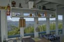 Quail Prairie LookoutSiskiyou National Forest · 2.1 miSouth Fork Camping and Day Use AreaSiskiyou National Forest · 4.7 mi
 Nook Bar Camping and Day Use AreaSiskiyou National Forest · 7.7 mi
 Snow Camp LookoutSiskiyou National Forest · 8.0 mi
 Miller Bar Camping and Day Use AreaSiskiyou National Forest · 8.7 mi
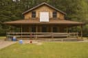 Ludlum HouseSiskiyou National Forest · 14 mi
From Portland take 1-5S to US 199 South to Brookings. From Brookings, Oregon, take U.S. Highway 101 and turn onto County Road 784 (North Bank Chetco River Road). This becomes Forest Road 1376. Follow this Forest Road 1376 to the junction with Forest Road 1917. Follow Forest Road 1917 for 5 miles to Forest Road 1917-110, the entrance to Packer’s Cabin. Travel time from Brookings is about an hour and a half, and easily accessible by highway and Forest Roads. Travel time from Brookings is about an 1.5 hours, and easily accessible by highway and Forest Service roads.
The weather
the next four days · the thirty-year normal
Next four days, and the thirty-year normal
Forecast
NWS forecast for Brookings, OR
Typical weather
Typical October night 39°F, day 72°F.
Coldest month of the year: typical January night 33°F. Bring the bag rated for it.
Daily high and lowDays with 0.10 in or more
A normal is the 1991-2020 average for the month, not a forecast: about half of all Julys are colder than the July line. The seven-day forecast above answers the other question.
The land, and who answers for it
what threatens it · who answers for it
What threatens this place
You’re camping on ground somebody wants. We track the threats and the comment deadlines.
Who answers for this land

Packers Cabin is in Oregon’s 4th congressional district. Its representative, Val Hoyle (D), votes on the laws that decide what happens to this land. Public-lands grade so far: A. See every public-lands vote →
How we know
every fact on this page, and where it came from
“the agency's own site records list "CELL PHONE SERVICE" on 1 of 1 campsites here”