South Fork Camping and Day Use Area
4Heads up4 fires, nearest 24 mi
This is how it should work.
- Right now
- Nobody has saidNo season, no closure, no bookings to read
The place
the agency’s own description · what’s there
In the agency’s own words
This is a dispersed campsite for tents and small trailers is located at the confluence of South Fork Chetco with the main stem of the Wild and Scenic Chetco River . Enjoy summer fun in the crystal clear waters of this outstanding river. Upper South Fork Camp provides a more secluded location along the South Fork Chetco River. Lower South Fork Camp provides a larger area with access to both the South Fork and main stem Chetco River. Keep reading
Facilities
Camp where you want No picnic table No fire pits No campground host No drinking water Portable toilet No garbage disposal - Please pack it out
Facilities
- Toilets
- Portable Toilets
- “No drinking water Portable toilet”
- Drinking water
- None, bring your own
- “No drinking water Portable toilet”
Around the campground
- On the water
- River
Nothing to book, just show up
One of 1,623 federal campgrounds where the site still goes to whoever pulls in first. Get there before noon on a summer weekend.
recreation.gov publishes no availability for a campground you can’t reserve, so there’s no thirty-night reading to draw here. The season bar above is what the agency does publish.
Every line of the receipt · 4
What you actually pay
How we know this receipt · 4
record Aug 24, 2026 · How we know all this
Getting there
the map and the coordinate
Where it is
 Nook Bar Camping and Day Use AreaSiskiyou National Forest · 3.1 mi
 Miller Bar Camping and Day Use AreaSiskiyou National Forest · 4.0 mi
 Packers CabinSiskiyou National Forest · 4.7 mi
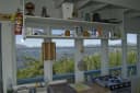 Quail Prairie LookoutSiskiyou National Forest · 5.6 mi
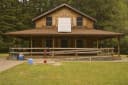 Ludlum HouseSiskiyou National Forest · 10 miLudlum CampgroundSiskiyou National Forest · 11 mi
The weather
the next four days · the thirty-year normal
Next four days, and the thirty-year normal
Forecast
NWS forecast for Brookings, OR
Typical weather
Typical October night 48°F, day 65°F.
Coldest month of the year: typical January night 42°F. Bring the bag rated for it.
Daily high and lowDays with 0.10 in or more
A normal is the 1991-2020 average for the month, not a forecast: about half of all Julys are colder than the July line. The seven-day forecast above answers the other question.
The land, and who answers for it
what threatens it · who answers for it
What threatens this place
You’re camping on ground somebody wants. We track the threats and the comment deadlines.
Who answers for this land
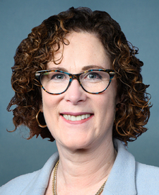
South Fork Camping and Day Use Area is in Oregon’s 4th congressional district. Its representative, Val Hoyle (D), votes on the laws that decide what happens to this land. Public-lands grade so far: A. See every public-lands vote →