Pictured Rocks National Lakeshore Backcountry Camping Permit
- Right now
- Taking bookingsSites offered on 30 of the next 30 nights read 16:48 UTC
- Sites
- 72All of them booked ahead
The place
the agency’s own description · what’s there · 14 notices
In the agency’s own words
Pictured Rocks National Lakeshore hugs the Lake Superior shoreline for more than 40 miles along Michigan's northern coast. Lake Superior is the largest, deepest, coldest, and most pristine of all the Great Lakes. In addition to boating and kayaking on the lake, the park's backcountry offers nearly 100 miles of walking and hiking trails and opportunities for solitude, inspiration, physical challenge, renewal, and camping. Keep reading
Access to Pictured Rocks' backcountry is primarily along the 'Lakeshore Trail', a part of the 42-mile long North Country National Scenic Trail where you can experience forests, dunes, beaches, waterfalls and wonderful panoramic views. Please download the Backcountry Camping Planner form the park website for complete details. The backcountry campgrounds are accessed by hiking or kayaking only. A backcountry camping permit is required year-round for all overnight trips into the Pictured Rocks National Lakeshore backcountry. Permits are not required for day hiking. To assist in planning an overnight backcountry trip into Pictured Rocks National Lakeshore, take time to carefully plan and prepare for your adventure. Pictured Rocks offers fourteen backcountry campgrounds, that are located at 2 to 5 mile intervals along the Lakeshore Trail. Private shuttle services are available. The permit holder must print and retain one copy of the permit when hiking to the campground; permit must be visibly secured to tent at campsite. You will be assigned a campsite number at every backcountry campground. Permit holder may have only one permit reserved at one time. Camp only in designated sites and follow permit itinerary. You must camp within 15 feet (4.5 m) of the numbered post at your chosen campsite. Individual campsites are available for groups of 1-6 people, and 3 tents or hammocks maximum (or a combination thereof). Group sites are available for groups of 7-20 people, and 10 tents or hammocks maximum (or a combination thereof). Group campsite reservations must camp in designated group sites. Each campground has a specific capacity; campsites within each backcountry campground are identified by a numbered post.
Recreation
Pictured Rocks National Lakeshore offers 100 miles (161 km) of hiking trails leading to waterfalls, beaches, forest wilderness, cultural sites, and breathtaking cliff-top views of Lake Superior. Whether you have only a few minutes, hours, or days to see a portion of the lakeshore, one of these hikes may be for you. Lake Superior's rugged shoreline invites individuals to explore the beautiful Pictured Rocks National Lakeshore with its miles of colorful sandstone cliffs and long stretches of sandy beaches. Watch the weather carefully while on the lake. The weather can change suddenly and unexpectedly. Just because it's calm in Munising Bay or Grand Marais Harbor does not mean it is calm along the more distant shores. The Pictured Rocks cliffs rise 50 to 200 feet (15 to 61 m) directly from the lake, offering precious few protected places if the wind and waves increase.
Facilities
Backcountry camping is spread across the National Lakeshore. Facilities are entirely primitive and located in the most remote regions of our park. There are 72 available backcountry campsites. 7 of these campsites are group campsites. Only one of these sites are a designated "boat-in" campsite. All campsites have food storage boxes on-site. Please store all food in these containers to protect from wildlife. All campsites are located along the North Country Trail, spanning only a small portion of the entire trail length. Pack in, pack out. There are no designated trash disposal areas at these campsites. There is no electricy or hookups located along the North Country Trail and backcountry campsites. There is no potable water located along the North Country Trail. A reminder to bring items to sanitize any lake or stream water for safe consumption. Certain parts of the North Country Trail are located along frontcountry camping. These campgrounds will have vault toilets for public use.
Natural Features
Sandstone cliffs, beaches, sand dunes, waterfalls, inland lakes, deep forest, and wild shoreline beckon you to visit Pictured Rocks National Lakeshore. The power of Lake Superior shapes the park's coastal features and affects every ecosystem, creating a unique landscape to explore. Hiking, camping, sightseeing, and four-season outdoor opportunities abound!
Charges & Cancellations
Cancellation Policy: Prior to printing your permit, you may cancel any time before your reservation date and receive a 50% refund of all backcountry camping permit fees ($5 per person, per night). The $15 reservation fee is non-refundable. If you have printed your permit, there are no refunds. Change Policy: Prior to printing your permit, you may make changes to your permit before your reservation date. Changes may be made to the group size, campground, and the duration of your trip. An additional $15 non-refundable fee will be charged for changes. Changes may be made to the group size through your Recreation.gov account or through the Call Center and may incur additional backcountry camping permit fees or be refunded these fees depending on whether you increase or decrease your group size. If decreasing your numbers, you will receive a full refund of the backcountry camping permit fees for the numbers you are decreasing only. A change to the duration of the trip or campground may only be made through the Call Center. For changes to the duration of the trip, you may incur additional backcountry camping permit fees or be refunded these fees depending on whether you increase or decrease your number of nights. If decreasing your numbers, you will receive a full refund of the backcountry camping permit fees for the numbers you are decreasing only. To change your entry date, you must cancel your permit and reserve a new permit. All fees apply. No Show Policy: If you do not print your permit by 11:59 p.m. on the first day of your scheduled trip, your entire backcountry camping permit will be canceled. No refunds. Please cancel your reservation if you are unable to use it to open space for others.
What the agency tells you
Backcountry Camping Regulations: Tents or hammocks must be within 15 feet of numbered site post. Maximum of three tents or hammocks, or combination thereof, per numbered individual site. Maximum 10 tents or hammocks per group site. All trash MUST be carried out. Glass bottles and containers, and axes are prohibited in backcountry campsites. Maximum party size permitted at each site in a designated backcountry campground is 6 persons, and 20 persons at a designated group campsite. Organized groups of more than six persons who wish to split up in order to utilize regular sites may do so but must camp at separate campsites.
Conditions for all camping: Camping is limited to 14 days per calendar year within the Lakeshore. Permits are required for all camping. Camping is only allowed at designated locations. A campsite must be occupied by the person in possession of the permit for the campsite on the date(s) of occupancy. The campsite must be vacated by 11:00 am of the following day. Quiet hours are from 10pm to 6am.
Backcountry Planning and Preparation: It is important to plan the appropriate amount of hiking each day when in the backcountry. The park recommends hiking no more than 10 miles (16 km) each day. Understand your limits and check the amount of mileage between each campsite on your itinerary. Factor in bugs, temperature, changing weather conditions and time. Pack the appropriate amount of water, food and gear for your trip. Cell phone service is extremely limited in these areas. You must adhere to your permit's trip itinerary. Download the Backcountry Camping Planner (PDF) from the park website.
Everything else this campground posts · 11
Parking: Parking for one or more days at designated parking lots/areas is permitted, but you will need to pay the entrance fee or have a National Park Pass.
Entrance Fee: Pictured Rocks National Lakeshore charges an entrance fee separate from camping fees. You may pay the fee upon arrival if you plan to stop at the visitor center or purchase in advance. The park also honors Federal interagency passes (e.g., annual, senior, access, 4th grade, Golden Age pass etc.).
Permit Holder: Permit users are repsonsible for following all rules/regulations. The permit holders must print and retain one copy of the permit at all times during the stay.
Shuttle Service: Altran in Munising, MI https://www.altranbus.com/backpacker/
Required Viewing: Leave No Trace Video or Leave No Trace Video with Audio Description.
No pets are permitted in any portion of our park's backcountry. No exceptions.
Campfires: Fires are permitted only in fire rings at the campgrounds. Fires or hot coals cannot be left unattended. Beach fires are not allowed. Fires are not allowed at Mosquito River and Chapel Beach backcountry campgrounds. Use only dead and down wood. No cutting of standing trees or limbs. Ash firewood is prohibited
Food Storage / The following conditions for the storage of food are in effect in the entirety of Pictured Rocks National Lakeshore: All food items, lawfully taken fish and wildlife, garbage and equipment used to cook or store food must be kept sealed in a camping unit that is constructed of solid, non-pliable material, in government provided receptacles or suspended at least 10 feet above the ground and 4 feet horizontally from a post, tree trunk or other object. This is bear country! Proper storage ensures safety for you and members of your party when enjoying the natural resource.
Conditions for the disposal, containerization, or carryout of human body waste have been established as follows: Where toilet facilities are not provided, human wastes will be disposed at least 200 feet from a trail, campsite, or water source; in a hole at least six inches deep; and covered with earth or packed out of the park. Where toilet facilities are provided (park campgrounds), human waste shall not be disposed of in park trash cans. Tent style enclosures for campsite portable toilets and/or showers are prohibited.
Weather and Insects: Be prepared for extreme weather, sun exposure and a variety of insects. Ticks, no see-ums and mosquitoes are prevalent during summer months.
Backcountry Kayaking: If you plan to access the backcountry overnight by kayak , a backcountry camping permit is required. The park recommends kayaking no more than 8-12 miles each day. A sea kayak must be used. Be prepared to bring the following when kayaking: Personal Flotation Device (PFD); whistle; bilge pump; wet suit/dry suit; spray skirt; paddle float; marine radio; signaling device; and float plan. When possible, kayak with a partner and check current weather conditions.
Tents and rigs
- Sites
- 72 · 71 walk-in, 1 boat-in, 7 group
- Hookups
- None
- Accessible sites
- None listed
- Campfires
- 2 of 8 sites
- Shade
- Every site
Facilities
- Toilets
- Vault Toilets
- “…camping. These campgrounds will have vault toilets for public use. Natural Features Sandstone cliffs,…”
- Drinking water
- None, bring your own
- “…Country Trail and backcountry campsites. There is no potable water located along the North Country Trail. A reminder…”
- Stay limit
- 14 nights
- recreation.gov facility rule maxStay
Around the campground
- On the water
- Waterfall, Lake, Creek, Beach, Coast
- Backpacking
- Canoeing
- Cross Country Skiing
- Hiking
- Ice Climbing
- Ranger programs
- Kayaking
- Sea Kayaking
- Visitor center
- Winter sports
12 of 144 site-nights open this Friday and Saturdayread 16:48 UTC
Every site here is reservable, and the record lists none held back for anyone who drives up.
OpenBooked
Watch for a cancellation
Full? Watch it.
One email when a night opens, plus More Than Just Parks dispatches. Unsubscribe any time.
We read recreation.gov once an hour, at 40 minutes past, and write the first time a site in your window is free for the nights you asked for.
Scanners that check every few minutes exist, and most of them charge. This one is free, it reads the same calendar, and it won’t always be first.
We make nothing when you book. The link goes straight to the government.
Every line of the receipt · 16
What you actually pay
“Cancellation Policy: Prior to printing your permit, you may cancel any time before your reservation date and receive a 50% refund of all backcountry camping permit fees ($5 per person, per night). The $15 reservation fee is non-refundable.” · this campground’s own no-show terms
Who keeps the booking fee
The agency’s own policy text says the reservation fee and the cancellation processing fee are “retained by the reservation service contractor”, and that a campground concessionaire will decline to refund them because “they did not receive these fees”. Recreation.gov is run under contract by Booz Allen Hamilton. What share of your booking fee the contractor keeps isn’t published in any federal dataset we can read, so we print no number for it. Our reporting on the contract →
How we know this receipt · 5
recreation.gov availability, read 16:48 UTC · rules read Sep 9, 2026 · rates Sep 10, 2026 · How we know all this
The sites
72 sites · which ones have room · the site map
The sites, ranked
from 71 mapped sites63 sites share one published coordinate and are left out of the rankings.
All 72 sites
Measured shade is NLCD Tree Canopy Cover 2024 (USDA Forest Service / MRLC) read at the site’s own coordinate, 27% canopy or more, and only for the sites the agency gave no Shade value. It never changes the agency’s own shaded count beside it.
| AuSable East | AuSable East 1 | hike to | 197 ftLake Superior | |
| AuSable East | AuSable East 2 | hike to | 197 ftLake Superior | |
| AuSable East | AuSable East 3 | hike to | 197 ftLake Superior | |
| AuSable East | AuSable East 4 | hike to | 197 ftLake Superior | |
| AuSable East | AuSable East 5 | hike to | 197 ftLake Superior | |
| AuSable East | AuSable East 6 | hike to | 197 ftLake Superior | |
| AuSable East | AuSable East Group | group hike to | 746 ft | 190 ftLake Superior |
| Beaver Creek | Beaver Creek 1 | hike to | 232 ftLake Superior | |
| Beaver Creek | Beaver Creek 2 | hike to | 232 ftLake Superior | |
| Beaver Creek | Beaver Creek 3 | hike to | 232 ftLake Superior | |
| Beaver Creek | Beaver Creek 4 | hike to | 232 ftLake Superior | |
| Beaver Creek | Beaver Creek 5 | hike to | 232 ftLake Superior | |
| Beaver Creek | Beaver Creek 6 | hike to | 232 ftLake Superior | |
| Benchmark | Benchmark 1 | hike to | 203 ftLake Superior | |
| Benchmark | Benchmark 2 | hike to | 203 ftLake Superior | |
| Benchmark | Benchmark 3 | hike to | 203 ftLake Superior | |
| Benchmark | Benchmark 4 | hike to | 203 ftLake Superior | |
| Benchmark | Benchmark 5 | hike to | 203 ftLake Superior | |
| Benchmark | Benchmark 6 | hike to | 203 ftLake Superior | |
| Chapel Beach | Chapel Beach 1 | hike to | 261 ftChapel Creek | |
| Chapel Beach | Chapel Beach 2 | hike to | 261 ftChapel Creek | |
| Chapel Beach | Chapel Beach 3 | hike to | 261 ftChapel Creek | |
| Chapel Beach | Chapel Beach 4 | hike to | 261 ftChapel Creek | |
| Chapel Beach | Chapel Beach 5 | hike to | 261 ftChapel Creek | |
| Chapel Beach | Chapel Beach 6 | hike to | 261 ftChapel Creek | |
| Cliffs | Cliffs 1 | hike to | 635 ftLake Superior | |
| Cliffs | Cliffs 2 | hike to | 635 ftLake Superior | |
| Cliffs | Cliffs 3 | hike to | 635 ftLake Superior | |
| Cliffs | Cliffs Group | group hike to | 5638 ft | 686 ftLake Superior |
| Coves | Coves 1 | hike to | 494 ftLake Superior | |
| Coves | Coves 2 | hike to | 494 ftLake Superior | |
| Coves | Coves 3 | hike to | 494 ftLake Superior | |
| Coves | Coves 4 | hike to | 494 ftLake Superior | |
| Coves | Coves 5 | hike to | 494 ftLake Superior | |
| Coves | Coves Group | group hike to | 6498 ft | 425 ftLake Superior |
| Grand Sable Lake | Boat In | boat in | 18105 ft | 268 ft |
| Lowney Creek | Lowney Creek 1 | hike to | 372 ft | |
| Lowney Creek | Lowney Creek 2 | hike to | 372 ft | |
| Lowney Creek | Lowney Creek 3 | hike to | 372 ft | |
| Lowney Creek | Lowney Creek 4 | hike to | 372 ft | |
| Lowney Creek | Lowney Creek Group | group hike to | 372 ft | |
| Masse Homestead | Masse Homestead 1 | hike to | 2,697 ftLake Superior | |
| Masse Homestead | Masse Homestead 2 | hike to | 2,697 ftLake Superior | |
| Masse Homestead | Masse Homestead 3 | hike to | 2,697 ftLake Superior | |
| Masse Homestead | Masse Homestead Group | group hike to | 826 ft | 2,486 ftLake Superior |
| Mosquito River | Mosquito River 1 | hike to | 214 ftMosquito River | |
| Mosquito River | Mosquito River 2 | hike to | 214 ftMosquito River | |
| Mosquito River | Mosquito River 3 | hike to | 214 ftMosquito River | |
| Mosquito River | Mosquito River 4 | hike to | ||
| Mosquito River | Mosquito River 5 | hike to | 214 ftMosquito River | |
| Mosquito River | Mosquito River 6 | hike to | 214 ftMosquito River | |
| Mosquito River | Mosquito River Group | group hike to | 834 ft | 312 ftLake Superior |
| Pine Bluff | Pine Bluff 1 | hike to | 370 ftLake Superior | |
| Pine Bluff | Pine Bluff 2 | hike to | 370 ftLake Superior | |
| Pine Bluff | Pine Bluff 3 | hike to | 370 ftLake Superior | |
| Pine Bluff | Pine Bluff 4 | hike to | 370 ftLake Superior | |
| Pine Bluff | Pine Bluff 5 | hike to | 370 ftLake Superior | |
| Potato Patch | Potato Patch 1 | hike to | 1,081 ftLake Superior | |
| Potato Patch | Potato Patch 2 | hike to | 1,081 ftLake Superior | |
| Potato Patch | Potato Patch 3 | hike to | 1,081 ftLake Superior | |
| Sevenmile Creek | Sevenmile Creek 1 | hike to | 138 ftSevenmile Creek | |
| Sevenmile Creek | Sevenmile Creek 2 | hike to | 138 ftSevenmile Creek | |
| Sevenmile Creek | Sevenmile Creek 3 | hike to | 138 ftSevenmile Creek | |
| Sevenmile Creek | Sevenmile Creek 4 | hike to | 138 ftSevenmile Creek | |
| Sevenmile Creek | Sevenmile Creek 5 | hike to | 138 ftSevenmile Creek | |
| Sevenmile Creek | Sevenmile Creek Group | group hike to | 613 ft | 129 ftSevenmile Creek |
| Trappers Lake | Trappers Lake 1 | hike to | 88 ftTrappers Lake | |
| Trappers Lake | Trappers Lake 2 | hike to | 88 ftTrappers Lake | |
| Trappers Lake | Trappers Lake 3 | hike to | 88 ftTrappers Lake | |
| Trappers Lake | Trappers Lake 4 | hike to | 88 ftTrappers Lake | |
| Trappers Lake | Trappers Lake 5 | hike to | 88 ftTrappers Lake | |
| Trappers Lake | Trappers Lake Group | hike to | 598 ft | 16 ftTrappers Lake |
25 of 72 listed
Getting there
the map and the coordinate · the agency’s directions · the phone number
Where it is
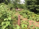 Lowney Creek Individual Backpacking SitesPictured Rocks National Lakeshore · 1.7 mi
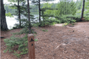 Trappers Lake Individual Backpacking SitesPictured Rocks National Lakeshore · 1.8 mi
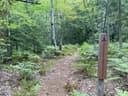 Trappers Lake Group Backpacking SitePictured Rocks National Lakeshore · 1.8 mi
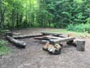 Lowney Creek Group Backpacking SitePictured Rocks National Lakeshore · 1.9 mi
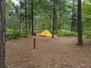 Pine Bluff Individual Backpacking SitesPictured Rocks National Lakeshore · 2.0 mi
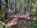 Beaver Creek Individual Backpacking SitesPictured Rocks National Lakeshore · 2.4 mi
https://www.nps.gov/piro/planyourvisit/directions.htm
The weather
the next four days · the thirty-year normal
Next four days, and the thirty-year normal
Forecast
NWS forecast for Munising, MI
Typical weather
Typical October night 39°F, day 55°F.
Coldest month of the year: typical February night 12°F, below freezing. Bring a bag rated colder than that, and expect ice in the water bottle.
Daily high and lowDays with 0.10 in or more
A normal is the 1991-2020 average for the month, not a forecast: about half of all Julys are colder than the July line. The seven-day forecast above answers the other question.
The land, and who answers for it
who answers for it
Who answers for this land

Pictured Rocks National Lakeshore Backcountry Camping Permit is in Michigan’s 1st congressional district. Its representative, Jack Bergman (R), votes on the laws that decide what happens to this land. Public-lands grade so far: F. See every public-lands vote →