National Park Service · Pictured Rocks National Lakeshore · MI
Site Cliffs 1.
at Pictured Rocks National Lakeshore Backcountry Camping Permit
This site, in 2 agency photographs
Photos · Isabella Aristizabal
Photos: Recreation.gov RIDB media records filed against this campsite · Oct 19, 2026
Filed by the agency against this site and no other here
Cliffs backcountry campsite map. · Isabella Aristizabal
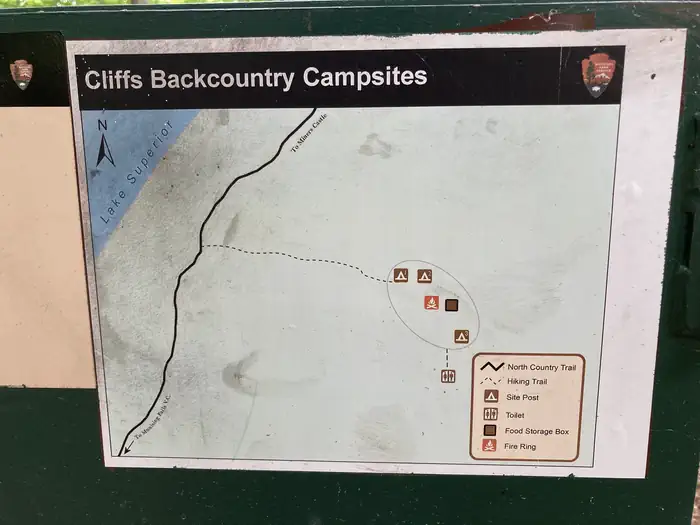
Filed: Recreation.gov RIDB media records filed against this campsite, the agency’s own titles · Oct 19, 2026
Hike ToType
Reservablerecreation.gov lists it
820 ftElevation
77%Tree cover
635 ftWater · to Lake Superior
Elevation: USGS 3DEP elevation point query at this site’s coordinate · Sep 7, 2026
Tree cover: NLCD Tree Canopy Cover 2024 (USDA Forest Service / MRLC), one 30 m cell at this coordinate · Sep 9, 2026
Room
0
2other sites within 100 ft
No RV or electric sites within 100 ftso, probably no generators
The site
TypeHike To
LoopCliffs
HookupsNone
Max Num of People6
Checkin Time1:00 PM
Checkout Time12:00 PM
Min Num of People1
AccessibleNot listed
Source: Recreation.gov RIDB full extract, per-site record · Oct 19, 2026
Book this exact site
Opens this site’s own calendar on recreation.gov.
Site Cliffs 1 on recreation.govSource: Recreation.gov
The campground
Every site, the season, fees, weather, and what’s happening on this land right now: Pictured Rocks National Lakeshore Backcountry Camping Permit →
Most private sites hereBoat In 18105 ftCoves Group 6498 ftCliffs Group 5638 ftMosquito River Group 834 ftMasse Homestead Group 826 ft
Source: CAMPANAC campground index