S-Tree Campground
- Right now
- OpenThe agency lists it open
- Season
- Year-roundOpen year-round
The place
the agency’s own description · what’s there
In the agency’s own words
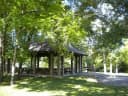
S-Tree Campground sits on a ridge above Horse Lick Creek near McKee in Jackson County, Kentucky. A small picnic area features a historic picnic shelter that was constructed in the 1930s by the Civilian Conservation Corps. The campground receives heavy weekend use from off-highway vehicle users who ride the adjacent Sheltowee Trace National Recreation Trail , Section #25 and the Renfro Loop Trail. These trails may be accessed from the campground. This campground cannot accommodate trailers 25 feet or more due to one lane roads and no turn-outs. Each campsite has a picnic table, tent pad, fire ring and lantern pole. Keep reading
Vault toilets are centrally located. Campsites and shelter are available on a first-come, first-served basis. Loop A has two double campsites. Loop B has two fire circles. All of the campsites are wooded. No electricity, water or dump station available. Pack out your trash. Picnicking nearby: A picnic shelter with tables is available on a first-come, first-served basis. Other picnic sites are located near an area where a fire lookout tower once stood. View S-Tree Campground Guide & Map (pdf) S-Tree Fire Tower once stood near the entrance to the campground. Towers like these were important tools in detecting and fighting devastating forest fires. Fire towers were home to the lookouts who ran them. A tower cab was just big enough for a wood stove, two cots, a cabinet, storage box, small table, and a stool. The all-important alidade, or fire finder, stood in the middle of the room. By the mid-1970s, firefighters used aircraft for fire detection. Many towers, like one that stood here, were torn down because they could no longer be maintained in a safe condition. Nearby Trails: Renfro Loop Trails Sheltowee Trace Trail #100 Section 25
Facilities
- Toilets
- Vault Toilets
- “…tent pad, fire ring and lantern pole. Vault toilets are centrally located. Campsites and shelter are…”
- Dump station
- Yes
Around the campground
- On the water
- Creek
Phone before you drive
recreation.gov publishes no availability for a campground you can’t reserve, so there’s no thirty-night reading to draw here. The season bar above is what the agency does publish.
Every line of the receipt · 3
What you actually pay
How we know this receipt · 4
record Aug 24, 2026 · How we know all this
Getting there
the map and the coordinate
Where it is
 S-Tree Campground3.7 miTurkey Foot CampgroundDaniel Boone National Forest · 10 miBee Rock CampgroundDaniel Boone National Forest · 28 miWhite Oak Boat-In CampgroundDaniel Boone National Forest · 29 mi
 Craigs Creek Group AreaDaniel Boone National Forest · 29 mi
 Holly BayDaniel Boone National Forest · 30 mi
The weather
the next four days · the thirty-year normal
Next four days, and the thirty-year normal
Forecast
NWS forecast for McKee, KY
Typical weather
Typical October night 45°F, day 69°F.
Coldest month of the year: typical January night 25°F, below freezing. Bring a bag rated colder than that, and expect ice in the water bottle.
Daily high and lowDays with 0.10 in or more
A normal is the 1991-2020 average for the month, not a forecast: about half of all Julys are colder than the July line. The seven-day forecast above answers the other question.
The land, and who answers for it
what threatens it · who answers for it
What threatens this place
You’re camping on ground somebody wants. We track the threats and the comment deadlines.
Who answers for this land

S-Tree Campground is in Kentucky’s 5th congressional district. Its representative, Hal Rogers (R), votes on the laws that decide what happens to this land. Public-lands grade so far: F. See every public-lands vote →