U.S. Forest Service · National Forest · Kentucky
Daniel Boone National Forest
Here, 5% take walk-ups.
20Campgrounds
1Take walk-ups
$20–$46A night, across 6
552Sites, from 8
720–1,460 ftElevation
Where they are
20 of 20 mappedDrawing the map
© OpenFreeMap · OpenStreetMap · Esri hillshadeSource: RIDB · NPS · USFS EDW · BLM, unified by CAMPANAC · Oct 24, 2026
The campgrounds
20 campgrounds
 Claylick Boat-In CampgroundReservableOpenfrom $202 boat-in sites2 hike-in sites2 sites750 ft
 Holly BayReservablefrom $4670 with a tent pad70 sitesrigs to 90 ft1,090 fthookupsdrinking watertoilets
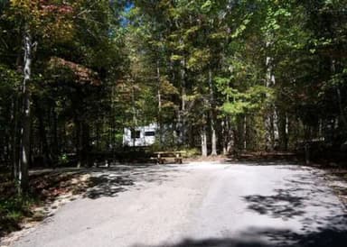 Twin Knobs CampgroundReservablefrom $352 group sites202 sitesrigs to 70 ft800 fthookupsdrinking watertoilets
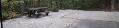 Zilpo - Daniel Boone Nat. For.Reservablefrom $3166 with a tent pad165 sitesrigs to 65 ft720 fthookupsdrinking watertoilets
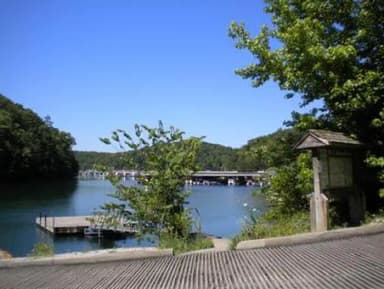 GroveReservablefrom $3255 sitesrigs to 50 ft1,170 fthookupsdrinking watertoilets
 Koomer Ridge CampgroundReservablefrom $359 walk-in sites54 sites1,250 ftdrinking watertoilets
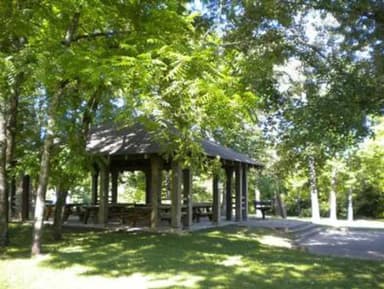 Craigs Creek Group AreaReservableSites from $1503 group sites3 sitesrigs to 20 ft1,060 fttoilets
 Boat Gunnel Group CampgroundReservableSites from $1751 with a tent pad1 group site1 site740 fthookupsdrinking watertoilets
 Clear Creek Campground760 ft
 Great Meadows Campground1,020 ftBee Rock CampgroundOpen740 ftS-Tree CampgroundOpen1,460 fttoiletsTurkey Foot CampgroundOpen860 ftGrove Boat-In CampgroundFirst-come1,040 fttoiletsGrove Drive-in Campground1,190 ftParagon Dispersed Camping Area740 fttoiletsTwin Knobs Recreation Area790 fttoiletsTwin Knobs West Group Use Area750 ftWhite Oak Boat-In Campground1,070 fttoiletsZilpo Recreation Area790 ft
Source: RIDB · NPS · USFS EDW · BLM, unified by CAMPANAC · Oct 24, 2026
This land
measured from the nearest campground in the unitdeveloping
Roadless
Camping here is a stake in what happens to it. More Than Just Parks tracks the threats and the comment windows.
Roadless areas: USFS Inventoried Roadless Areas via MTJP Roadless Map · Jul 29, 2026
Source: MTJP Threatened Lands map · Sep 28, 2026
Heads up
Wildfire
Kys - Skullbones Tower fire · 8.8 mi from the nearest campground here · 3 acres
Source: NIFC/IRWIN via MTJP wildfire tracker · Oct 24, 2026
Who answers for this land
Daniel Boone National Forest’s campgrounds sit in one congressional district. These members vote on the laws that decide what happens to this land.
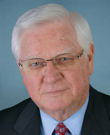
Hal Rogers (R)
Source: campground records from RIDB, NPS, USFS EDW and BLM, unified by CAMPANAC, refreshed nightly