Saguaro National Park Wilderness Permits
- Right now
- Taking bookingsSites offered on 30 of the next 30 nights read 15:35 UTC
- A night
- $8From, per site
- Sites
- 21All of them booked ahead
The place
the agency’s own description · what’s there · 10 notices
In the agency’s own words
Wilderness campgrounds are the ONLY campgrounds in Saguaro National Park. For fit hikers interested in backpacking a minimum of 4.4 miles (7 km) into the rugged Rincon Mountains, six wilderness campgrounds are available. The Rincon Mountains in Saguaro National Park rise out of the Sonoran Desert to over 8000 feet (2438 m) in elevation and host vegetative communities ranging from desert cacti, desert grasslands, and oak woodlands, to mixed conifer forests. Keep reading
In 1976, congress designated 57,930 acres (23,443 ha) within these Mountains as the Saguaro Wilderness managed as "an area where the each and its community of life are untrammeled by humans, where people themselves are visitors who do not remain." None of these wilderness campgrounds is accessible by vehicle (including RVs) . For car or RV camping, the only options in the immediate area are private or commercial campgrounds. Further away, there are campgrounds in the Coronado National Forest, some of which may be available to book on Recreation.gov.
Recreation
Solitude awaits you on these cool, forested slopes. A strenuous hike and the solitude of the wilderness are the primary forms of recreation in the Rincon Mountains. From cactus-covered desert to pine-cloaked mountain heights, the Saguaro Wilderness Area in the Rincon Mountains protects the last roadless ‘sky island’ mountain range in Southern Arizona. All within sight of the sprawling city of Tucson. Limited overnight livestock pack trips are permitted in the park. Please contact 520-733-5153 for additional information. Plant and wildlife viewing is also popular...a hike to any of the six wilderness campgrounds in the Rincon Mountains provides a stark chronical of plant and animal life as you climb from saguaro cactus forests at your trailhead to grasslands, manzanita and scattered juniper at Douglas Spring (minimum 6 miles/9.6 km and a 2000 foot/609 m climb) to a full stand of juniper trees at Juniper Basin (6,000 feet/(1829 m). By the time you reach Manning Camp at 8000 feet (2438km) you’re in a ponderosa pine forest with reliable water year-round except in the very driest years. Water Without question, water will be your most important concern while visiting the Saguaro Wilderness. Surface water is generally scarce during most of the year. At times, it is non-existent. Start your trip with plenty of potable water. Know where water sources are located and plan your trip according to water availability. It is recommended that you treat/filter all water used for human consumption. All campgrounds within the Saguaro Wilderness are situated next to intermittent streams or springs. During dry seasons, water may not be available. The water source at Manning Camp is a spring surrounded by chain link fencing. Please do not enter the fenced area. Water may be obtained a short distance downstream. The water tap at the Manning Camp Cabin is not for public use and is usually turned off. If your itinerary calls for you to exit on the same trail you entered, you might consider caching potable water along the trail. This will assure a source of drinking water on your way out. We recommend sealed water containers with your name and the date written on them. For current water reports, inquire at the visitor center - (520) 733-5153. Weather Temperatures and weather can vary greatly across the Saguaro Wilderness and is largely dependent on elevation. Manning Camp is located at an elevation of 8,000 feet (2438 m), and the visitor center is at an elevation of 3,080 feet (939 m). The average high temperature at the visitor center in January is 63° F (17° C) and the average low temperature is 38° F (3° C). For the same month, the average high temperature at Manning Camp is 44° F (7° C) and the average low is 25° F (-4° C). In June, the average high temperature at Manning Camp is 77° F (25° C) and the average low temperature is 48° F (9° C). For the same month, the average high temperature at the visitor center is 98° F (37° C) and the average low temperature is 67° F (19° C). Winter Rainy Season : The typical winter rainy season occurs from December through February. Rainfall is generally light and gentle but may fall for extended periods. Expect snow at higher elevations. Summer Rainy Season : The typical summer rainy season occurs from July through September. Rainfall can be intense and heavy. Lightning and flash flooding are common - extra caution is advised. When to Go Summer temperatures in the Sonoran Desert regularly exceed 100° F (38° C) and can reach 115° F (46° C). Higher elevation areas such as Manning Camp can receive significant winter snowfall. Spring and Fall can be ideal times to backpack in the Saguaro Wilderness but it is still important to pay attention to projected weather. If the predicted high temperature at your trailhead is between 80° and 95° F, plan your trip so that you arrive at higher elevations by early afternoon. If the predicted high temperature is between 95° and 110° F, leave the trailhead early enough that you can arrive at elevations over 7000 feet (2133 m) by 10 a.m. -- leaving the trailhead before sunrise is recommended. And, if the predicted high temperature is over 110° F, consider cancelling your trip. At any time of the year, backpackers should plan to leave their trailhead by noon. Backpacking in the Rincon Mountains is a difficult endeavor. Later starts frequently lead to camping illegally in areas other than designated campgrounds. Livestock. Limited overnight livestock pack trips are permitted in the park. Please contact 520-733-5153 for additional information. Topographic Maps All visitors to the Saguaro Wilderness should have the necessary orienteering and map reading skills to safely get around. We suggest that you carry National Geographic’s “Trails Illustrated Map”, which covers the entire park in one waterproof, tear-resistant map. The map is available at the visitor center. If you would like to purchase the map to aid in planning trip, by mail or phone prior to your arrival contact the Western National Parks Association bookstore. WNPA Bookstore 3693 South Old Spanish Trail Tucson, Arizona 85730 (520) 733-5155 Facilities This is not car or RV camping! It is not possible to drive to the campgrounds.The 6 campgrounds are primitive and offer few, if any, amenities. Campgrounds require a minimum hike of 4.4 miles (7 km) to the closest (lowest elevation) campground, while Manning Camp is a minimum hike of 10 miles (22.5 km) depending on your starting trailhead. Water: While all campgrounds are near intermittent streams or springs, during dry seasons, water may not always be available. Start your trip with at least one gallon (4 L) of water per person per day. Treat all water for human consumption. Campfires . While some campgrounds have fire rings and grills, fires are prohibited at others. Gas stoves are encouraged at all campgrounds. Toilets. Toilets at campgrounds are rarely visited by park staff. Campers are strongly encouraged to carry and use personal hand sanitizer. Primitive Campground Amenities: Douglas Spring (4,800 feet/1463 m): 3 campsites, No Campfires! There are plenty of mesquites and junipers in the area that provide some shade in the hotter months. Water is seasonal. The campground has a vault toilet. Grass Shack (5,200 feet/1585m): 2 campsites under the shade of large oaks and other trees. No Campfires! Chimenea Creek provides water most of the year. The campground has a vault toilet. Juniper Basin (6,000 feet/1829 m): 3 campsites. Water is seasonal (often dry during the spring and fall). The campground has a vault toilet. Fires are allowed here using only dead and downed wood. Happy Valley Saddle (6,200 feet/1890 m): 3 campsites. Water is available only during wet times. The campground has a vault toilet. Spud Rock Spring (7,400 feet/2255 m): 3 campsites under the shade of pines and aspens. Water is available seasonally. The campground has a composting (pit) toilet. Manning Camp (7,920 feet/2414 m): 6 campsites, each with a fire ring and grill, shaded by ponderosa pines. Water is virtually always available. The campground has a vault toilet.
Natural Features
The 70,000 square mile (18,1299 sq. km) Sky Island region of southeastern Arizona, southwestern New Mexico, and northwestern Mexico is globally important because of its rich diversity of species and habitats. These mountain "islands"--which include the Rincon Mountains—are --forested ranges separated by vast expanses of desert and grassland plans and , are among the most diverse ecosystems in the world. The Rincon Mountains of Saguaro National Park are the largest roadless sky island in the region. Are you constantly checking out cool flowers, bugs, and mushrooms along the trail? Saguaro National Park biologists would love to know what you're seeing! The park is revamping a project to document rare plants in the remote Rincon Mountain backcountry. If you make a free iNaturalist account (at inaturalist.org or the iNaturalist app), you can submit photo observations of plants and other living things you notice while hiking. Our staff and other specialists will help with IDs! For more information, check out our iNaturalist project Plants of the Saguaro NP High Country. Join the project if you’d like occasional updates on target species, seasonal trends, and exciting findings. Visitor-submitted observations help us learn more about mountain plant communities including distributions, flowering times, and leaf emergence. Rare sightings are always a possibility too! This project complements focused survey efforts conducted by botanists, park staff, and trained volunteers.
Charges & Cancellations
Changes/Modifications Changes may be made prior to the day the reservation begins. If a customer wants to switch dates that are entirely outside of the original reservation dates, there is a $10 change fee. There is no change fee if a customer extends or shortens a reservation, as long as the change includes dates from the original reservation. If a reservation is made that includes dates beyond the maximum booking window, that reservation cannot be changed until 18 days have passed from the original booking date. Cancellations Customers may cancel their reservation prior to day of arrival both on-line and through the call center. A $10 cancellation fee will be withheld from any refund due back the customer. Depending on when you cancel in relation to your arrival day, it may be considered a late cancellation (see below). Late Cancellations or Cancellations within the Cut-off Window A customer who cancels a reservation the day before or on the day of arrival will have a $10.00 cancellation fee withheld from their refund AND will forfeit the first night's use fee (not to exceed the total paid for the original reservation). Cancellations for a one-night reservation will forfeit the entire amount paid and will not be subject to an additional service fee. Review Rules and Reservation Policies for additional details about changes and cancellations.
What the agency tells you
This is not car or RV camping! The six campgrounds within the Saguaro Wilderness require a minimum of 4.4 miles (7 km) to the closest (lowest elevation) campground. Manning Camp is a minimum hike of 14 miles (22.5 km) depending on your starting point.
Hiking Safety at Saguaro National Park. Review the Hiking Safety Information page on the park website to plan for water, heat and other conditions you may encounter in the Rincon Mountains and review the Saguaro Wilderness Area (PDF) to help you plan your hike.
Water is your most important concern! Water is a critical resource in the Rincon Mountains. While all campgrounds are near intermittent streams or springs, during dry seasons, water may not be available or may be non-existent. Start your trip with at least 1 gallon (4 L) of water per person per day. Treat/filter all water used for human consumption. For current water reports, call the visitor center at (520) 733-5153. NOTE: The water source at Manning Camp is a spring surrounded by chain link fencing. Please do not enter the fenced area. Water may be obtained a short distance downstream. The water tap at the Manning Camp Cabin is not for public use and is usually turned off.
Everything else this campground posts · 7
Heat Safety-Backpackers should plan to hit the trailhead before noon at all times of year (and before sunrise in the summer) to ensure that they are able to reach their campsite before dark OR reach elevations over 7000 feet (2133 m) by 10 a.m. in summer. If the temperature forecast is over 110° F (44° C), consider cancelling your trip.
Extreme Weather Changes with Elevation. The Rincon Mountains range in elevation from under 3000 feet (914 m) to over 8000 feet (2438 m). Summer temperatures at 3000 feet regularly exceed 100° F (38° C) and can exceed 115° F (46° C). During the winter months, snow is common at higher elevations. Temperatures and weather can vary greatly and is largely dependent on elevation. Check forecasts and more on the Current Weather Information at Saguaro National Park on the park website.
Toilets. Vault toilets at campgrounds are rarely visited by park staff. All campers are strongly encouraged to carry and use personal hand sanitizer.
Livestock. Limited overnight livestock pack trips are permitted in the park. Please contact 520-733-5153 for additional information.
Topographic Maps. All hikers should have the necessary orienteering and map reading skills to safely get around. We suggest that you carry National Geographic’s “Trails Illustrated Map”, which covers the entire park in one waterproof, tear-resistant map. The map is available at the visitor center or you may purchase in advance by contacting Saguaro’s Western National Parks Association (WNPA) bookstore at (520) 733-5155,
You can help us catalog the diversity of plants while you hike! In the last 5 years, Saguaro has documented over 40 new plant species, many right along trails! Make a free iNaturalist account (or download the iNaturalist app) and submit photos of plants that you see while hiking. Our staff will help identify them! We especially need observations from the less-traveled, higher elevations of the Rincon Mountains. For more information, check our iNaturalist project Plants of the Saguaro NP High Country.
Wilderness Regulations - Off trail travel is only permissible above 4,500 feet (1372 m) in elevation. - Campfires are prohibited at the Douglas Spring and Grass Shack Campgrounds. Gas stoves are encouraged at all campgrounds. - Where campfires are allowed, make sure your fire is completely extinguished before departing. - Only dead and downed wood may be collected and burned. - Mechanized transport (bikes) or motorized equipment are prohibited in the wilderness area. - Pets are prohibited on all trails within Saguaro National Park. - Outhouses are provided at all six designated campgrounds. Elsewhere, bury human waste at least 150 feet from trails, meadows and water sources. - Do not put trash in the outhouses. - The use of firearms and other weapons is prohibited in Saguaro National Park. - Digging trenches around tents or modifying camp areas is prohibited. - Camping is allowed in designated campgrounds only. Do not deviate from your itinerary. - Pack out everything you pack in. - Use bear-proof containers provided at campsites. Store all scented items including food, garbage and toiletries inside these containers. - Persons under 16 years of age must be accompanied by an adult. - The total length of stay may not exceed 10 days, with no more than 5 consecutive days at any one campground. - Maximum group size is per campsite is 6 people and the total maximum group size is 18 persons.
Tents and rigs
- Sites
- 21 · 21 walk-in
- Hookups
- None
- Accessible sites
- None listed
- Campfires
- 15 of 21 sites
- Shade
- Little
Facilities
- Toilets
- Vault Toilets · Pit Toilets
- VAULT TOILETS on 18 of 21 campsite records / PIT TOILETS on 3 of 21 campsite records
- Drinking water
- Yes
- WATER (SEASONAL) on 18 of 21 campsite records
20 of 40 site-nights open this Friday and Saturdayread 15:35 UTC
Every site here is reservable, and the record lists none held back for anyone who drives up.
OpenBooked
Watch for a cancellation
Full? Watch it.
One email when a night opens, plus More Than Just Parks dispatches. Unsubscribe any time.
We read recreation.gov once an hour, at 40 minutes past, and write the first time a site in your window is free for the nights you asked for.
Scanners that check every few minutes exist, and most of them charge. This one is free, it reads the same calendar, and it won’t always be first.
We make nothing when you book. The link goes straight to the government.
Every line of the receipt · 13
What you actually pay
Derived by CAMPANAC: the agency’s published rate for this season, $8 a night, plus one $8 recreation.gov reservation fee for the booking. A weekend here means Friday and Saturday night, booked once. Optional charges (an extra vehicle, a second tent, a dump-station fee) are listed separately and aren’t in this total.
“Changes/Modifications - Changes may be made prior to the day the reservation begins. - If a customer wants to switch dates that are entirely outside of the original reservation dates, there is a $10 change fee. - There is no change fee if a customer extends or shortens a reservation, as long as the change includes d…” · this campground’s own terms
Who keeps the booking fee
The agency’s own policy text says the reservation fee and the cancellation processing fee are “retained by the reservation service contractor”, and that a campground concessionaire will decline to refund them because “they did not receive these fees”. Recreation.gov is run under contract by Booz Allen Hamilton. What share of your booking fee the contractor keeps isn’t published in any federal dataset we can read, so we print no number for it. Our reporting on the contract →
How we know this receipt · 6
recreation.gov availability, read 15:35 UTC · rules read Sep 9, 2026 · rates Sep 10, 2026 · How we know all this
The sites
21 sites
All 21 sites
The price is derived by CAMPANAC, not published per site: the per-night rate this campground publishes for each site’s own site type. 21 of the 21 sites listed carry one, and a site whose type has no published rate sits out of the price rather than being called free.
| Douglas Springs | Douglas Springs 1 | hike to | $8 |
| Douglas Springs | Douglas Springs 2 | hike to | $8 |
| Douglas Springs | Douglas Springs 3 | hike to | $8 |
| Grass Shack | Grass Shack 1 | hike to | $8 |
| Grass Shack | Grass Shack 2 | hike to | $8 |
| Grass Shack | Grass Shack 3 | hike to | $8 |
| Happy Valley | Happy Valley 1 | hike to | $8 |
| Happy Valley | Happy Valley 2 | hike to | $8 |
| Happy Valley | Happy Valley 3 | hike to | $8 |
| Juniper Basin | Juniper Basin 1 | hike to | $8 |
| Juniper Basin | Juniper Basin 2 | hike to | $8 |
| Juniper Basin | Juniper Basin 3 | hike to | $8 |
| Manning Camp | Manning Camp 1 | hike to | $8 |
| Manning Camp | Manning Camp 2 | hike to | $8 |
| Manning Camp | Manning Camp 3 | hike to | $8 |
| Manning Camp | Manning Camp 4 | hike to | $8 |
| Manning Camp | Manning Camp 5 | hike to | $8 |
| Manning Camp | Manning Camp 6 | hike to | $8 |
| Spud Rock | Spud Rock 1 | hike to | $8 |
| Spud Rock | Spud Rock 2 | hike to | $8 |
| Spud Rock | Spud Rock 3 | hike to | $8 |
Getting there
the map and the coordinate · the agency’s directions · the phone number
Where it is
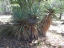 Grass ShackSaguaro National Park · 1.2 mi
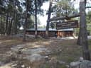 Manning CampSaguaro National Park · 1.5 mi
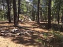 Spud Rock SpringSaguaro National Park · 2.6 mi
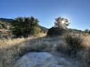 Douglas SpringSaguaro National Park · 3.0 mi
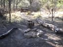 Juniper BasinSaguaro National Park · 4.1 mi
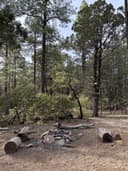 Happy Valley SaddleSaguaro National Park · 4.3 mi
This is not car or RV camping! There are no campgrounds accessible by vehicle (including RVs) within Saguaro National Park. For fit hikers interested in backpacking a minimum of 4.4 miles into the rugged Rincon Mountains, 6 wilderness campgrounds are available. The six campgrounds within the Saguaro Wilderness are accessed only by hiking a minimum of 4.4 miles (7 km).
Trailhead Driving Directions
Five trailheads lead into the Saguaro Wilderness. To help you plan your trip, we have separated these trailheads by the level of difficulty it takes to reach a particular trailhead.
Access to the Saguaro Wilderness is available from the south boundary of the park, at Camino Loma Alta Trailhead. There is NO public access to Madrona, which is permanently closed and is not staffed at any time.
The weather
the next four days
Next four days, and the thirty-year normal
Forecast
NWS forecast for Rincon Valley, AZ
The land, and who answers for it
what threatens it · who answers for it
Roadless country, and what’s coming for it
You’re camping on ground somebody wants. We track the threats and the comment deadlines.
Who answers for this land

Saguaro National Park Wilderness Permits is in Arizona’s 6th congressional district. Its representative, Juan Ciscomani (R), votes on the laws that decide what happens to this land. Public-lands grade so far: F. See every public-lands vote →