National Park Service · Saguaro National Park · AZ

Spud Rock Spring

4Heads uppark alerts
Information
RV and trailer precautions: be aware of vehicle restrictions before visit. As the busy season ramps up, traffic will be denser and can result in delays and complications particularly for owners of longer vehicles. The Tucson Mountain District (west side) of the park can accommodate vehicles up to 40ft in total…
Caution
Vehicle Break-Ins Vehicle break-ins have occurred at the King Canyon Trailhead, as well as at other trailheads throughout the park. Hide valuables and consider taking them with you, secure your vehicle, and report any suspicious activity. Please call 911 to…
Danger
Loop Drive closed in Tucson Mountain District due to storms. The following areas in the Tucson Mountain District of Saguaro National Park are closed to public use: Bajada Loop Drive, including all of Hohokam Road and Golden Gate Road. The closure is a result of road damage due to flash flooding. The…
Information
Rideshare services should be used with caution if visiting the Tucson Mountain District Rideshare services will drop visitors off at the park, but usually will not pick them back up. To avoid being stranded in the park, coordinate two-way trips before using rideshares to visit the West side. No major trails start at the…
Alerts: National Park Service alerts API · Oct 17, 2026
The agency doesn’t say how you get a siteIts record carries no access type, so treat it as a place to phone before you drive.
Right now
Nobody has saidNo season, no closure, no bookings to read
A night
$8From, per site
7,350 ftElevation
4.4 miWater · Hidden Tank, a pond
7.4 miNE of Rincon Valley, AZ
38%Tree cover
Bortle 4Night sky · 218th darkest of 262 in AZ

The place

the agency’s own description · what’s there

In the agency’s own words

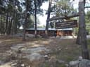
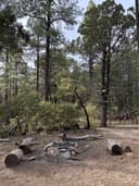
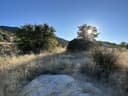
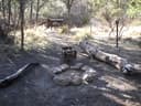
- 3 campsites (6 people max per site) *This campground is hike in only! Spud Rock is the most isolated of our six campgrounds, sitting on the east side of the range at 7200 feet. Access is generally from the east, but Turkey Creek trailhead is very difficult to drive and requires a lifted truck or a jeep. At the very least, you will need a vehicle with four-wheel drive. Also, make sure to check the conditions of the road before heading out as it can become muddy and treacherous after some rain.

Source: National Park Service API · Aug 24, 2026

Around the campground

On the water
Creek
Source: Stated in the agency description

Phone before you drive

recreation.gov publishes no availability for a campground you can’t reserve, so there’s no thirty-night reading to draw here. The season bar above is what the agency does publish.

Booking window6 months outBooking opens 6 months ahead; today unlocks arrivals through April 16, 2027. The agency publishes no reservable season in the record we hold, so the window may close earlier than that.recreation.gov
A night$8Per site, fromthe agency’s fee record
A weekend$16DerivedFriday and Saturday, everything includedours, from the lines above
Runs itNational Park Servicethe agency’s record
Every line of the receipt · 7

What you actually pay

The sign priceNational Park Service
A night, from$8
General Camping Fee$8
Senior Pass Holder Camping Fee$4
Access Pass Holder Camping Fee$4
The booking feerecreation.gov
We hold no recreation.gov booking record for this campground, so we can’t say whether a booking fee applies.
What a stay costs
One night, fromDerived$8
A weekend, Friday and Saturday, fromDerived$16

Derived by CAMPANAC: the lowest per-night amount the agency’s fee record states ($8), and no booking fee, because this campground takes no reservations. A weekend here means Friday and Saturday night. Optional charges (an extra vehicle, a second tent, a dump-station fee) are listed separately and aren’t in this total.

How we know this receipt · 5
Source: National Park Service API · Aug 24, 2026

record Aug 24, 2026 · How we know all this

Seen something wrong here? Tell us.

Getting there

the map and the coordinate · the phone number

The weather

the next four days

Next four days, and the thirty-year normal

Forecast

Tonight41°Partly Cloudy3% rain
Saturday51°Partly Sunny then Slight Chance Rain Showers15% rain
Saturday Night42°Chance Rain Showers47% rain
Sunday55°Chance Showers And Thunderstorms43% rain

NWS forecast for Rincon Valley, AZ

The land, and who answers for it

what threatens it · who answers for it

Roadless country, and what’s coming for it

Roadless
Upper Rincon Roadless2,991 acres · 6 mi · inventoried roadless area
Roadless
Happy Valley7,972 acres · 7 mi · inventoried roadless area
Roadless
Lower Rincon3,278 acres · 10 mi · inventoried roadless area

You’re camping on ground somebody wants. We track the threats and the comment deadlines.

Who answers for this land

Juan Ciscomani, official portrait

Spud Rock Spring is in Arizona’s 6th congressional district. Its representative, Juan Ciscomani (R), votes on the laws that decide what happens to this land. Public-lands grade so far: F. See every public-lands vote →

Seen something wrong here? Tell us.

How we know

every fact on this page, and where it came from
Right now: National Park Service publishes no season and no closure for this campground, and it takes no bookings we can read. That’s a gap in the record and not a locked gate: the number below is the only way to be sure.
Cell signal: the Park Service’s own campground description, read as text by CAMPANAC. None of this is a measurement. It’s what the land manager published about the place, and phones, carriers and weather all disagree with each other; treat it as a warning, not a promise.