Seely Creek Guard Station
- Right now
- Nobody has saidNo season, no closure, no bookings to read
- Sites
- 1All of them booked ahead
The place
the agency’s own description · what’s there · 13 notices
In the agency’s own words
Seely Creek Guard Station is located near the top of the Wasatch Plateau, within the Manti-La Sal National Forest in central Utah. The cabin was built in late-1907 or early-1908 and is listed on the National Register of Historic Places. Guests enjoy year-round recreational activities, including hiking, off-roading, snowmobiling and skiing. Keep reading
Recreation
Skyline Drive passes along the ridge line just above the cabin, providing great trail opportunities for off-road vehicles, mountain biking and hiking. In the winter, the surrounding area becomes a playground for snowmobile enthusiasts. Cross-country skiing, back country skiing and snowshoeing are also popular activities. Horseback riding trails crisscross the area as well. A maximum of 20 horses is allowed at the guard station, though no horse facilities (corrals, hitching posts, etc) are present. The surrounding meadow can be used for picketing or hobbling.
Facilities
Seely Guard Station can accommodate a maximum of 30 people, with six inside and 24 camped outside in a maximum of six vehicles (truck and trailer combination counts as one vehicle). The rustic guard station is spacious inside, with four single bunks without mattresses. Guests must bring their own linens, bedding and pillows. The cabin is equipped with a table and chairs, a fireplace and wood stove. No water is available. A vault toilet is located approximately 50 feet behind the cabin and a campfire ring lies outside the fenced area on the north side.
Natural Features
The cabin is situated in a beautiful wildflower-filled meadow, at an elevation of approximately 10,000 feet. Seely Creek flows along the edge of the meadow. Skyline Drive runs along the top of the Wasatch Plateau for more than 60 miles, rewarding visitors with beautiful mountain scenery, glacial cirques, spruce-fir and aspen forests, numerous lakes and reservoirs. Wildlife and summer wildflowers are plentiful, and autumn leaves put on quite a show. Due to the guard station's high elevation, guests should be prepared for all types of weather including snow or hail, especially after September.
Nearby Attractions
John August Lake is less than three miles from the guard station, with fishing and scenic high alpine views. Pete's Hole and Soup Bowl are less than eight miles away, offering fishing and a hiking trail.
What the agency tells you
A combination key code is required to open the lock on the cabin door(s); at least three days prior to arrival, call the Ferron Ranger District office at (435) 384-2372, Sanpete Ranger District at (435) 283-4151, or the Price Ranger District at (435) 637-2817 on Monday through Friday, between 8 a.m. to 4:30 p.m. MST, to obtain the code.
Access to the cabin may be very difficult during inclement weather; the last mile into the cabin is through a meadow that gets rather muddy and often requires four-wheel drive and/or high clearance vehicles.
Anytime after September, snow may make the cabin inaccessible to wheeled vehicles. Snowmobile access is necessary after significant snow accumulation; call the Ferron Ranger District at (435) 384-2372 for current conditions
Everything else this campground posts · 10
There is no potable or running water at this cabin, therefore guests should plan to bring their own for consumption and cooking. There is a wood-burning stove and a fireplace to heat the cabin.
This guard station is solar powered, please use wisely. Turn off lights that aren't in use. Power is for lights and phone charging only.
This is a 'pack it in, pack it out' site; please bring garbage bags and remove all trash upon departure
Forest Service will not guarantee enough feed/grass available for your horses, so bring your own; hay must be certified weed-free and removed upon departure
Livestock is not allowed within the fence surrounding the cabin
Water for horses is available in a creek 200 yards across the meadow south of the cabin; water must be treated if used for human consumption
No pets allowed in the cabin
All Utah State OHV rules are enforced on the forest; call the OHV Hotline at (801) 538-7433 for more information; maps of the road and trail system may be obtained at the Ranger District
Click here for more information on the Manti-La Sal National Forest
Don't Move Firewood: Help prevent the spread of tree-killing pests in our national forests by obtaining firewood near your destination and burning it on-site. For more information visit dontmovefirewood.org.
Tents and rigs
- Sites
- 1 · 1 cabin
- Hookups
- None
- Accessible sites
- None listed
- Campfires
- Allowed, barring fire bans
Facilities
- Toilets
- Vault Toilets
- VAULT TOILETS on 1 of 1 campsite records
- Drinking water
- None, bring your own
- “…and chairs, a fireplace and wood stove. No water is available. A vault toilet is located…”
- Playground
- Yes
- Stay limit
- 14 nights
- recreation.gov facility rule maxStay
Around the campground
- On the water
- Lake, Creek, Meadow
- Biking
- Fishing
- Hiking
- Historic site
- Horseback riding
- Hunting
- Wildlife viewing
- Fall color · reported 14 days ago, 14 km away
- Peak color
No reading yet, book on recreation.gov
Every site here is reservable, and the record lists none held back for anyone who drives up.
No availability snapshot inside the last 36 hours, so this page draws nothing rather than ageing a reading into fiction.
Watch for a cancellation
Full? Watch it.
One email when a night opens, plus More Than Just Parks dispatches. Unsubscribe any time.
We read recreation.gov once an hour, at 40 minutes past, and write the first time a site in your window is free for the nights you asked for.
Scanners that check every few minutes exist, and most of them charge. This one is free, it reads the same calendar, and it won’t always be first.
Tell me when the season opens
Watch for the season to open
One email when the season goes on sale, plus More Than Just Parks dispatches. Unsubscribe any time.
We check once an hour, at 40 minutes past, and write the first time the agency has that season on sale.
Scanners that check every few minutes exist, and most of them charge. This one is free, it reads the same calendar, and it won’t always be first.
We make nothing when you book. The link goes straight to the government.
Every line of the receipt · 12
What you actually pay
Who keeps the booking fee
The agency’s own policy text says the reservation fee and the cancellation processing fee are “retained by the reservation service contractor”, and that a campground concessionaire will decline to refund them because “they did not receive these fees”. Recreation.gov is run under contract by Booz Allen Hamilton. What share of your booking fee the contractor keeps isn’t published in any federal dataset we can read, so we print no number for it. Our reporting on the contract →
How we know this receipt · 5
rules read Sep 9, 2026 · rates Sep 10, 2026 · How we know all this
The sites
1 sites · the site map
All 1 sites
Toilet distances are OpenStreetMap’s, measured for 1 of the 1 sites listed. A site with no reading is unknown, never far.
The price is derived by CAMPANAC, not published per site: the per-night rate this campground publishes for each site’s own site type. 1 of the 1 sites listed carry one, and a site whose type has no published rate sits out of the price rather than being called free.
| SEELY CREEK GUARD STATION | 001 | cabin nonelectric | 288 ft | 92 ft | $50 |
Getting there
the map and the coordinate · the agency’s directions · the phone number
Where it is
 Lake HillManti-La Sal National Forest · 3.8 mi
 Orange OlsenManti-La Sal National Forest · 7.1 mi
 Manti CommunityManti-La Sal National Forest · 7.2 mi
 Joes Valley ReservoirManti-La Sal National Forest · 7.4 mi
 Joes Valley Pavilion Group Site AManti-La Sal National Forest · 7.6 miUpper Joes Valley Dispersed SiteManti-La Sal National Forest · 8.9 mi
From Orangeville, travel west on State Highway 29 to Joe's Valley Reservoir. At the reservoir, turn right and follow the road around to the other side. When you start heading away from the reservoir and toward the plateau, you'll pass Orange Olsen Administrative Site on the right and then a road on the left. Do not turn. Continue on Highway 29, which is now a dirt road, and continues to the top of the plateau. (Warning: The road here gets narrow and when wet, can be extremely slick. Travelers may want to wait for it to dry especially if pulling a trailer). From where the road turns to dirt, it's about 11 miles to the top. Just before you reach the top, look for Forest Road 050 and a sign on the left that says, "Seely Guard Station 2 miles." This will be within a quarter-mile of Skyline Drive (Forest Road 150). Take Forest Road 050 to the left and travel 1.25 miles to the cabin.
From Ephraim, head east on State Highway 29 along Ephraim Canyon. You'll pass the Forest Boundary about 3.5 miles from town. Stay on Highway 29, which is now a dirt road, all the way to the top of the plateau (approximately another 11.5 miles). When you reach Skyline Drive on the top of the plateau, turn right and at just over a tenth of a mile, take Forest Road 2326 to the left. Go down this two-track road for just under a mile, to the cabin.
The weather
the next four days
Next four days, and the thirty-year normal
Forecast
NWS forecast for Ephraim, UT
The land, and who answers for it
what threatens it · who answers for it
Roadless country, and what’s coming for it
You’re camping on ground somebody wants. We track the threats and the comment deadlines.
Who answers for this land
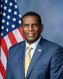
Seely Creek Guard Station is in Utah’s 4th congressional district. Its representative, Burgess Owens (R), votes on the laws that decide what happens to this land. Public-lands grade so far: F. See every public-lands vote →