Shirttail Creek
1Heads up1 fire 9.0 mi away
We don’t think it should be. Every campground should hold some sites for whoever drives up.Tell your representative →
- Right now
- OpenThe agency lists it open
- A night
- $24–$72Across the site types the agency prices
- Sites
- 3929 on recreation.gov
- Season
- April 30 – October 31Open April 30 through October 31
The place
the agency’s own description · what’s there · 7 notices
In the agency’s own words
Shirttail Campground is located on the north shore of Sugar Pine Reservoir, in the Tahoe National Forest, 15 miles from Foresthill. Visitors enjoy the area for its fishing, boating, OHV, and hiking opportunities. This facility is operated and maintained by the Tahoe National Forest. Keep reading
Recreation
Fishing, swimming and both motorized and non-motorized boating are popular activities on the reservoir. A paved, non-motorized accessible trail connects recreation sites on the north shore with recreation sites on the south shore and has interpretive signs and shaded benches for rest breaks. The North Fork of the American River is nearby, with additional fishing, white water boating, and swimming. Many miles of hiking, biking and off-road vehicle trails are in the surrounding area.
Facilities
The campground offers single and double family campsites and one triple site; a few of the campsites are accessible. Picnic tables, campfire rings and grills are provided, as well as vault toilets and drinking water. Firewood is available for purchase from the host.
Natural Features
Sugar Pine Reservoir covers 160 acres at an elevation of 3600 feet. The campground lies above the north shoreline, in a forest of manzanita and ponderosa pine. Summertime temperatures are warm during the day and cool at night.
Nearby Attractions
Shirttail Creek Campground is a recreation site within the Sugar Pine Recreation Area which includes an additional family campground, a group campground, a boat ramp, and a day use picnic site, as well as a trail that circles the entire lake. The North Fork American Wild And Scenic River can be accessed near by. Other recreation opportunities include many hiking, equestrian, mountain biking, and OHV trails.
What the agency tells you
*** Large single unit RVs are not suitable for the campground roads. Even though a site might have a 40 foot parking space, a 40 foot long RV can’t navigate through the campground. Also please remember that site parking length includes trailer and vehicle.***
Water Faucets: • While safe to drink, the potable water in the campground has a high iron content and visitors may wish to bring their own drinking water. • Visitors may not connect hoses to faucets for sanitation concerns. • Faucets are meant for drinking water only. For sanitation reasons there can be no bathing or cleaning at faucets. • All grey water must be properly disposed of at the dump station. Trash: • Trash should be placed in dumpsters. If the dumpsters are full then trash must be properly stored in a bear box until the dumpster is emptied, or can be taken to the nearest dumpster. This is to avoid wildlife getting in the trash and dispersing it through the forest. • Make sure to properly close/lock dumpsters to avoid wildlife getting in the trash. Campsite: • Camp only in designated camping areas. Areas beyond the campground could have hazard trees. • Only park in designated parking spaces. Parking off of pavement in camping areas is prohibited. • No parking in or blocking road ways. • Keep food in bear boxes at all times. • If visitors need to hang things they can use rachets straps or bungees. Using screws, nails, and staples is prohibited. • Stapling into the preparation tables and/or picnic tables is prohibited due to the damage it causes. • Cutting or damaging standing trees is prohibited. • Collecting dead wood is highly encouraged. Visitors must have a wood cutting permit to cut wood on the ground. • DAY USE: • NO Swimming on or around the boat dock/ ramp. Swimmers must stay 100 feet away at all times to keep a safe distance from boat traffic. • Park in designated parking spots. No parking along painted curbs or by boat ramp. • All vehicles must pay for day use parking at the Sugar Pine Day Use Area. The $5.00 Day use parking is not included in the camping fee. Fire restrictions may be imposed at any time due to hot, dry weather conditions, at which time campfires and charcoal fires may not be allowed. For current fire conditions or weather closures contact the American River Ranger District (530) 367-2224 (voice), (530) 367-2226 (TDD).
Don't Move Firewood: Protect California's forests from tree-killing pests by buying your firewood locally in Foresthill or by using down wood debris from the area that fit within the fire ring. For more information visit firewood.ca.gov.
Everything else this campground posts · 4
This is not Sugar Pine Point State Park
Off-road vehicle use is prohibited within the Sugar Pine Complex, except for at the staging area near the turnoff to Big Reservoir, such as Sugarpine OHV and Parker Flat.
Utility hookups and showers are not available
Click here for more information on the Tahoe National Forest
Tents and rigs
- Sites
- 39 · 2 tent-only
- Hookups
- None
- Longest rig
- 100 ft
- Paved pads
- 38 of 39
- Accessible sites
- 3
- Pets
- Allowed
- Shade
- Every site
Facilities
- Toilets
- Vault Toilets
- “…and grills are provided, as well as vault toilets and drinking water. Firewood is available for…”
- Drinking water
- Yes
- “…provided, as well as vault toilets and drinking water. Firewood is available for purchase from the host.…”
- Boat ramp
- Yes
- Firewood
- Sold here
- Stay limit
- 15 nights
- recreation.gov facility rule maxStay
Around the campground
- On the water
- Reservoir, Lake, River, Creek, Beach
- Boating
- Fishing
- Hiking
- Mountain biking
- Non-Motorized Boating
- Swimming
- Water access
- Night sky · 904th darkest of 1,201 in CA
- Bortle 4
Full this Saturdayread 16:08 UTC
How full the weekend is nationally.
OpenBooked
Every one of the 24 sites on offer is taken this Saturday. 26 are free on Mon, Oct 19. read 16:08 UTC Why the weekend fills and the week doesn’t
Watch for a cancellation
Watch this campground
One email when a night opens, plus More Than Just Parks dispatches. Unsubscribe any time.
We read recreation.gov once an hour, at 40 minutes past, and write the first time a site in your window is free for the nights you asked for.
Scanners that check every few minutes exist, and most of them charge. This one is free, it reads the same calendar, and it won’t always be first.
Tell me when the season opens
Watch for the season to open
One email when the season goes on sale, plus More Than Just Parks dispatches. Unsubscribe any time.
We check once an hour, at 40 minutes past, and write the first time the agency has that season on sale.
Scanners that check every few minutes exist, and most of them charge. This one is free, it reads the same calendar, and it won’t always be first.
We make nothing when you book. The link goes straight to the government.
Every line of the receipt · 16
What you actually pay
Derived by CAMPANAC: the agency’s published rates for this season, $24–$72 a night, plus one $8 recreation.gov reservation fee for the booking. A weekend here means Friday and Saturday night, booked once. Optional charges (an extra vehicle, a second tent, a dump-station fee) are listed separately and aren’t in this total.
Who keeps the booking fee
The agency’s own policy text says the reservation fee and the cancellation processing fee are “retained by the reservation service contractor”, and that a campground concessionaire will decline to refund them because “they did not receive these fees”. Recreation.gov is run under contract by Booz Allen Hamilton. What share of your booking fee the contractor keeps isn’t published in any federal dataset we can read, so we print no number for it. Our reporting on the contract →
How we know this receipt · 5
recreation.gov availability, read 16:08 UTC · rules read Sep 9, 2026 · rates Sep 10, 2026 · How we know all this
The sites
41 records · which ones have room · the site map
The sites, ranked
from 20 mapped sitesAll 41 records
The price is derived by CAMPANAC, not published per site: the per-night rate this campground publishes for each site’s own site type. 39 of the 41 sites listed carry one, and a site whose type has no published rate sits out of the price rather than being called free.
| AREA SHIRTTAIL CREEK | 001 | standard nonelectric | 45 ft | 216 ft | 192 ft | $24–$72 | |
| AREA SHIRTTAIL CREEK | 002 | standard nonelectric | $24–$72 | ||||
| AREA SHIRTTAIL CREEK | 002 | type not stated | 45 ft | 143 ft | $24 | ||
| AREA SHIRTTAIL CREEK | 003 | standard nonelectric | 45 ft | 113 ft | 20 ft | $24–$72 | |
| AREA SHIRTTAIL CREEK | 004 | standard nonelectric | 40 ft | 48 ft | 62 ft | $24–$72 | |
| AREA SHIRTTAIL CREEK | 005 | standard nonelectric | $24–$72 | ||||
| AREA SHIRTTAIL CREEK | 005 | type not stated | 45 ft | 63 ft | $24 | ||
| AREA SHIRTTAIL CREEK | 006 | standard nonelectric | 35 ft | 94 ft | 50 ft | $24–$72 | |
| AREA SHIRTTAIL CREEK | 007 | standard nonelectric | 35 ft | yes | 94 ft | 14 ft | $24–$72 |
| AREA SHIRTTAIL CREEK | 008 | tent only nonelectric | 48 ft | 109 ft | $24 | ||
| AREA SHIRTTAIL CREEK | 009 | standard nonelectric | 35 ft | 67 ft | 174 ft | $24–$72 | |
| AREA SHIRTTAIL CREEK | 010 | standard nonelectric | 40 ft | 76 ft | 129 ft | $24–$72 | |
| AREA SHIRTTAIL CREEK | 011 | tent only nonelectric | 107 ft | 256 ft | $24 | ||
| AREA SHIRTTAIL CREEK | 012 | standard nonelectric | 40 ft | 67 ft | 200 ft | $24–$72 | |
| AREA SHIRTTAIL CREEK | 013 | standard nonelectric | 30 ft | 78 ft | 70 ft | $24–$72 | |
| AREA SHIRTTAIL CREEK | 014 | standard nonelectric | 35 ft | $24–$72 | |||
| AREA SHIRTTAIL CREEK | 014 | type not stated | 45 ft | 110 ft | $24 | ||
| AREA SHIRTTAIL CREEK | 015 | type not stated | 40 ft | 57 ft | $24 | ||
| AREA SHIRTTAIL CREEK | 016 | type not stated | 45 ft | 112 ft | $24 | ||
| AREA SHIRTTAIL CREEK | 016 | standard nonelectric | $24–$72 | ||||
| AREA SHIRTTAIL CREEK | 017 | standard nonelectric | $24–$72 | ||||
| AREA SHIRTTAIL CREEK | 017 | type not stated | 45 ft | 161 ft | $24 | ||
| AREA SHIRTTAIL CREEK | 018 | standard nonelectric | 40 ft | 77 ft | 241 ft | $24–$72 | |
| AREA SHIRTTAIL CREEK | 019 | standard nonelectric | 40 ft | 77 ft | 214 ft | $24–$72 | |
| AREA SHIRTTAIL CREEK | 020 | standard nonelectric | 35 ft | 94 ft | 120 ft | $24–$72 | |
| AREA SHIRTTAIL CREEK | 021 | type not stated | 45 ft | 172 ft | $24 | ||
| AREA SHIRTTAIL CREEK | 021 | standard nonelectric | $24–$72 | ||||
| AREA SHIRTTAIL CREEK | 022 | standard nonelectric | 50 ft | 131 ft | 80 ft | $24–$72 | |
| AREA SHIRTTAIL CREEK | 023 | standard nonelectric | 31 ft | 151 ft | 112 ft | $24–$72 | |
| AREA SHIRTTAIL CREEK | 024 | standard nonelectric | $24–$72 | ||||
| AREA SHIRTTAIL CREEK | 024 | type not stated | 45 ft | 25 ft | $24 | ||
| AREA SHIRTTAIL CREEK | 025 | standard nonelectric | 100 ft | 101 ft | 97 ft | $24–$72 | |
| AREA SHIRTTAIL CREEK | 026 | standard nonelectric | 30 ft | yes | 147 ft | 118 ft | $24–$72 |
| AREA SHIRTTAIL CREEK | 027 | type not stated | 45 ft | 210 ft | $24 | ||
| AREA SHIRTTAIL CREEK | 027 | standard nonelectric | $24–$72 | ||||
| AREA SHIRTTAIL CREEK | 028 | standard nonelectric | $24–$72 | ||||
| AREA SHIRTTAIL CREEK | 028 | type not stated | 45 ft | 234 ft | $24 | ||
| AREA SHIRTTAIL CREEK | 029 | standard nonelectric | 50 ft | yes | 117 ft | 211 ft | $24–$72 |
| AREA SHIRTTAIL CREEK | 030 | standard nonelectric | 40 ft | 78 ft | 109 ft | $24–$72 | |
| AREA SHIRTTAIL CREEK | XXX | unnamed record | 45 ft | $24 | |||
| AREA SHIRTTAIL CREEK | XXX10 | unnamed record | $24 |
The agency files 2 more records here that aren’t sites for the night. It types every one of them MANAGEMENT rather than a campsite. They’re in the table above, marked for what they are, and none of them is counted as a site.
OpenStreetMap has no toilet mapped within 1 km of this campground, so no site here carries a toilet distance. That’s a gap in the map, not a finding about the campground.
25 of 41 listed
Getting there
the map and the coordinate · the agency’s directions · the phone number
Where it is
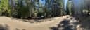 Giant GapTahoe National Forest · 0.4 miForbes Group CampgroundTahoe National Forest · 0.8 mi
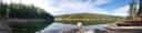 Forbes CreekTahoe National Forest · 0.8 mi
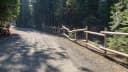 Big Reservoir CampgroundTahoe National Forest · 1.7 mi
 Tunnel Mills IITahoe National Forest · 11 miOnion Valley CampgroundTahoe National Forest · 11 mi
From either east bound or west bound Interstate 80 take exit 121, Auburn Ravine Road to Foresthill. Continue east for 17 miles, to Foresthill. Travel through town, about 9 miles, to Forest Road 10/Sugar Pine Road. Turn left and continue 9 miles to the Sugar Pine Campgrounds road (approximately 1 mile after crossing the Sugar Pine Reservoir dam). Turn right and continue about 1.5 miles, turn left into the campground.
The weather
the next four days · the thirty-year normal
Next four days, and the thirty-year normal
Forecast
NWS forecast for Alta, CA
Typical weather
Typical October night 47°F, day 71°F.
Coldest night of the open season: typical April night 40°F. Bring the bag rated for it.
Daily high and lowDays with 0.10 in or moreOutside the published season
A normal is the 1991-2020 average for the month, not a forecast: about half of all Julys are colder than the July line. The seven-day forecast above answers the other question.
The land, and who answers for it
what threatens it · who answers for it · a letter you can send
Roadless country, and what’s coming for it
You’re camping on ground somebody wants. We track the threats and the comment deadlines.
Who answers for this land
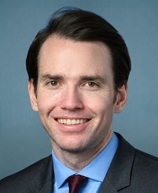
Shirttail Creek is in California’s 3rd congressional district. Its representative, Kevin Kiley (I), votes on the laws that decide what happens to this land. Public-lands grade so far: F. See every public-lands vote →
Who can change it · 3
Two offices, two different asks. The draft to the agency asks it to set aside a published share of the sites here for whoever drives up. The draft to Congress asks why that share is zero and presses for a published minimum at the campgrounds it funds.
- The member who votes the moneyKevin KileyU.S. Representative · California’s 3rd district
No contact form we could verify, so that link is their own site. Contact is inside it. Washington office: 202-225-2523.
- Your senator, on the same appropriationAdam B. SchiffU.S. Senator · California
- Your senator, on the same appropriationAlex PadillaU.S. Senator · California
Read the draft, or change the wording
For the camper who turned up, or tried to book, and couldn’t get in. Every draft is written from this campground’s own record (its agency, its unit, its site count and its own weekend) and the buttons above copy whichever wording is selected here.
Asks them to put the question to the agency in writing, and to press for a published minimum share of walk-up sites across the campgrounds they fund.
Subject Walk-up camping at Shirttail Creek, Tahoe National Forest, California
Dear Kevin Kiley,

I’m a constituent in California’s 3rd district. I tried to camp at Shirttail Creek, Tahoe National Forest, California, and couldn’t.

recreation.gov lists 29 of the 39 campsites the agency files at Shirttail Creek, and every one of them is booked ahead, and the agency's own record lists none held back for somebody who drives up. On Saturday, October 17, all 24 sites recreation.gov was offering there were already booked.

1,623 of the 7,647 federal campgrounds in this country still keep at least some sites for whoever arrives first. Shirttail Creek keeps none, and that’s a choice somebody made rather than a rule.

I’m not asking you to run Shirttail Creek. I’m asking you to put it to the U.S. Forest Service in writing: why is the share of first-come sites there zero, and what would a published minimum share cost? Please press for that minimum at the federal campgrounds you fund.

The people who open these campgrounds, collect the fees and keep the water running are seasonal positions. At GS-5, base pay plus the government's own 36.25% benefit factor, one costs about $47,414 a year. One percent of the $13.3 billion the USS Gerald R. Ford cost to procure would pay for about 2,800 of them for a year. Both figures are the government's own (a Congressional Research Service report and an OPM pay table), and I’m glad to send them.

Sent about Shirttail Creek (Tahoe National Forest, California) via campanac.com
Asks them to put the question to the agency in writing, and to press for a published minimum share of walk-up sites across the campgrounds they fund.
Subject Walk-up camping at Shirttail Creek, Tahoe National Forest, California
Dear Adam B. Schiff,

I’m a constituent in California. I tried to camp at Shirttail Creek, Tahoe National Forest, California, and couldn’t.

recreation.gov lists 29 of the 39 campsites the agency files at Shirttail Creek, and every one of them is booked ahead, and the agency's own record lists none held back for somebody who drives up. On Saturday, October 17, all 24 sites recreation.gov was offering there were already booked.

1,623 of the 7,647 federal campgrounds in this country still keep at least some sites for whoever arrives first. Shirttail Creek keeps none, and that’s a choice somebody made rather than a rule.

I’m not asking you to run Shirttail Creek. I’m asking you to put it to the U.S. Forest Service in writing: why is the share of first-come sites there zero, and what would a published minimum share cost? Please press for that minimum at the federal campgrounds you fund.

The people who open these campgrounds, collect the fees and keep the water running are seasonal positions. At GS-5, base pay plus the government's own 36.25% benefit factor, one costs about $47,414 a year. One percent of the $13.3 billion the USS Gerald R. Ford cost to procure would pay for about 2,800 of them for a year. Both figures are the government's own (a Congressional Research Service report and an OPM pay table), and I’m glad to send them.

Sent about Shirttail Creek (Tahoe National Forest, California) via campanac.com
Asks them to put the question to the agency in writing, and to press for a published minimum share of walk-up sites across the campgrounds they fund.
Subject Walk-up camping at Shirttail Creek, Tahoe National Forest, California
Dear Alex Padilla,

I’m a constituent in California. I tried to camp at Shirttail Creek, Tahoe National Forest, California, and couldn’t.

recreation.gov lists 29 of the 39 campsites the agency files at Shirttail Creek, and every one of them is booked ahead, and the agency's own record lists none held back for somebody who drives up. On Saturday, October 17, all 24 sites recreation.gov was offering there were already booked.

1,623 of the 7,647 federal campgrounds in this country still keep at least some sites for whoever arrives first. Shirttail Creek keeps none, and that’s a choice somebody made rather than a rule.

I’m not asking you to run Shirttail Creek. I’m asking you to put it to the U.S. Forest Service in writing: why is the share of first-come sites there zero, and what would a published minimum share cost? Please press for that minimum at the federal campgrounds you fund.

The people who open these campgrounds, collect the fees and keep the water running are seasonal positions. At GS-5, base pay plus the government's own 36.25% benefit factor, one costs about $47,414 a year. One percent of the $13.3 billion the USS Gerald R. Ford cost to procure would pay for about 2,800 of them for a year. Both figures are the government's own (a Congressional Research Service report and an OPM pay table), and I’m glad to send them.

Sent about Shirttail Creek (Tahoe National Forest, California) via campanac.com