Shoreline Campground and Group sites
- Right now
- Nobody has saidNo season, no closure, no bookings to read
The place
the agency’s own description · what’s there
In the agency’s own words
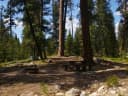
Shoreline Campground has single, double and group sites and is located just across the road from beautiful Warm Lake, at an elevation of 5,300 feet. Visitors enjoy boating, fishing, swimming, hiking and viewing local wildlife. Natural Features: The campground is situated in a mixed-growth lodgepole pine forest, which offers partial shade. Summer wildflowers are abundant in the area. A variety of wildlife including bears, deer, elk, fox, grouse, eagles, osprey, grosbeaks, whooping cranes and otters, lives around the lake. Keep reading
Recreation: Warm Lake offers great fishing opportunities for cutthroat, rainbow, lake and bull trout. Boating, canoeing and swimming are popular activities. Billy Rice Swim Beach is nearby, offering a day-use site for picnicking and swimming. A boat ramp is located just across the road from the campground. The surrounding area offers great hiking, mountain biking, horseback and off-road vehicle riding, and hunting. The WeWuKiye (Wa Wu Kia) Trail No. 252 is popular among hikers and mountain bikers. It was recently built and can be accessed at the campground's entrance. For off-road vehicle enthusiasts, Telephone Ridge Trail No. 112 offers 20 miles of trails for all riding levels, with staging areas within the campground and at Warm Lake Campground just down the road.
Facilities
- Boat ramp
- Yes
Around the campground
- On the water
- Lake, Beach
Phone before you drive
recreation.gov publishes no availability for a campground you can’t reserve, so there’s no thirty-night reading to draw here. The season bar above is what the agency does publish.
Every line of the receipt · 3
What you actually pay
How we know this receipt · 4
record Aug 24, 2026 · How we know all this
Getting there
the map and the coordinate
Where it is
 ShorelineBoise National Forest · 0.1 mi
 Picnic Point (ID)Boise National Forest · 0.4 mi
 Warm LakeBoise National Forest · 0.6 miSouth Fork Salmon River CampgroundBoise National Forest · 1.7 miSummit Lake CampgroundBoise National Forest · 4.1 miPenny Springs CampgroundBoise National Forest · 4.2 mi
The weather
the next four days · the thirty-year normal
Next four days, and the thirty-year normal
Forecast
NWS forecast for Cascade, ID
Typical weather
Typical October night 31°F, day 58°F.
Coldest month of the year: typical January night 15°F, below freezing. Bring a bag rated colder than that, and expect ice in the water bottle.
Daily high and lowDays with 0.10 in or more
A normal is the 1991-2020 average for the month, not a forecast: about half of all Julys are colder than the July line. The seven-day forecast above answers the other question.
The land, and who answers for it
what threatens it · who answers for it
What threatens this place
You’re camping on ground somebody wants. We track the threats and the comment deadlines.
Who answers for this land
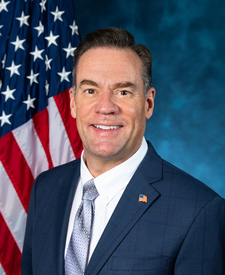
Shoreline Campground and Group sites is in Idaho’s 1st congressional district. Its representative, Russ Fulcher (R), votes on the laws that decide what happens to this land. Public-lands grade so far: F. See every public-lands vote →