Southfork Campground
5Heads up5 fires, nearest 18 mi
This is how it should work.
- Right now
- Nobody has saidNo season, no closure, no bookings to read
The place
the agency’s own description · what’s there
In the agency’s own words
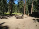
At a Glance: 4,500-foot elevation 21 sites RV's up to 16' No water Vault toilets Campsites are first-come, first-served What to Expect South Fork Campground on the backside of the San Gabriel Mountains is a hidden gem in the Mojave Desert. Tucked in the middle of steep canyon walls descending from Mt. Islip from the South and Vazquez Rocks in the North, this campground offers 21 spacious sites of year-round tranquility. Each site comes with a fire-ring and grill to huddle around and cook those family campfire meals. Keep reading
Additionally, each site comes with a picnic bench should your group decide a game of cards is in order. After an evening around the fire, the South Fork Campground offers hiking and horseback riding to some of the most beautiful features in the San Gabriels. Campers turned hikers can travel south along Big Rock Creek towards Islip Saddle and see seasonal waterfalls or spot a Nelson's Big Horn Ram. What's more, hikers can head east along the Manzanita Trail towards Vincent's Gap or west to the Devil's Punchbowl - one of the most geologically interesting places in Los Angeles County. Regardless of the time of the year, visitors can find a trail that suits their needs and experience level. If hiking isn't your "thing," South Fork Campground delivers excellent snow play, fishing, and stargazing.
Facilities
- Toilets
- Vault Toilets
- “Glance: 4,500-foot elevation 21 sites RV's up to 16' No water Vault toilets Campsites are first-come, first-served What to Expect South Fork Campground on the backside of the San Gabriel Mountains is a hidden gem in the Mojave Desert.”
- Drinking water
- None, bring your own
- “…elevation 21 sites RV's up to 16' No water Vault toilets Campsites are first-come,…”
Around the campground
- On the water
- Waterfall, Creek
- Picnicking
Nothing to book, just show up
One of 1,623 federal campgrounds where the site still goes to whoever pulls in first. Get there before noon on a summer weekend.
recreation.gov publishes no availability for a campground you can’t reserve, so there’s no thirty-night reading to draw here. The season bar above is what the agency does publish.
Every line of the receipt · 3
What you actually pay
How we know this receipt · 4
rules read Sep 7, 2026 · record Aug 23, 2026 · How we know all this
Getting there
the map and the coordinate
Where it is
 Jackson FlatsSan Gabriel Mountains National Monument · 2.7 mi
 Deer Group CampSan Gabriel Mountains National Monument · 4.5 miJackson Flat Group CampgroundSan Gabriel Mountains National Monument · 4.9 mi
 Crystal LakeSan Gabriel Mountains National Monument · 4.9 mi
The weather
the next four days · the thirty-year normal
Next four days, and the thirty-year normal
Forecast
NWS forecast for Piñon Hills, CA
Typical weather
Typical October night 43°F, day 63°F.
Coldest month of the year: typical January night 29°F, below freezing. Bring a bag rated colder than that, and expect ice in the water bottle.
Daily high and lowDays with 0.10 in or more
A normal is the 1991-2020 average for the month, not a forecast: about half of all Augusts are colder than the August line. The seven-day forecast above answers the other question.
The land, and who answers for it
what threatens it · who answers for it
What threatens this place
You’re camping on ground somebody wants. We track the threats and the comment deadlines.
Who answers for this land

Southfork Campground is in California’s 28th congressional district. Its representative, Judy Chu (D), votes on the laws that decide what happens to this land. Public-lands grade so far: A. See every public-lands vote →