Up Up Lookout
1Heads up1 fire 13 mi away
- Right now
- Nobody has saidNo season, no closure, no bookings to read
- Sites
- 1All of them booked ahead
The place
the agency’s own description · what’s there · 8 notices
In the agency’s own words
Up Up Lookout is 40 feet tall and perched on a beautiful rock pinnacle in the Bitterroot Mountains of western Montana. It is close to the Idaho border, giving guests a bird's eye view of the entire area. The lookout is a fantastic place by which to view the St. Regis River drainage and the high alpine country. The tower can be accessed by vehicle. Children are discouraged, as the tower has an exterior open stairway. Guests are responsible for their own travel arrangements and safety, and must bring several of their own amenities. Keep reading
Recreation
The Up Up Ridge Trail takes visitors into the spectacular Ward and Eagle peaks roadless area, where visitors will find several scenic alpine lakes and various points of exploration. The trail leads to other trails, which take hikers and mountain bikers to the 7,300-foot Eagle Peak, providing ample views of the surrounding area. Big game hunters often camp along the ridge. It is also a great place to see vibrantly colored fall leaves, beautiful waterfalls, wildlife, do some berry picking and even fishing. The area holds many scenic and recreational attractions. The trail leads all the way to the Idaho state line, near Ward Peak.
Facilities
THE LOOKOUT CAN SLEEP UP TO FOUR PEOPLE AND IS EQUIPPED WITH ONE TWIN BED AND MATTRESS PAD. IT IS RECOMMENED TO BRING ADDITIONAL COTS TO SLEEP ON. It has propane lights and a heater. There are no cooking facilities or refrigeration. A campfire ring with a grill and a picnic table are provided at the base of the tower, along with an outhouse with a pit toilet. Guests will need to bring water for drinking, cooking and cleaning purposes, as well as cooking equipment and fuel. Cots, bedding, towels, soap, cooking and eating utensils, matches, toilet paper and garbage bags are not provided. Guests will need to clean the facility prior to leaving.
Natural Features
The wooden tower was built in the 1930s and used as a fire lookout for several years. It is situated between the main highway and the Idaho border, at an elevation of 5,900 feet. With the growing use of aircraft for fire detection, fewer lookouts have been staffed in recent years and many are converted to cabin rentals available to the public. The Lolo National Forest is home to many species of wildlife, from mule deer, whitetail deer, elk, bighorn sheep, mountain goats, black bear, mountain lions and moose, to many varieties of smaller animals and birds. Wildlife viewing areas offer guests ample opportunity to view animals in their natural habitat.
What the agency tells you
The entry gate and cabin remain locked; a key code will be sent to you in your reservation confirmation.
This facility is located in a remote area; before making a reservation, become aware of bear, water, and weather safety.
Water is not available at the facility.
Everything else this campground posts · 5
All garbage, food and personal belongings must be packed out.
Smoking and pets are prohibited at the lookout.
Learn more about the Lolo National Forest at: https://www.fs.usda.gov/lolo
Don't Move Firewood: Prevent the spread of tree-killing pests by obtaining firewood near your destination and burning it on-site. For more information visit dontmovefirewood.org.
Maximum stay limit is 3 nights per reservation.
Tents and rigs
- Sites
- 1 · 1 cabin
- Hookups
- None
- Accessible sites
- None listed
- Campfires
- Allowed, barring fire bans
- Shade
- Every site
Facilities
- Toilets
- Pit Toilets
- “…the tower, along with an outhouse with a pit toilet. Guests will need to bring water for drinking,…”
- Drinking water
- None, bring your own
- “…with a pit toilet. Guests will need to bring water for drinking, cooking and cleaning purposes, as…”
Around the campground
- On the water
- Waterfall, Lake, River
- Biking
- Hiking
- Historic site
- Hunting
- Wildlife viewing
No reading yet, book on recreation.gov
Every site here is reservable, and the record lists none held back for anyone who drives up.
No availability snapshot inside the last 36 hours, so this page draws nothing rather than ageing a reading into fiction.
Watch for a cancellation
Full? Watch it.
One email when a night opens, plus More Than Just Parks dispatches. Unsubscribe any time.
We read recreation.gov once an hour, at 40 minutes past, and write the first time a site in your window is free for the nights you asked for.
Scanners that check every few minutes exist, and most of them charge. This one is free, it reads the same calendar, and it won’t always be first.
Tell me when the season opens
Watch for the season to open
One email when the season goes on sale, plus More Than Just Parks dispatches. Unsubscribe any time.
We check once an hour, at 40 minutes past, and write the first time the agency has that season on sale.
Scanners that check every few minutes exist, and most of them charge. This one is free, it reads the same calendar, and it won’t always be first.
We make nothing when you book. The link goes straight to the government.
Every line of the receipt · 11
What you actually pay
Who keeps the booking fee
The agency’s own policy text says the reservation fee and the cancellation processing fee are “retained by the reservation service contractor”, and that a campground concessionaire will decline to refund them because “they did not receive these fees”. Recreation.gov is run under contract by Booz Allen Hamilton. What share of your booking fee the contractor keeps isn’t published in any federal dataset we can read, so we print no number for it. Our reporting on the contract →
How we know this receipt · 4
rules read Sep 9, 2026 · rates Sep 10, 2026 · How we know all this
The sites
1 sites · the site map
All 1 sites
Toilet distances are OpenStreetMap’s, measured for 1 of the 1 sites listed. A site with no reading is unknown, never far.
| AREA UP UP LOOKOUT | 001 | lookout | 2,803 ft | 145 ft |
Getting there
the map and the coordinate · the agency’s directions · the phone number
Where it is
 Savenac BunkhouseLolo National Forest · 4.4 mi
 Savenac CookhouseLolo National Forest · 4.4 mi
 Savenac West CottageLolo National Forest · 4.4 mi
 Savenac East Cottage (MT)Lolo National Forest · 4.4 mi
 Cabin City Campground (MT)Lolo National Forest · 4.8 miLittle Joe Campground - Lolo NFLolo National Forest · 11 mi
Do not follow your GPS. Please use the following directions.
West bound on I-90 take the Drexel Exit #25. From Drexel turn back east on I-90 to Ward Creek Exit #26. East bound on I-90 take the Ward Cr Exit #26. Proceed up the Ward Creek Rd #889, travel 3.2 miles. Turn right onto Road #3816 and travel 12.1 miles to the locked gate. Proceed 3.2 miles behind the gate to the base of the tower.
The weather
the next four days · the thirty-year normal
Next four days, and the thirty-year normal
Forecast
NWS forecast for De Borgia, MT
Typical weather
Typical October night 32°F, day 44°F.
Coldest month of the year: typical December night 18°F, below freezing. Bring a bag rated colder than that, and expect ice in the water bottle.
Daily high and lowDays with 0.10 in or more
A normal is the 1991-2020 average for the month, not a forecast: about half of all Julys are colder than the July line. The seven-day forecast above answers the other question.
The land, and who answers for it
what threatens it · who answers for it
Roadless country, and what’s coming for it
You’re camping on ground somebody wants. We track the threats and the comment deadlines.
Who answers for this land
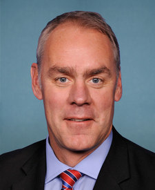
Up Up Lookout is in Montana’s 1st congressional district. Its representative, Ryan Zinke (R), votes on the laws that decide what happens to this land. Public-lands grade so far: F. See every public-lands vote →