Upper Arcadia
- Right now
- Closedrecreation.gov lists every site closed this weekend, read 16:19 UTC
- A night
- $30When it reopens, per site
- Sites
- 2In the agency’s record
- Season
- Year-roundOpen year-round
The place
the agency’s own description · what’s there · 15 notices
In the agency’s own words
Upper Arcadia sits along Swift Trail in southeastern Arizona, providing an escape from desert heat and a pleasant place to take in the high desert scenery in spring and fall. Visitors enjoy hiking, camping, birding and picnicking. Keep reading
Recreation
The campground lies along the Swift Trail Scenic Drive, which takes visitors from the Sonoran Desert at 2,900 feet to alpine meadows and forest on the 9,000+ foot ridges of the Pinaleño Range. Because of its diverse habitat, the area is well-known for birding and wildlife watching. The Swift Trail provides access to a number of hiking, horseback riding and mountain biking trails, along with several other campgrounds that invite you for an afternoon picnic. A trip up to Riggs Lake, stocked with trout by Arizona Game & Fish, or to the Columbine Visitors Center could make a worth-while day trip as well. The Arcadia Trail #328 starts at the Upper Arcadia Campground and leads up the mountain to Shannon Campground. A 1-mile spur off this trail leads to the top of Heliograph Peak, one of the highest mountains in southeastern Arizona.
Facilities
The group camping area can accommodate up to 75 people. Amenities include drinking water (available seasonally), vault toilets, picnic tables, and campfire rings with grills. Bear-proof food lockers and trash cans are provided to keep visitors and wildlife safe. Dead-and-down firewood may be collected in and around the campsite. Several first-come, first-served sites are located nearby (must pay separately).
Natural Features
The shady campground is in a thick forest of tall ponderosa pines interspersed with Gambel oaks and Arizona walnuts, at an elevation of 6,700 feet. The Coronado National Forest covers 1.78 million acres of southeastern Arizona and southwestern New Mexico. Elevations range from 3,000 to 10,720 feet in 12 widely scattered mountain ranges, or "sky islands," that rise dramatically from the desert floor, supporting biologically diverse plant communities.
Nearby Attractions
The Mount Graham Wilderness Study Area, which includes the 10,720-foot Mount Graham, the tallest mountain in southern Arizona. Columbine Visitor Center, Riggs Lake, and a variety of trails can be accessed along the Swift Trail Scenic Drive. The town of Safford is approximately a 30 minute drive from the Upper Arcadia campground, heading north on SR 191. Safford is home to our Ranger Station, where you can go to find information about trails, camping, hunting and fishing, and other questions you may have about our district (open Monday-Friday, 8am-4:30pm).
Charges & Cancellations
Please review the Rules & Reservations Policies page on recreation.gov
What the agency tells you
There is a $5 per vehicle fee. Please pay by cash or check at the Fee Station upon arrival
Drinking water is provided during peak season. Water availability is dependent on weather conditions.
For groups over 30, one portable/self-contained toilet is required for every 15 people
Everything else this campground posts · 12
To keep visitors and wildlife safe, make sure all food is secure and place all garbage in the proper receptacles. If your garbage does not fit in the bins, please pack it out of the Forest. Please remove all garbage from food-storage lockers.
Season dates may depend on weather and fire conditions; call 928-428-4150 for current information. Campsites are located behind a locked gate that you can walk around as gate will not be unlocked.
Total vehicle length must be less than 40 feet. Trailers are recommended to be less than 22 feet due to the narrow switchbacks of AZ 366.
No hookups are available
Check-in is at 2 p.m.; check-out is at noon
Maximum 75 people and 8 vehicles.
Be sure your fire is completely extinguished before leaving; do not leave fires unattended. Only dead-and-downed trees and shrubs may be collected as firewood; tree cutting is prohibited.
Pack and saddle stock are not permitted in camping area
Shooting is prohibited within 150 yards of any recreation site. Fireworks are prohibited anywhere on the Forest.
This is a high elevation facility; please use caution when traveling from lower elevations
Click here to learn more about Coronado National Forest
Don't Move Firewood: Prevent the spread of tree-killing pests by obtaining firewood near your destination and burning it on-site. For more information visit dontmovefirewood.org.
Tents and rigs
- Sites
- 2 · 1 group
- Hookups
- None
- Longest rig
- 40 ft
- Accessible sites
- None listed
- Pets
- Allowed
- Campfires
- Allowed, barring fire bans
- Shade
- Every site
Facilities
- Toilets
- Vault Toilets
- “…drinking water (available seasonally), vault toilets, picnic tables, and campfire rings with grills.…”
- Drinking water
- Yes
- DRINKING WATER (PEAK SEASON) on 1 of 2 campsite records
- Firewood
- Mentioned
Around the campground
- On the water
- Lake, Meadow
- Biking
- Fishing
- Hiking
- Picnicking
- Ranger Station
- Scenic drives
- Visitor center
- Wildlife viewing
- Night sky · 118th darkest of 262 in AZ
- Bortle 3
Nothing to book until it reopensread 16:19 UTC
recreation.gov lists every site closed this weekend
OpenBookedClosed
Tell me when it reopens
Watch for it to come back
One email when the agency reopens it, plus More Than Just Parks dispatches. Unsubscribe any time.
We check the agency’s own record once an hour, at 40 minutes past, and write the first time it stops saying closed.
Scanners that check every few minutes exist, and most of them charge. This one is free, it reads the same calendar, and it won’t always be first.
Every line of the receipt · 14
What you actually pay
“Please review the Rules & Reservations Policies page on recreation.gov” · this campground’s own terms
Who keeps the booking fee
The agency’s own policy text says the reservation fee and the cancellation processing fee are “retained by the reservation service contractor”, and that a campground concessionaire will decline to refund them because “they did not receive these fees”. Recreation.gov is run under contract by Booz Allen Hamilton. What share of your booking fee the contractor keeps isn’t published in any federal dataset we can read, so we print no number for it. Our reporting on the contract →
How we know this receipt · 5
Why this page can’t say why
recreation.gov lists every site at Upper Arcadia closed this Friday and Saturday night. The U.S. Forest Service has published no closure notice we hold, so this page can’t say why, and it won’t fill the gap with a guess. A closed night isn’t a sold-out one: the reservations its record still carries were taken before the sites were closed.
There’s no notice to quote and no reason to argue with, so this page offers you the watch and the list below, and no letter.
Open within 60 miles · 4
The agency’s own word that these are open, not our reading of a season.
- Arcadia CampgroundCoronado National Forest · 0.0 mi
- Lower Twilight Group SiteCoronado National Forest · 0.5 mi · 1 site
- Snow Flat Dispersed Camping AreaCoronado National Forest · 2.7 mi · walk-up
- Treasure Park - EastCoronado National Forest · 3.2 mi · 1 site
recreation.gov availability, read 16:19 UTC · rules read Sep 9, 2026 · rates Sep 10, 2026 · How we know all this
The sites
2 sites · the site map
All 2 sites
Toilet distances are OpenStreetMap’s, measured for 1 of the 2 sites listed. A site with no reading is unknown, never far.
The price is derived by CAMPANAC, not published per site: the per-night rate this campground publishes for each site’s own site type. 2 of the 2 sites listed carry one, and a site whose type has no published rate sits out of the price rather than being called free.
| A | Upper Arcadia Double Site | standard nonelectric | 40 ft | $30 | ||
| UPPER ARCADIA | Upper Arcadia | group standard area nonelectric | 40 ft | 995 ft | 28 ft | $25 |
Getting there
the map and the coordinate · the agency’s directions · the phone number
Where it is
 Arcadia CampgroundCoronado National Forest · 0.0 mi
 Lower Twilight Group SiteCoronado National Forest · 0.5 mi
 Upper Twilight Group SiteCoronado National Forest · 0.5 mi
 Shannon CampgroundCoronado National Forest · 2.3 miSnow Flat Dispersed Camping AreaCoronado National Forest · 2.7 miTreasure Park - EastCoronado National Forest · 3.2 mi
From Safford, Arizona: Take State Route 191 south for 6 miles. Turn right onto State Route 366/Swift Trail and travel 11.5 miles to the Arcadia Campground entrance (MM 125.5), taking the next right turn to access Upper Arcadia.
From Tucson, Arizona: Take I-10 East for 90 miles. Take exit 352 for State Route 191, and turn left toward Safford. Drive 26.3 miles north and turn left on State Route 366/Swift Trail. Continue for 11.5 miles to the Arcadia Campground entrance (MM 125.5), taking the next right turn to access Upper Arcadia.
The weather
the next four days
Next four days, and the thirty-year normal
Forecast
NWS forecast for Swift Trail Junction, AZ
The land, and who answers for it
what threatens it · who answers for it
What threatens this place
You’re camping on ground somebody wants. We track the threats and the comment deadlines.
Who answers for this land
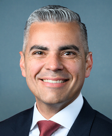
Upper Arcadia is in Arizona’s 6th congressional district. Its representative, Juan Ciscomani (R), votes on the laws that decide what happens to this land. Public-lands grade so far: F. See every public-lands vote →