Upper Tonto Creek
- Right now
- Closedrecreation.gov lists every site closed this weekend, read 14:23 UTC
- A night
- $20When it reopens, per site
- Sites
- 10In the agency’s record
- Season
- April 1 – October 31Open April 1 through October 31
The place
the agency’s own description · what’s there · 3 notices
In the agency’s own words
The Upper Tonto Creek is a small campground tucked away from the main highway where the Tonto and Horton Creeks merge. 6 Campsites are available for reservation only. This location is available only through reservation May 1through November 3rd. Campground map available here . Keep reading
Recreation
Families may enjoy fishing at both Tonto and Horton Creeks or pass time hiking through nearby Horton Creek Trail or Derrick Trail. Both of these trails access the Highline National Recreation Trail (#31).
Facilities
This campground contains 6 campsites, 3 picnic sites, and a double vault toilet.
Natural Features
The union of Tonto and Horton Creeks is at the north end of the Upper Tonto Creek campground. Fishing in both creeks is a popular sport. Contact Info This location is unstaffed. To speak with our main office for general information, please call: (928) 474-7900.
What the agency tells you
Sites are small in this campground so trailers have to be short or only over camper type mounts.
This campground is small with 6 sites sitting above Tonto Creek. The campground road is tight with no turn around options.
Check in time is 2:00pm and check out time is 11:00am. Quiet hours are from 10:00pm to 6:00am.
Tents and rigs
- Sites
- 10
- Hookups
- None
- Accessible sites
- None listed
- Pets
- Allowed
- Campfires
- Allowed, barring fire bans
- Shade
- 1 of 6 sites
Facilities
- Toilets
- Vault Toilets
- “…campsites, 3 picnic sites, and a double vault toilet. Natural Features The union of Tonto and Horton…”
- Stay limit
- 13 nights
- recreation.gov facility rule maxStay
Nothing to book until it reopensread 14:23 UTC
recreation.gov lists every site closed this weekend
Every one of the next thirty nights is in recreation.gov’s record and not one site is being offered on any of them. That’s a campground closed or not yet released for booking, not a sold-out one.
Tell me when it reopens
Watch for it to come back
One email when the agency reopens it, plus More Than Just Parks dispatches. Unsubscribe any time.
We check the agency’s own record once an hour, at 40 minutes past, and write the first time it stops saying closed.
Scanners that check every few minutes exist, and most of them charge. This one is free, it reads the same calendar, and it won’t always be first.
Every line of the receipt · 10
What you actually pay
Who keeps the booking fee
The agency’s own policy text says the reservation fee and the cancellation processing fee are “retained by the reservation service contractor”, and that a campground concessionaire will decline to refund them because “they did not receive these fees”. Recreation.gov is run under contract by Booz Allen Hamilton. What share of your booking fee the contractor keeps isn’t published in any federal dataset we can read, so we print no number for it. Our reporting on the contract →
How we know this receipt · 4
Why this page can’t say why
recreation.gov lists every site at Upper Tonto Creek closed this Friday and Saturday night. The U.S. Forest Service has published no closure notice we hold, so this page can’t say why, and it won’t fill the gap with a guess. A closed night isn’t a sold-out one: the reservations its record still carries were taken before the sites were closed.
There’s no notice to quote and no reason to argue with, so this page offers you the watch and the list below, and no letter.
Open within 60 miles · 4
The agency’s own word that these are open, not our reading of a season.
- Lower Tonto CreekTonto National Forest · 0.5 mi · 13 sites
- Ponderosa Campground and Group SitesTonto National Forest · 3.0 mi
- Christopher CreekTonto National Forest · 4.0 mi · 44 sites
- Sharp CreekTonto National Forest · 6.1 mi · 20 sites
recreation.gov availability, read 14:23 UTC · rules read Sep 9, 2026 · rates Sep 10, 2026 · How we know all this
The sites
13 records · the site map
All 13 records
Toilet distances are OpenStreetMap’s, measured for 1 of the 13 sites listed. A site with no reading is unknown, never far.
The price is derived by CAMPANAC, not published per site: the per-night rate this campground publishes for each site’s own site type. 6 of the 13 sites listed carry one, and a site whose type has no published rate sits out of the price rather than being called free.
Measured shade is NLCD Tree Canopy Cover 2024 (USDA Forest Service / MRLC) read at the site’s own coordinate, 27% canopy or more, and only for the sites the agency gave no Shade value. It never changes the agency’s own shaded count beside it.
| Scan and Pay | Scanpay 1 | type not stated | 414 ft | 627 ft | |
| Scan and Pay | ScanPay 2 | type not stated | |||
| Scan and Pay | ScanPay 3 | type not stated | |||
| Scan and Pay | ScanPay 4 | type not stated | |||
| Upper Tonto Creek | 1 | standard nonelectric | $20 | ||
| Upper Tonto Creek | 2 | standard nonelectric | $20 | ||
| Upper Tonto Creek | 3 | standard nonelectric | $20 | ||
| Upper Tonto Creek | 4 | standard nonelectric | $20 | ||
| Upper Tonto Creek | 5 | standard nonelectric | $20 | ||
| Upper Tonto Creek | 6 | standard nonelectric | $20 | ||
| Upper Tonto Creek | day use | ||||
| Upper Tonto Creek | day use | ||||
| Upper Tonto Creek | day use |
The agency files 3 more records here that aren’t sites for the night. It files them as day use. They’re in the table above, marked for what they are, and none of them is counted as a site.
Getting there
the map and the coordinate · the agency’s directions · the phone number
Where it is
 Lower Tonto CreekTonto National Forest · 0.5 miPonderosa Campground and Group SitesTonto National Forest · 3.0 mi
 Ponderosa (AZ)Tonto National Forest · 3.0 mi
 Christopher CreekTonto National Forest · 4.0 mi
 Knoll Lake CampgroundCoconino National Forest · 6.0 mi
 Sharp CreekTonto National Forest · 6.1 mi
This site is 17 miles northeast of Payson. From Payson, travel 16 miles east on State Hwy. 260. Just east of mile marker 268 at Kohl’s Ranch, turn left (north) on Forest Road (FR) 289. Travel one mile and turn right into the site.
The weather
the next four days · the thirty-year normal
Next four days, and the thirty-year normal
Forecast
NWS forecast for Kohls Ranch, AZ
Typical weather
Typical October night 41°F, day 76°F.
Coldest night of the open season: typical April night 36°F. Bring the bag rated for it.
Daily high and lowDays with 0.10 in or moreOutside the published season
A normal is the 1991-2020 average for the month, not a forecast: about half of all Julys are colder than the July line. The seven-day forecast above answers the other question.
The land, and who answers for it
what threatens it · who answers for it
Roadless country, and what’s coming for it
You’re camping on ground somebody wants. We track the threats and the comment deadlines.
Who answers for this land
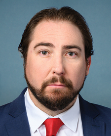
Upper Tonto Creek is in Arizona’s 2nd congressional district. Its representative, Eli Crane (R), votes on the laws that decide what happens to this land. Public-lands grade so far: F. See every public-lands vote →