U.S. Forest Service · National Forest · Oregon
Willamette National Forest
Here, 7% take walk-ups.
84Campgrounds
6Take walk-ups
1Free to camp
$5–$165A night, across 51
1,165Sites, from 69
900–5,730 ftElevation
Where they are
84 of 84 mappedDrawing the map
© OpenFreeMap · OpenStreetMap · Esri hillshadeSource: RIDB · NPS · USFS EDW · BLM, unified by CAMPANAC · Oct 23, 2026
The campgrounds
84 campgrounds
In 1 places, folded
Willamette National Forest84 campgrounds · 16 open›
 Yukwah CampgroundReservableOpenfrom $2516 with a tent pad4 pull-through sites20 sitesrigs to 99 ft1,240 ftdrinking watertoilets
 House Rock CampgroundReservableOpenfrom $2517 with a tent pad17 sitesrigs to 65 ft1,690 ftdrinking watertoilets
 Campers FlatReservableOpenSites from $501 group site1 site2,020 ftdrinking watertoilets
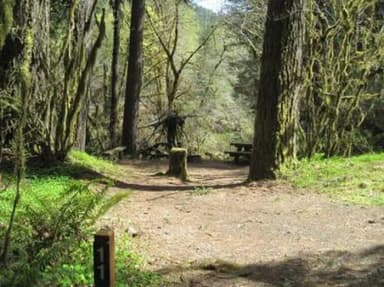 Fernview Group SiteReservableOpenSites from $2001 with a tent pad1 group site1 siterigs to 35 ft1,370 ftdrinking watertoilets
 Fox Creek Group CampReservableOpenSites from $651 group site1 siterigs to 40 ft1,940 fttoilets
 Horse Creek Group CampgroundReservableOpenSites from $751 group site1 siterigs to 35 ft1,460 ftdrinking watertoilets
 Longbow Organization GroupReservableOpenSites from $2251 with a bear box1 group site1 siterigs to 15 ft2,090 ftdrinking watertoilets
 Lost Prairie Group SiteReservableOpenSites from $2251 group site1 siterigs to 35 ft3,350 ftdrinking watertoilets
 Roaring River (Group)ReservableOpenSites from $501 group site1 siterigs to 30 ft2,640 fttoilets
 Black Canyon Campground (Willamette National Forest, OR)Reservablefrom $261 pull-through site2 group sites74 sitesrigs to 44 ft1,490 fthookupsdrinking watertoilets
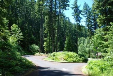 Cove Creek (OR)ReservableSeasonalfrom $289 pull-through sites1 group site66 sitesrigs to 99 ft1,630 ftdrinking watertoilets
 Paradise in OregonReservablefrom $298 pull-through sites61 sitesrigs to 80 ft1,520 fttoilets
Source: RIDB · NPS · USFS EDW · BLM, unified by CAMPANAC · Oct 23, 2026
This land
measured from the nearest campground in the unitRoadless
Roadless
Roadless
Roadless
Roadless
Roadless
Camping here is a stake in what happens to it. More Than Just Parks tracks the threats and the comment windows.
Source: USFS Inventoried Roadless Areas via MTJP Roadless Map · Jul 29, 2026
Heads up
Wildfire
Austin fire · 17 mi from the nearest campground here · 12,888 acres · 98% contained
Wildfire
The Narrows fire · 23 mi from the nearest campground here · 305 acres · 98% contained
Wildfire
Castle fire · 28 mi from the nearest campground here · 3,615 acres · 100% contained
Wildfire
Bench fire · 29 mi from the nearest campground here · 67,071 acres · 90% contained
Wildfire
0902 Quail fire · 30 mi from the nearest campground here · 4 acres
Source: NIFC/IRWIN via MTJP wildfire tracker · Oct 21, 2026
Who answers for this land
Willamette National Forest’s campgrounds sit in 3 congressional districts. These members vote on the laws that decide what happens to this land.

Val Hoyle (D)

Janelle Bynum (D)
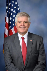
Cliff Bentz (R)
Source: campground records from RIDB, NPS, USFS EDW and BLM, unified by CAMPANAC, refreshed nightly