Fish Creek Campground
- Right now
- Nobody has saidNo season, no closure, no bookings to read
- A night
- $7From, per site
- Sites
- 7All of them booked ahead
The place
the agency’s own description · what’s there · 1 notices
In the agency’s own words
Fish Creek Campground is nestled adjacent to Fish Creek and is the starting point for the 10-mile Fish Creek National Recreation Trail and is just a short distance from the popular Scofield Reservoir. Fish Creek Campground is surrounded by aspen trees. The campground is sought after by campers looking for solitude outside of a typical campground setting. Scan & Pay is available at this campground using the Recreation.gov mobile app (Android and iOS). This location is available on a first-come, first-served basis only. Visitors are required to physically arrive at the campground to purchase and claim a site. Once on-site, you can pay for your campsite(s) by scanning a QR code using the Recreation.gov mobile app. Download the free Recreation.gov mobile app on Android or iOS prior to your arrival as some remote areas have limited or no cellular service. Keep reading
Recreation
There are many recreational activities available including hiking, biking, horseback riding, fishing and the Fish Creek UTV trail (60" wide) begins only a few miles away. The Fish Creek hiking trail has been designated as a National Recreation Trail. It is a gentle, walk along a small mountain stream, usually well maintained and easy to follow.
Facilities
This campground is a small remote horse friendly campground with six campsites. The site is in an open area with partial shade. You will find parking for horse trailers as well as parking for the Fish Creek National Recreation Trail which begins on-site. Amenities include a vaulted toilet, picnic tables, fire rings and a horse corral. Water and garbage service is not available. This is a "pack it in, pack it out" facility.
Natural Features
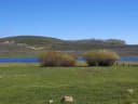
Fish Creek runs down a wide, gently sloping canyon from a point near Skyline Drive to the Scofield Reservoir. The canyon is popular with hunters because of the abundance of deer and elk in the area. Deer are everywhere, but the elk seem to prefer grazing in the large, open meadows high above the south bank of the creek. Take along a pair of binoculars and stop occasionally to scan these grassy meadows. If you are attentive you are almost certain to see at least a few of the magnificent animals. The creek runs from west to east, and you will notice a tremendous difference in vegetation between the north and south facing sides of the canyon. The north facing side is covered with aspens and conifers, interspaced with lush green meadows. The south facing side, on the other hand, is sage brush country with scarcely a tree to be found.
Nearby Attractions
Scofield State Park is situated 7,600 feet above sea level in the Manti-La Sal Mountains of the Wasatch Plateau. The 2,800-acre lake offers excellent boating and year-round fishing. During winter months, the area serves as a base for snowmobile and cross-country skiing in the spectacular mountains surrounding the park. Three state-owned facilities are available. Mountain View, located six miles north of the town of Scofield, offers a 34-unit campground, modern restrooms, hot showers, fish cleaning and sanitary disposal stations, group use areas, and boat launch ramp. Madsen Bay, located on the north end of the reservoir, is a popular area for groups and family reunions. Contact Info This location is unstaffed. To speak with our main office for general information, please call: (435) 384-2372.
What the agency tells you
• We offer first-come, first-served campsites. You will need to pay after arriving on-site either by cash/check deposited into fee tube or by scanning our facility QR code using the Recreation.gov mobile app. Please download the recreation.gov app prior to arrival as some remote areas have limited or no cell service. • Six single-family sites at $7/night per site. • Pets must be leashed in campground. • Some sites are now in full sun. • Off-road vehicle use is prohibited within the campground. • This is a "pack it in, pack it out" facility; no garbage service is provided. • There are no electricity or sewer hookups. • Picnic tables and fire rings at each site. • Vault toilet available.
Tents and rigs
- Sites
- 7
- Hookups
- None
- Longest rig
- 30 ft
- Accessible sites
- None listed
- Pets
- Allowed
- Campfires
- Allowed, barring fire bans
- Shade
- 4 of 5 sites
Facilities
- Toilets
- Vault Toilets
- VAULT TOILETS on 5 of 6 campsite records
- Boat ramp
- Yes
Around the campground
- On the water
- Reservoir, Lake, Creek, Coast, Meadow
- Fishing
- Hiking
- Horseback riding
- Night sky · 288th darkest of 458 in UT
- Bortle 3
Nothing on the booking system for the next 30 nightsread 15:47 UTC
Every site here is reservable, and the record lists none held back for anyone who drives up.
Every one of the next thirty nights is in recreation.gov’s record and not one site is being offered on any of them. That’s a campground closed or not yet released for booking, not a sold-out one.
Watch for a cancellation
Full? Watch it.
One email when a night opens, plus More Than Just Parks dispatches. Unsubscribe any time.
We read recreation.gov once an hour, at 40 minutes past, and write the first time a site in your window is free for the nights you asked for.
Scanners that check every few minutes exist, and most of them charge. This one is free, it reads the same calendar, and it won’t always be first.
We make nothing when you book. The link goes straight to the government.
Every line of the receipt · 12
What you actually pay
Derived by CAMPANAC: the agency’s published rate for this season, $7 a night, plus one $8 recreation.gov reservation fee for the booking. A weekend here means Friday and Saturday night, booked once. Optional charges (an extra vehicle, a second tent, a dump-station fee) are listed separately and aren’t in this total.
Who keeps the booking fee
The agency’s own policy text says the reservation fee and the cancellation processing fee are “retained by the reservation service contractor”, and that a campground concessionaire will decline to refund them because “they did not receive these fees”. Recreation.gov is run under contract by Booz Allen Hamilton. What share of your booking fee the contractor keeps isn’t published in any federal dataset we can read, so we print no number for it. Our reporting on the contract →
How we know this receipt · 5
recreation.gov availability, read 15:47 UTC · rules read Sep 9, 2026 · rates Sep 10, 2026 · How we know all this
The sites
7 sites · which ones have room · the site map
The sites, ranked
from 6 mapped sitesAll 7 sites
The price is derived by CAMPANAC, not published per site: the per-night rate this campground publishes for each site’s own site type. 7 of the 7 sites listed carry one, and a site whose type has no published rate sits out of the price rather than being called free.
| Fish Creek | 01 | standard nonelectric | 30 ft | 208 ft | 93 ft | $7 |
| Fish Creek | 02 | standard nonelectric | 30 ft | 186 ft | 74 ft | $7 |
| Fish Creek | 03 | standard nonelectric | 25 ft | 65 ft | 209 ft | $7 |
| Fish Creek | 04 | standard nonelectric | 25 ft | 65 ft | 225 ft | $7 |
| Fish Creek | 05 | standard nonelectric | 25 ft | 83 ft | 256 ft | $7 |
| Fish Creek | 06 | standard nonelectric | 25 ft | 117 ft | 328 ft | $7 |
| Fish Creek Standard | standard nonelectric | $7 |
OpenStreetMap has no toilet mapped within 1 km of this campground, so no site here carries a toilet distance. That’s a gap in the map, not a finding about the campground.
Getting there
the map and the coordinate · the agency’s directions
Where it is
 Gooseberry ReservoirManti-La Sal National Forest · 6.6 mi
 Mammoth CabinManti-La Sal National Forest · 7.7 mi
 Gooseberry Creek CampgroundManti-La Sal National Forest · 7.9 mi
 Flat CanyonManti-La Sal National Forest · 9.4 miCleveland Reservoir CampgroundManti-La Sal National Forest · 14 miLake Canyon CampgroundManti-La Sal National Forest · 14 mi
From Fairview, UT travel east for 8.4 miles on Highway 31. Turn left onto Highway 264 for 18 miles, turn left onto W Myrtle Street for 0.1 miles then take a right onto N Church Street for 3.8 miles then at last, slight left onto Fish Creek road for 2 miles to destination.
The weather
the next four days · the thirty-year normal
Next four days, and the thirty-year normal
Forecast
NWS forecast for Scofield, UT
Typical weather
Typical October night 22°F, day 48°F.
Coldest month of the year: typical December night 2°F, below freezing. Bring a bag rated colder than that, and expect ice in the water bottle.
Daily high and lowDays with 0.10 in or more
A normal is the 1991-2020 average for the month, not a forecast: about half of all Julys are colder than the July line. The seven-day forecast above answers the other question.
The land, and who answers for it
what threatens it · who answers for it
Roadless country, and what’s coming for it
You’re camping on ground somebody wants. We track the threats and the comment deadlines.
Who answers for this land

Fish Creek Campground is in Utah’s 3rd congressional district. Its representative, Mike Kennedy (R), votes on the laws that decide what happens to this land. Public-lands grade so far: F. See every public-lands vote →