Lost Creek Campground/Day Use Area
4Heads up4 fires, nearest 18 mi
- Right now
- Listed not openA database flag with no reason and no date
The place
the agency’s own description · what’s there
In the agency’s own words
Lost Creek Campground is a fully accessible campground allowing anyone access to campsites, fishing and a paved nature trail that meanders through the area. The campground is also near the Wild and Scenic Sandy River and not far from the popular Ramona Falls Trailhead . Mt. Hood is just southeast of the campground and is close enough for visitors to enjoy a day trip and sightseeing. This campground is constructed to be entirely barrier-free, offering the mobility-impaired access to campsites, the fishing platform, and a nature trail which meanders through the area. The campground is also near the Wild and Scenic Sandy River.
Around the campground
- On the water
- River, Creek
Phone before you drive
recreation.gov publishes no availability for a campground you can’t reserve, so there’s no thirty-night reading to draw here. The season bar above is what the agency does publish.
Every line of the receipt · 6
What you actually pay
“more info at www.redskyshelters.com ) $8/extra vehicle Day Use: $10/day/vehicle” · the U.S. Forest Service’s own fee record
How we know this receipt · 5
record Aug 24, 2026 · How we know all this
Getting there
the map and the coordinate
Where it is
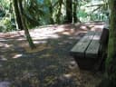 Lost CreekMt. Hood National Forest · 0.0 mi
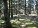 Riley Horse CampgroundMt. Hood National Forest · 1.2 miTollgate Campground & Day Use AreaMt. Hood National Forest · 5.3 mi
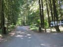 TollgateMt. Hood National Forest · 5.3 mi
 Camp CreekMt. Hood National Forest · 5.5 mi
 Lost Lake Resort and CampgroundMt. Hood National Forest · 7.4 mi
The weather
the next four days · the thirty-year normal
Next four days, and the thirty-year normal
Forecast
NWS forecast for Mount Hood Villages, OR
Typical weather
Typical October night 36°F, day 60°F.
Coldest month of the year: typical December night 27°F, below freezing. Bring a bag rated colder than that, and expect ice in the water bottle.
Daily high and lowDays with 0.10 in or more
A normal is the 1991-2020 average for the month, not a forecast: about half of all Julys are colder than the July line. The seven-day forecast above answers the other question.
The land, and who answers for it
what threatens it · who answers for it
What threatens this place
You’re camping on ground somebody wants. We track the threats and the comment deadlines.
Who answers for this land

Lost Creek Campground/Day Use Area is in Oregon’s 3rd congressional district. Its representative, Maxine Dexter (D), votes on the laws that decide what happens to this land. Public-lands grade so far: A. See every public-lands vote →