Lost Creek
4Heads up4 fires, nearest 18 mi
- Right now
- Closedrecreation.gov lists every site closed this weekend, read 16:03 UTC
- A night
- $20.41When it reopens, per site
- Sites
- 15In the agency’s record
The place
the agency’s own description · what’s there · 6 notices
In the agency’s own words
Lost Creek Campground is a fully accessible campground allowing anyone access to campsites, fishing and a paved nature trail that meanders through the area. The campground is also near the Wild and Scenic Sandy River and not far from the popular Ramona Falls Trailhead. Mt. Hood is just southeast of the campground and is close enough for visitors to enjoy a day trip and sightseeing. Keep reading
Recreation
A variety of trails exist within and near the campground, including the accessible Lost Creek Nature Trail, which explains events in history that helped form the area's geology. A deviation from the road coming into the campground (Forest Road 1825), will lead to a trailhead for spectacular Ramona Falls on the Sandy River. The 7.1-mile trail leads to cascading waterfalls and is one of the most popular hikes on the forest. Fishing is available in the Sandy River and anglers can expect steelhead year-round, Coho salmon in the fall and Chinook salmon from February through October. Trout also inhabit the river. Scenic driving and picnicking are popular activities as well.
Facilities
The campground is fully accessible and provides a variety of single, double and walk-to campsites. The structures can accommodate up to six campers each. Visitors must provide their own bedding. Picnic tables and campfire rings with grills are provided, as are accessible vault toilets and drinking water. Utility hookups are not available. Firewood is available for purchase from the campground host.
Natural Features
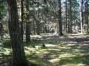
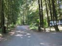
Moss and shrubbery covers the ground and evergreens tower overhead, providing ample shade for the campground and privacy between the individual and group campsites. The campground is situated in the Old Maid Flat area of Mt. Hood National Forest, northwest of majestic Mt. Hood at an elevation of about 2,600 feet. It sits on one of the largest pyroclastic volcanic mudflows from Mt. Hood's "Old Maid" eruption in the 1700s.
Nearby Attractions
The town of Government Camp is located at the base of Mt. Hood, about 18 miles from the campground. Year-round skiing is available there, as well as a variety of activities and amenities.
What the agency tells you
Off-road vehicle use is prohibited within the campground
In accordance with standard industry practices, Mount Hood Recreation will be assessing an additional vehicle fee on the second vehicle in each single family campsite, and on the third and fourth vehicle in any double family campsite, provided these vehicles are not joined to the first vehicle by a hitch and towed onto the site. In the case of motorcycles, the first two are considered as one vehicle for determining additional vehicle fees. The third and fourth motorcycle would also be considered as one vehicle. No additional vehicle fees are collected for bicycles.
Click here for more information on the Mt. Hood National Forest
Everything else this campground posts · 3
Fire Restrictions: Fire restrictions may be imposed at any time due to hot, dry weather conditions, at which time campfires and charcoal fires may not be allowed
Refunds: Refund requests made through www.recreation.gov will be charged a $10 processing fee. This fee is retained by the reservation service contractor along with the non-refundable reservation fee. All requests for the return of the non-refundable reservation fee and the cancellation fee will be declined by the campground concessionaire as they did not receive these fees (these are the fees retained by the reservation contractor, a different entity).
Don't Move Firewood: Please protect Pacific Northwest forests by preventing the spread of invasive species. Firewood can carry insects and diseases that can threaten the health of our western forests. You can make a difference by obtaining and burning your firewood near your camping destination. Visit Dontmovefirewood.org for further information.
Tents and rigs
- Sites
- 15 · 5 walk-in
- Hookups
- None
- Longest rig
- 40 ft
- Paved pads
- All
- Accessible sites
- None listed
- Pets
- Allowed
- Campfires
- Allowed, barring fire bans
- Shade
- Every site
Facilities
- Toilets
- Vault Toilets
- “…grills are provided, as are accessible vault toilets and drinking water. Utility hookups are not…”
- Drinking water
- Yes
- “…as are accessible vault toilets and drinking water. Utility hookups are not available. Firewood is…”
- Firewood
- Sold here
- Stay limit
- 14 nights
- recreation.gov facility rule maxStay
Around the campground
- On the water
- Waterfall, River, Creek
- Fishing
- Hiking
- Wildlife viewing
- Night sky · 724th darkest of 770 in OR
- Bortle 4
Nothing to book until it reopensread 16:03 UTC
recreation.gov lists every site closed this weekend
Every one of the next thirty nights is in recreation.gov’s record and not one site is being offered on any of them. That’s a campground closed or not yet released for booking, not a sold-out one.
Tell me when it reopens
Watch for it to come back
One email when the agency reopens it, plus More Than Just Parks dispatches. Unsubscribe any time.
We check the agency’s own record once an hour, at 40 minutes past, and write the first time it stops saying closed.
Scanners that check every few minutes exist, and most of them charge. This one is free, it reads the same calendar, and it won’t always be first.
Every line of the receipt · 11
What you actually pay
Who keeps the booking fee
The agency’s own policy text says the reservation fee and the cancellation processing fee are “retained by the reservation service contractor”, and that a campground concessionaire will decline to refund them because “they did not receive these fees”. Recreation.gov is run under contract by Booz Allen Hamilton. What share of your booking fee the contractor keeps isn’t published in any federal dataset we can read, so we print no number for it. Our reporting on the contract →
How we know this receipt · 4
Why this page can’t say why
recreation.gov lists every site at Lost Creek closed this Friday and Saturday night. The U.S. Forest Service has published no closure notice we hold, so this page can’t say why, and it won’t fill the gap with a guess. A closed night isn’t a sold-out one: the reservations its record still carries were taken before the sites were closed.
There’s no notice to quote and no reason to argue with, so this page offers you the watch and the list below, and no letter.
Open within 60 miles · 4
The agency’s own word that these are open, not our reading of a season.
- Govt Mineral Springs Guard StaGifford Pinchot National Forest · 35 mi · 1 site
- Sunset Falls CampgroundGifford Pinchot National Forest · 36 mi · 18 sites
- Elk Lake CampgroundMt. Hood National Forest · 41 mi · walk-up
- Fox Creek Group CampWillamette National Forest · 43 mi · 1 site
recreation.gov availability, read 16:03 UTC · rules read Sep 9, 2026 · rates Oct 1, 2026 · How we know all this
The sites
15 sites · which ones have room · the site map
The sites, ranked
from 14 mapped sitesAll 15 sites
The price is derived by CAMPANAC, not published per site: the per-night rate this campground publishes for each site’s own site type. 14 of the 15 sites listed carry one, and a site whose type has no published rate sits out of the price rather than being called free.
| AREA LOST CREEK | 001 | type not stated | 380 ft | |||
| AREA LOST CREEK | 002 | standard nonelectric | 40 ft | 76 ft | 283 ft | $20.41 |
| AREA LOST CREEK | 003 | standard nonelectric | 35 ft | 89 ft | 354 ft | $20.41 |
| AREA LOST CREEK | 004 | standard nonelectric | 40 ft | 76 ft | 223 ft | $20.41 |
| AREA LOST CREEK | 005 | standard nonelectric | 35 ft | 49 ft | 237 ft | $20.41 |
| AREA LOST CREEK | 006 | standard nonelectric | 30 ft | 49 ft | 190 ft | $20.41 |
| AREA LOST CREEK | 007 | standard nonelectric | 130 ft | 307 ft | $20.41 | |
| AREA LOST CREEK | 008 | standard nonelectric | 61 ft | 428 ft | $20.41 | |
| AREA LOST CREEK | 009 | standard nonelectric | 40 ft | 61 ft | 377 ft | $20.41 |
| AREA LOST CREEK | 011 | standard nonelectric | 40 ft | 111 ft | 342 ft | $20.41 |
| AREA LOST CREEK | B-01 | walk to | 58 ft | 244 ft | $20.41 | |
| AREA LOST CREEK | B-02 | walk to | 41 ft | 282 ft | $20.41 | |
| AREA LOST CREEK | B-03 | walk to | 65 ft | 265 ft | $20.41 | |
| AREA LOST CREEK | B-04 | walk to | 41 ft | 316 ft | $20.41 | |
| AREA LOST CREEK | B-05 | walk to | 58 ft | 298 ft | $20.41 |
OpenStreetMap has no toilet mapped within 1 km of this campground, so no site here carries a toilet distance. That’s a gap in the map, not a finding about the campground.
Getting there
the map and the coordinate · the agency’s directions · the phone number
Where it is
 Riley Horse CampgroundMt. Hood National Forest · 1.2 miTollgate Campground & Day Use AreaMt. Hood National Forest · 5.3 mi
 TollgateMt. Hood National Forest · 5.3 mi
 Camp CreekMt. Hood National Forest · 5.5 mi
 Lost Lake Resort and CampgroundMt. Hood National Forest · 7.4 mi
From Portland, follow Highway 26 for 18 miles past the town of Sandy to the community of Zigzag. Turn north (left) onto Lolo Pass Road (Forest Road 18). Travel just over 4 miles and turn right onto Forest Road 1825. Continue for less than a mile and then bear right, staying on Forest Road 1825, and cross the Sandy River bridge. Continue for approximately 2 miles and then bear right at the "Y" junction. The campground is less than a mile past the junction, on the right.
The weather
the next four days · the thirty-year normal
Next four days, and the thirty-year normal
Forecast
NWS forecast for Mount Hood Villages, OR
Typical weather
Typical October night 36°F, day 60°F.
Coldest month of the year: typical December night 27°F, below freezing. Bring a bag rated colder than that, and expect ice in the water bottle.
Daily high and lowDays with 0.10 in or more
A normal is the 1991-2020 average for the month, not a forecast: about half of all Julys are colder than the July line. The seven-day forecast above answers the other question.
The land, and who answers for it
what threatens it · who answers for it
What threatens this place
You’re camping on ground somebody wants. We track the threats and the comment deadlines.
Who answers for this land

Lost Creek is in Oregon’s 3rd congressional district. Its representative, Maxine Dexter (D), votes on the laws that decide what happens to this land. Public-lands grade so far: A+. See every public-lands vote →